Download
1 / 8
80 likes | 83 Views
This working group aims to develop an international operational water quality information system based on Earth observation data. It will integrate water quality data from multiple sources, assimilate it with other data, and generate higher-level information products such as trends and anomalies. This component addresses both flowing and static water bodies and recognizes different approaches to assessing their water quality.

E N D
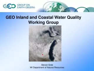
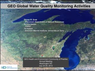
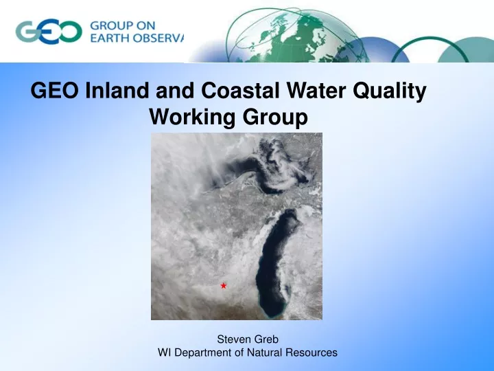
GEO Inland and Coastal Water Quality Working Group Steven GrebWI Department of Natural Resources
A new framework for Earth Observations: GEOSS: A Global, Coordinated, Comprehensive and Sustained System of Observing Systems • Relevant Facts: • Involves ~80 nations and ~50 international • organizations who have agreed to work together • to build the GEOSS. • - Coordinated by the Group on Earth Observations • (GEO) which implements the GEOSS work plan • through the best efforts of its community. Targets Tasks The Water Target By 2015, produce comprehensive sets of data, information products and services to support decision-making for efficient management of the world's water resources, based on coordinated, sustained observations of the water cycle on multiple scales.
GEO Inland and Coastal Water Quality Working Group 2012-15 WA-01: Water Task Work Plan C1 Integrated Water-cycle Products and Services C2 Information Systems for Hydro-meteorological Extremes (incl. Floods and Droughts) C3 Information Service for Cold Regions C4 Global Water Quality Products and Services C5 Information System Development and Capacity Building
C4 Global Water Quality Products and Services The goal of this component is to develop an international operational water quality information systems based on Earth observation This component will integrate water quality data from multiple sources in a timely manner and through data assimilation of Earth observations with other sources of data such as water quantity, hydrodynamics, biogeochemical modelling, generate higher level information products such as trends and anomalies and additional “value-added” products such as fluxes and flows This component encompasses both the collation and development of in-situ water quality databases and remote-sensed data, particularly space-borne data. The component addresses both flowing and static water bodies, recognizes differing approaches to assessing their water quality and the linkages/interface between them. Lakes Mendota & Monona -University of Wisconsin SSEC image
Knowledge/ Decision Making Tools Products/ Indicators Data Information Task Coordination Feedback Fast Track End-to-End application C4 Global Water Quality Products and Services Develop 2012-15 Work Plan
Inland and Coastal Water Quality working group Research Consultation Education & CB Advocacy Applications