Download
1 / 29
290 likes | 534 Views
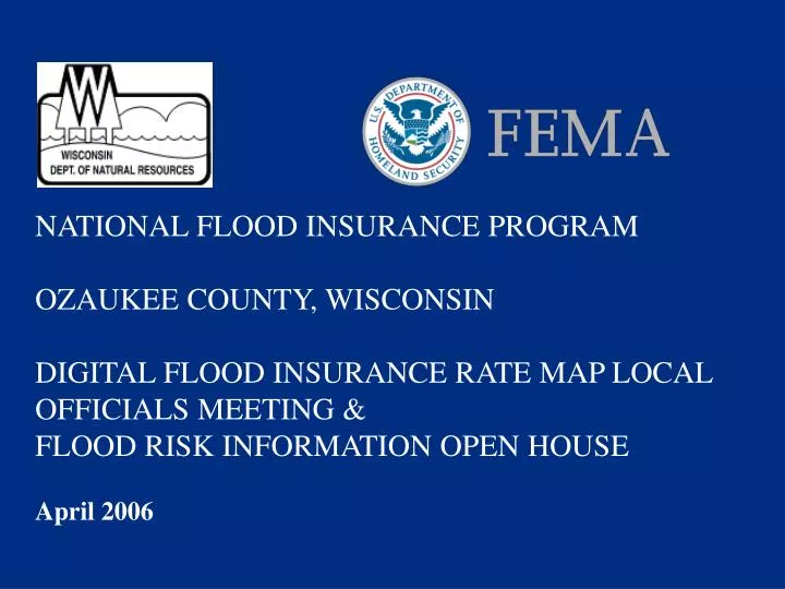
NATIONAL FLOOD INSURANCE PROGRAM OZAUKEE COUNTY, WISCONSIN DIGITAL FLOOD INSURANCE RATE MAP LOCAL OFFICIALS MEETING & FLOOD RISK INFORMATION OPEN HOUSE April 2006. Amanda Schwoegler – CTP Program Manager, WDNR Ken Hinterlong – Senior Civil Engineer, FEMA 101 S. Webster St. Box 7921

E N D
NATIONAL FLOOD INSURANCE PROGRAMOZAUKEE COUNTY, WISCONSINDIGITAL FLOOD INSURANCE RATE MAP LOCAL OFFICIALS MEETING &FLOOD RISK INFORMATION OPEN HOUSEApril 2006
Amanda Schwoegler – CTP Program Manager, WDNR Ken Hinterlong – Senior Civil Engineer, FEMA 101 S. Webster St. Box 7921 Madison, Wisconsin 53707-7921 (608) 267-7571 amanda.schwoegler@dnr.state.wi.us (312) 408-5529 ken.hinterlong@dhs.gov (312) 408-5551, fax, for Eric Kuklewski Welcome & Introduction
WDNR Amanda Schwoegler Bob Watson, P.E. Rich Gleason Gary Heinrichs Miriam Anderson Andy Selk Brent Binder, P.E.. Kathy Kramasz Sharon Gayan SEWRPC Mike Hahn, P.E. FEMA Ken Hinterlong, P.E. Eric Kuklewski Ozaukee County Andrew Struck, Asst. Director and Planner Damon Anderson, Land Information Officer Andy Hoelschbach, Planning Director Wisconsin Emergency Management Roxanne Gray Introductions
Map scope and methodology (Amanda & Rich) Appeals process and timeframes (Ken) SOMA & Adoption of Maps (Eric) Status of Ozaukee County ordinance updates (Gary) Meeting Agenda
Reduce the loss of life and property caused by flooding Reduce rising disaster relief costs caused by flooding The short range goal is to provide flood insurance and the long range goal is encourage wise use of the floodplain NFIP Goals
Publish maps - identify risk Educate the public on their own risk Provide federally-backed flood insurance coverage Encourage development away from the flooding risks Accomplishing NFIP Goals
Flood Maps support the National Flood Insurance Program 5-Year Congressionally mandated program to modernize FEMA’s inventory of flood maps Every community will be identified and mapped Ozaukee County selected in 2003 for DFIRM production, one of the first maps to be produced countywide in this GIS format in Wisconsin Map Modernization
Scoping Meeting December 18, 2003 Map Production Local Officials Coordination Meeting October 26, 2005 Preliminary Maps finalized and distributed February 3, 2006 Flood Risk Information Open House Local Officials Public Background
Ozaukee County: 2’ Contours, Structure Surveys through the Wisconsin Land Information Association (WLIA) Strategic Grant, Planimetrics/Parcel Database, Hydrologic/Hydraulic Modeling SEWRPC: Hydrologic/Hydraulic Modeling, Structure Surveys, Coordination with Communities Villages of Grafton and Theinsville, City of Mequon: Hydrologic/Hydraulic Modeling, Structure Surveys Local Contributors
Detailed Study Multiple hydrology methods Floodplain characteristics determined by in-field visits, detailed topography, and recent land-use Structure elevation surveyed/tied to mean sea level (NGVD29) Floodplain results compared to known high water marks and/or flooding accounts where available 10-, 50-, 100-, and 500-year flood profiles modeled Models and Flood characteristics detailed in Flood Insurance Study for use by communities and constituents Mapped as AE or VE Zone Types of Studies/Mapping
Limited Detail Study: Multiple hydrology methods Floodplain characteristics determined by in-field visits, detailed topography, and recent land-use Structure elevation information not tied to mean sea level (NGVD29). Elevations are not valid for zoning purposes. Mapped as A or V Zones. Types of Studies/Mapping
Re-delineation: Two types: Map existing detailed study model elevations on 2 foot contour topography using automated mapping techniques. Mapped as AE or VE Zones. Estimating the intended mapping elevation based on the assumed basemap (USGS 7.5” Quadrangle maps). The intended mapping elevation is then re-delineated on 2 foot contour topography using automated mapping techniques. Mapped as A or V Zones. Types of Studies/Mapping
New/Revised Detailed Studies: Canyon Creek Cedar Creek Fredonia Creek Milwaukee River Mineral Springs Mole Creek North Branch Milwaukee River Pigeon Creek For Ozaukee County we generated: • Sauk Creek • Ulao Creek • UT1 to the Belgium-Holland Drainage Ditch • UT1 to the Milwaukee River • UT1 to Ulao Creek • UT to UT1 Ulao Creek • UT2 to Pigeon Creek • UT3 to the Milwaukee River
Belgium-Holland Drainge Ditch, UT2 and UT3 to the Belgium-Holland Drainage Ditch Cedarburg Creek Lac du Cours Tributary Mud Lake Creek Ozaukee County UT1 and UT2 to the Menomonee River Riveredge Creek Sandhill Creek Silver Creek Sucker Creek UT1 and UT to UT2 to Pigeon Creek UT1 to Cedar Creek For Ozaukee County we generated: Limited Detail Studies: • UT1 and UT2 to Little Menomonee Creek • UT1 to the Little Menomonee River • UT1, UT2, UT3, and UT4 to Mole Creek • UT1 to Nor-x-way • UT1, UT2, and UT3 to Sauk Creek • UT4 to the North Branch of the Milwaukee River • UT5, UT6, UT7, UT8, UT9 to the Milwaukee River
Reconnaissance Basemap Preparation New Studies Leverage Studies Redelineation DFIRM and FIS Production Project Tasks Entering this Phase
Communities sent copies of Preliminary Map, and/or sent location to view on the Web (February 2006) WDNR and partners hold a meeting with the community and public (Today) FEMA issues proposed BFEs to CEO of community and publishes proposed BFEs in local newspaper and Federal Register (Anticipate early June 2006) Appeals period opens (Anticipate mid June 2006) What’s Next?
Work remaining • Receive recommendations from “new BFE” communities on a general circulation newspaper • Start concurrent 90-day appeal/comment period • Resolve appeals and comments • Issue Letter of Final Determination (LFD) of BFEs where appropriate • Notify all communities of start of six-month adoption process and plan release of effective maps
APPEALS Errors in data used for new BFEs Concerns for methodology in BFE or floodway computations COMMENTS Errors in street names Omissions of streets, highways, railroads, etc Interest in using better topographic data for floodplain delineation Appeals vs. Comments
The community, or individuals through the community contact, may appeal the proposed flood elevations. The only basis for an appeal of the FIRM is possession of knowledge or information that shows the flood hazard determinations are scientifically or technically incorrect. Protests can be filled to correct errors which do not change the BFE. Ninety Day Appeal/ Comment Period
90-day appeal period Communities gather & submit appeal/protests to WDNR WDNR resolves all appeals or protests, if received. Appeals are technically-based comment to new or revised BFEs Upon resolution of appeals/protest, Letter of Final Determination (LFD) issued to communities indicating final BFEs and date their new map will go into effect Property owners can continue to work through FEMA’s Letter of Map of Amendment (LOMA) process independent of the appeals process. Appeals Period
1. The Point of Contact (POC) for your Municipality (To be determined today, please fill out the form.) 2. Andrew Struck, Oz Assistant Director and Planner 121 West Main Street; P. O. Box 994 Port Washington, WI 53074 3. WDNR Submit Appeals and Comments To:
A Summary of Map Actions (SOMA) is prepared to assist a community in maintaining the Flood Insurance Rate Map (FIRM). A SOMA will document previous Letters of Map Change (LOMC) actions (i.e., Letters of Map Amendment (LOMAs), Letter of Map Revision based on fill (LOMR-F), Letters of Map Revision (LOMRs)) that will be superseded when the revised FIRM panels become effective. What is a SOMA?
Category 1: LOMCs for which results have been incorporated in the revised FIRM panels. Category 2: LOMCs for which results could not be shown on the revised FIRM panels because of scale limitations or because the LOMC issued had determined that the lots or structures involved were outside the Special Flood Hazard Area (SFHA) as shown on the FIRM. Category 3: LOMCs for which results have not been included on the revised FIRM panels because the flood hazard information on which the original determinations were based is being superseded by new flood hazard information. Category 4: LOMCs issued for multiple lots or structures where the determination for one or more of the lots or structures cannot be revalidated through an administrative process like the LOMCs in Category 2 above. What is a SOMA?
If the Lowest Adjacent Grade (LAG) or Low Lot Elevation (LLE) is still higher then the Base Flood Elevation (BFE) then classify the case as a Category 2. If the LAG/LLE has been superseded by a higher BFE then classify the case as a Category 3. If the LAG/LLE cannot be found and the BFEs have changed or if no address is given, then supersede the case and classify as Category 3. Categorizing LOMCs
If the LOMA/LOMR-F was issued for multiple lots or structures where the determination for one or more of the lots or structures has changed, then the LOMA/LOMR-F cannot be revalidated through this process. These LOMCs would be reevaluated and classified as Category 4. If the LOMC revises a large portion of the map, (generally LOMRs) retrieve the case file and determine whether or not the area of revision was reflected on the Preliminary copies of the revised FIRM panels. If the revisions have been incorporated onto the Preliminary FIRM, then classify the case as a Category 1. Categorizing LOMCs
Gary Heinrichs Floodplain Planner Wisconsin Department of Natural Resources 101 S. Webster St Madison, WI 53707 608-266-3093 gary.heinrichs@dnr.state.wi.us Map Adoption
Belgium, Village of Cedarburg, City of Fredonia, Village of Grafton, Village of Mequon, City of Ozaukee County (Unincorporated Areas) Port Washington, City of Saukville, Village of Thiensville, Village of Communities affected by this study:
Public Open House tonight 4pm – 8pm Local Officials welcome, please see me if you will be here If public has questions: Refer them to FEMA or WDNR Pass along information received today Common homeowner questions and issues Flood Insurance purchase – misconceptions and when it is required Grandfathering Revalidation of LOMAs and LOMR-Fs Public Meeting and Outreach
Individual Questions Maps NFIP Map Adoption Mitigation Break Out Session