Download
1 / 20
200 likes | 410 Views
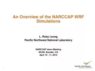
An Overview of the NARCCAP WRF Simulations and Analysis. L. Ruby Leung Pacific Northwest National Laboratory NARCCAP Users Meeting Foothills Laboratory, NCAR, Boulder, CO September 10 - 11, 2009. What is WRF. WRF stands for Weather Research and Forecasting model

E N D
An Overview of the NARCCAP WRF Simulations and Analysis L. Ruby Leung Pacific Northwest National Laboratory NARCCAP Users Meeting Foothills Laboratory, NCAR, Boulder, CO September 10 - 11, 2009 1
What is WRF • WRF stands for Weather Research and Forecasting model • It is a supported “community model” – a free and shared resource with distributed development (NCAR, NOAA, AFWA, FAA, NRL, …) and centralized support (NCAR) • Since version 2.1 (2005), WRF has two dynamical cores: ARW and NMM (as in NCEP Eta model) – both non-hydrostatic, Eulerian mass, with terrain following vertical coordinates • ARW uses Arakawa C grid staggering v and Runge-Kutta 3rd time integration u T u v • NMM uses Arakawa E grid staggering T V T and Adams-Bashforth/Crank-Nicholson V T V time integration scheme T V T 2
WRF Configurations • The NARCCAP WRF simulations are based on WRFV2.0.1 (ARW dynamical core) (as of 2004 – also used in the NRCM tropical channel simulations) • Features added to WRFV2.0.1 (now mostly available in WRFV3.1) include: - CAM3 radiation (prescribed spatially uniform aerosol concentrations and monthly/latitudinally varying ozone concentration) - Background surface albedo changes between summer/winter seasons - Prescribed seasonal changes in vegetation cover - Updating SST and sea ice in the lower boundary condition - Cloud fraction follows Xu and Randall (1996) instead of 0/1 3
WRF Configurations • Features added to WRFV2.0.1 (Cont’d): - Output accumulated instead of instantaneous fluxes for budget analysis (plus added clear sky / total sky fluxes) - Prognostic deep soil temperature based on Salathe et al. (2008), where a = 0.6 and n = 140 - Use of linear-exponential functional form for the nudging coefficients in the relaxation boundary conditions; buffer zone is 10-grid point wide - CO2 concentration temporally interpolated from time series of annual mean CO2 concentration based on the GCM scenarios - For downscaling CCSM – used 365 day calendar • Most “climate” implementations are incorporated in the standard WRFV3.0 4
WRF configurations: • Physics options: - Radiation: CAM3 for both shortwave and longwave - Boundary layer turbulence: A nonlocal scheme based on YSU (similar to the MM5 MRF nonlocal scheme) - Cloud microphysics: mixed phase (wsm4) – water, ice, snow, rain - Cumulus convection: Grell-Devenyi scheme (also used Kain-Fritsch scheme for simulation driven by reanalysis) - Land surface model: Noah LSM - No lake model: Lake surface temperature prescribed based on reanalysis/GCM surface temperature over water • Grid resolution: 50 km (155x130); vertical levels: 35 • Time step: 150 s 5
WRF initialization: • For the reanalysis driven runs: - Initial atmospheric and land surface conditions are based on the global reanalysis - Simulations were initialized on 9/1/1979 (only 3 months of model spinup) - Lateral and lower boundary (SST and sea ice) conditions are updated every 6 hours based on the global reanalysis • For GCM driven runs: - Initial atmospheric conditions are based on GCMs; initial land surface conditions are based on global reanalysis - Lateral and lower boundary conditions updated every 6 hours based on GCMs - Allow 2 years of model spinup (e.g., 1/1/1968 – 12/31/1969) 6
WRF Simulations: • Completed two simulations driven by NCEP/DOE global reanalysis for 1979/9/1 – 2004/12/31 using GD and KF • Completed two simulations driven by the CCSM control (1968/1/1 – 1999/12/31) and future (2038/1/1 – 2069/12/31) using GD • Will begin two simulations driven by the CGCM control (1968/1/1 – 1999/12/31) and future (2038/1/1 – 2069/12/31) using GD 7
WRF model outputs: • WRF writes two kinds of model outputs: - The standard wrfout* files are written every 3 hours (include both 2D and 3D fields) (~ 600 MB/day) - Auxiliary output files (aux*) are written every hour (include only some 2D fields – where daily max/min values are postprocessed) (~ 28 MB/day) 8
WRF model outputs: • Postprocessed model outputs: - Same as NARCCAP Table 1 – Table 5 - Additional variables added to Table 3 for April – September (e.g., CAPE, wind shear, LLJ cat (Bonner), u/v moisture transport, virtual potential temp), pbl mixing ratio) - Postprocessing of reanalysis driven KF and GD runs ~ 80% complete - Postprocessing of CCSM driven control run ~ 90% complete - Postprocessing of CCSM driven future run ~ 75% complete 9
Comparison of Reanalysis Driven KF and GD Runs • Currently only Table 2/3 results from the KF run are available on ESG • For consistency with the GCM downscaled runs, the GD simulation should be used as the “standard” 10
OBS GD DJF Temperature (K) KF KF minus GD 11
OBS GD DJF Precipitation (mm/day) KF KF minus GD 12
OBS GD JJA Temperature (K) KF KF minus GD 13
OBS GD JJA Precipitation (mm/day) KF KF minus GD 14
OBS CCSM Control DJF Temperature (K) CCSM Future Future - Control 15
OBS CCSM Control DJF Precipitation (mm/day) CCSM Future Future - Control 16
OBS CCSM Control JJA Temperature (K) CCSM Future Future - Control 17
OBS CCSM Control JJA Precipitation (mm/day) CCSM Future Future - Control 18
Analysis of WRF simulations • Atmospheric river induced heavy precipitation and flooding in the western US and potential changes in the future Leung, L.R., and Y. Qian. 2009: Atmospheric rivers induced heavy precipitation and flooding in the western U.S. simulated by the WRF regional climate model. Geophys. Res. Lett., 36, L03820, doi:10.1029/2008GL036445 Ralph et al. (2005) Source: Neiman et al. 2008 19
Analysis of WRF simulations • Dry bias in the central/northern Great Plains (comparison of KF vs GD simulations, analysis of LLJ, land-atmosphere interactions) • Simulations of severe weather environments during summer and changes in the future LLJ Frequency at 06z • In Southern Great Plains, LLJ has good frequency but wind directions are more SW • In Northern Great Plains, LLJ frequency is too low, and winds are too SW 20