Download
1 / 18
190 likes | 360 Views
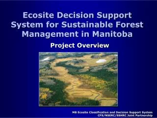
Colorado’s Decision Support Systems (CDSS) & Information Management. Carolyn Fritz & Susan Lesovsky September 25, 2007. CWCB at a Glance. CWCB Colorado’s water policy agency

E N D
Colorado’s Decision Support Systems (CDSS) & Information Management Carolyn Fritz & Susan Lesovsky September 25, 2007
CWCB at a Glance • CWCB • Colorado’s water policy agency • Represents each major water basin, Denver & other state agencies in our joint effort to use water wisely and protect our water • Water Information Section • Provides water information & support to the State, the CWCB and the public through data, models, GIS, imaged data and the internet www.cwcb.state.co.us
CDSS & Information Tools • StateView & HydroBase • Modeling (Consumptive Use, Ground & Surface Water) • GIS Mapping • Map Viewer • Stream & Lake Protection Database • Laserfiche Imaging System • CWCB Website • Tying it All Together www.cwcb.state.co.us
Dividing the State • 9 Major River Basins • 7 Administrative Divisions www.cwcb.state.co.us
CDSS Overview/History CRDSS Development (Gunnison, Yampa, Colorado, San Juan, Dolores) SPDSS Development (South Platte, North Platte) Legislative Authorization RGDSS Development (Rio Grande) Maintenance & Updates, Upper Arkansas Future 1993 1998 2001 1992 www.cwcb.state.co.us
StateView & Hydrobase • Historical Data • Stations & Structures • Water Rights • Ground Water Levels & Pumping Tests • Calls • Agricultural Statistics • Crop Growth Coefficients • Climate Data • GIS Mapping • Current Conditions • Real-time streamflow data www.cwcb.state.co.us
Modeling • Consumptive Use • Groundwater • Surface Water www.cwcb.state.co.us
DSS Website • One stop shopping for all DSS products • Model software, inputs & documentation • GIS data • Real time & historic data cdss.state.co.us www.cwcb.state.co.us
GIS Mapping • CDSS spatial data • Irrigated Acreage • Snow pack • Flood Reports • Instream Flow Analysis • Displays and Informational Items www.cwcb.state.co.us
Irrigated Acreage Mapping • State 70% mapped • Lands are mapped every 5 years • Provides CU inputs • Satellite imagery and aerial photography used to analyze irrigation status and crop type www.cwcb.state.co.us
Map Viewer • Publicly available on the web • Provides access to CDSS spatial data • Allows access to additional data from HydroBase via the web cdss.state.co.us www.cwcb.state.co.us
ISFDSS • ArcMap based • Supports all Instream Flow Section activities • Investigations • Appropriations/Donations • Legal Protection • Physical Protection • Links to HydroBase, ISF Database & Laserfiche www.cwcb.state.co.us
Stream & Lake Protection Database • Search for instream flow & natural lake water case specifics (appropriations, flow recommendations, etc.) • Access water rights tabulations by division www.cwcb.state.co.us
Laserfiche Imaging • 1999: DNR imaging initiative: • 2003: CWCB documents on web: • 2006: Laserfiche system • Present: ~55,000 documents~1.4 million pages www.cwcb.state.co.us
Accessing Laserfiche • CWCB Websitewww.cwcb.state.co.us • IBCC Websitewww.ibcc.state.co.us • Directlycwcbweblink.state.co.us www.cwcb.state.co.us
CWCB Website • Main portal to CWCB’s programs & services • All water information tools accessible from website www.cwcb.state.co.us
Water Information Section on the Web • CDSS • Mapping & GIS • Electronic Data Management • Water Resource Information Center www.cwcb.state.co.us
Tying Tools Together • Map viewer access to stream data • CWCB website search for stream data • Stream data used to access imaged data www.cwcb.state.co.us