Download
1 / 35
350 likes | 551 Views
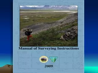
The Next Edition of the Manual of Surveying Instructions and the Modern Cadastre. Presented by: Steve Hansen, BLM Chief Cadastral Surveyor Arizona State Office, Phoenix, AZ and Bob Dahl, BLM Cadastral Surveyor Division of Lands, Realty & Cadastral Survey Washington, D.C.

E N D
The Next Edition of theManual of Surveying Instructionsand the Modern Cadastre Presented by: Steve Hansen, BLM Chief Cadastral Surveyor Arizona State Office, Phoenix, AZ and Bob Dahl, BLM Cadastral Surveyor Division of Lands, Realty & Cadastral Survey Washington, D.C. 2009 Arizona Professional Land Surveyors/Nevada Association of Land Surveyors Conference & Technology Exposition Las Vegas, NV March 16, 2009
Agenda Cadastre – Cadastral – Cadastral Survey What is the Manual of Surveying Instructions? Why is the Manual relevant to Private, County, and State Surveyors in Arizona?
Agenda • Scope of the project • Technical project nested in a web of • administration and legal processes What is the process? How are we going about it? Where are we to date?
OHA → ↑ IBLA IBIA IBCA
Cadastral Presence • At the BLM State Office level – Cadastral is 1 of 45 Programs, and is considered “support” • Within BLM Arizona – Cadastral has 2% of the total State Office personnel
What is the Manual of Surveying Instructions? (Manual) Whom/What is affected?
Why is the Manual Relevant to the Private, County, and State Surveyor in Arizona?
ARIZONA REVISED STATUTESTitle 33. PropertyChapter 1. Landmarks and SurveysArticle 1. In General A.R.S. § 33-103 Lost corners shall be reestablished under rules adopted by the U.S. for the survey of public lands.
ARIZONA ADMINISTRATIVE CODETitle 4. Professions and OccupationsChapter 30. Board of Technical Registration Article 3. Regulatory Provisions A.A.C. § R4-30-301. Rules of Professional Conduct Land surveys shall be conducted in accordance with APLS Boundary Survey Minimum Standards
ARIZONA PROFESSIONAL LAND SURVEYORS Arizona Boundary Survey Minimum Standards Land Surveying Minimum Standards 3. If the property is referenced to the PLSS, the surveyor shall consult the pertinent PLSS source documents
SUPREME COURT OF ARIZONAGalbraith v. Parker, 17 Ariz. 369 (1915) The law is settled, government monuments as placed upon the ground control • The rule is settled, where corners are lost: • plat, field notes and calls therein are determinative of the rights • the apportionment of any excesses or deficiencies shall be in accordance with the rule laid down by the Manual
SUPREME COURT OF ARIZONAIvy v. Parker, 18 Ariz. 503 (1917) [Ivy is Administrator of Galbraith estate] Monuments placed by private parties without any reference to the government original survey were rightfully not used by the jury
SUPREME COURT OF ARIZONAHein v. Nutt, 66 Ariz. 107 (1947) The surveyor shall re-establish lost corners under the rules adopted by the Manual and Circular There is a clear mistake; the key method [double proportionate measurement] as laid down by our law and the Manual was not used
SUPREME COURT OF ARIZONAWacker v. Price, 70 Ariz. 99 (1950) Long-established fences/long established property lines/long standing monuments Ancient boundaries/fences Best evidence rule/best possible evidence/best evidence available Substantial evidence
UNITED STATES CODETitle 43 Public Lands § 2 The Secretary of the Interior or such officer as he may designate (BLM) shall perform all executive duties appertaining to the surveying and sale of the public lands of the United States
Other Federal Laws – Containing Survey Rules – The Federal Survey Rules Title 43 U.S.C. §§ 751-753, 772, 773, 1737(c)
UNITED STATES CODETitle 25 Indians § 176 Whenever it becomes necessary to survey any Indian lands, the same shall be surveyed under the direction and control of the BLM And as nearly as may be in conformity to the rules and regulations under which other public lands are surveyed
INTERIOR BOARD OF LAND APPEALSHoward Vagneur, 159 IBLA 272 (2003) 1) BLM is authorized to resurvey the corners and lines of government surveys 2) BLM Survey Manual defines a resurvey 3) Manual defines “existent” “obliterated” and “lost” corners
INTERIOR BOARD OF LAND APPEALSHoward Vagneur, 159 IBLA 272 (2003) 4) Manual provides guidance to surveyors on how to base a resurvey on the “best available evidence” 5) BLM Official Surveys are presumed regular 6) An accurate retracement and reestablishment of the lines of the original survey
United States Supreme Court It is settled law that the United States may survey what it owns and thereby establish and reestablish boundaries, but what the government does in this regard is for its own information and cannot affect the rights of owners on the other side of an existing boundary. United States v. State Investment Co., 264 U.S. 206, 212 (1924), citing Lane v. Darlington, 249 U.S. 331, 333 (1919).
MANUAL The Manual of Surveying Instructions describes how cadastral surveys of the public lands are made in conformance to statutory law and its judicial interpretation. (1973 Manual § 1-1.) It is within the province of the Director to determine what are public lands, what lands have been surveyed, what are to be surveyed, what have been disposed of, what remains to be disposed of, and what are reserved. (1973 Manual § 1-11.)
SUMMARY By fundamental law, upon the issuance of a patent for land by the Federal government; it is just as if the monuments, survey plat and field notes, and the laws, regulations and rules governing how to survey the land described in the patent, are attached to the face of the patent. The survey rules are spelled out in the manuals, circulars, instructions and regulations issued by the GLO and later by the BLM.
Chapter Crosswalk 1973 Manual Next Edition Ch. 1 - The General Plan Ch. 2 - Methods of Survey Ch. 3 - System of….. Ch. 4 - Monumentation Ch. 5 - Lost or Obliterated Corners Ch. 6 - Resurveys Ch. 7 - Special Surveys and Instructions Ch. 8 - Field Notes Ch. 9 - Plats Ch. 10 - Mineral Surveys Ch. 1 - The General Plan Ch. 2 - Methods of Survey Ch. 3 - System of….. Ch. 4 - Monumentation Ch. 5 - Principles of Resurveys Ch. 6 - Resurveys and Evidence Ch. 7 - Resurveys and Restoration Ch. 8 - Water Boundaries Ch. 9 - Special Instructions…….. Ch. 10 - Special Surveys and Mineral Surveys
Areas of: Change – Clarification - Addition • Water boundaries • Standard of evidence • Coordinates as collateral evidence • Technology • Mineral survey resurveys • Closing corners • Bona Fide Rights & Good Faith Location
Water BoundariesChapters III and VIII • Chapter III includes concepts and case studies of original surveys and water boundaries. • Chapter VIII includes concepts and case studies of resurveys and water boundaries. • Navigability determinations. • Submerged lands issues. • Ownership of unsurveyed islands in meandered nonnavigable waters.
Standard of Evidence • Interior Board of Land Appeals (IBLA) has altered the evidentiary standard for proof of a corner point. “beyond reasonable doubt” replaced with “substantial evidence” (More than a scintilla, but less than a preponderance) • Existent – Obliterated - Lost corner definitions use “substantial evidence” standard.
Coordinatesas Collateral Evidence • Repeatable coordinatesmay be the best available evidence for the position of an obliterated corner. • “…if the first surveyor documents how he or she obtained the coordinates so the second surveyor can, within an acceptable degree of confidence, determine the same point on the earth's surface (following in the computational footsteps) within an acceptable level of certainty, then coordinates may be the best available evidence of the corner position.”
Measurement TechnologyChange in Principal • The next edition is largely technology independent. • How the surveyor determines the relationship between point A and point B (measurement procedures; what instrumentation is used) will be determined for each survey from the best available technology to meet the purpose of that survey. • How to measure is better handled by special instructions.
Mineral Survey Resurveys • Expanded instructions for mineral survey resurveys, mineral leasing surveys, and mineral segregation surveys. • Incorporates much that is in the BLM publication “Mineral Survey Procedures Guide.”
Closing CornersPolicy Clarification For treatment of closing corners, the Manual will instruct the surveyor to determine how an existing closing corner was established. A corner, no matter what it has been called in the official record, (closing corner, junior corner, crossing closing corner, intersection point, or corner of minimum control) established during an obviously careful retracement of the intersected, senior, or existing line, can be accepted in place, and may be an angle point in the intersected, senior, or existing line.
Bona Fide RightsandGood Faith Location Before we get carried away with these doctrines: A landowner's bona fide belief concerning the boundary between his land and Federal interest land is not the same as a bona fide right that must be protected in a survey under 43 U.S.C. § 772. Although a person may have a bona fide belief, based on an understanding with a predecessor-in-interest that a fence marks a boundary, a bona fide right within the meaning of 43 U.S.C. § 772 is based on good faith reliance on evidence of the original survey. Tracy v. Rylee, 174 IBLA 239 (2008).
Next Edition Website http://www.blm.gov/wo/st/en/prog/more/cadastralsurvey/next_edition.html BLM Arizona PLSS/GCDB Records: ftp://ftp.blm.gov/pub/ARIZONA/ Federal Land Patents: http://www.glorecords.blm.gov
Addendum – March 26, 2009 ARIZONA PROFESSIONAL LAND SURVEYORS Arizona Boundary Survey Minimum Standards Land Surveying Minimum Standards 9A. When monumenting a PLSS corner refer to “applicable state statutes.” Board of Technical Registration Substantive Policy Statement No. 9 “Applicable state statutes” refers to A.R.S. 33-103.