Download
1 / 14
140 likes | 147 Views
Virtual reality takes us to a 3D environment, which is a bit different from our actual situation. The 3d effect offers us an accurate representation of the construction with various elements in front of us as if in reality. As construction professionals, we have started exploring the advantages of 3D Virtual Reality.<br><br>Tejjy Inc. delivering comprehensive solution in Architectural BIM Engineering Services ,Construction Management in USA. 3D /4D/5D/6D/7D/8D BIM solutions.

E N D
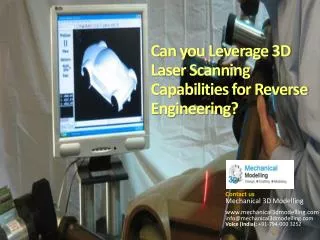
Leveraging Laser Scanning Point Cloud BIM (Virtual Reality) to Provide Enhanced Customer Service
What is Scan to BIM? SCAN to BIM Provides Single Reference File in Precise Digital Model Facilitates Customers To: • Manage, Benchmark, Synchronize & Supervise Incoming Data • Obtain Verified, Reliable Reference Data in Real Time • Manage Change, Plan Ahead & Optimize Performance of New Buildings
Laser Scan to BIM Uniqueness • Design Build is one of the most challenging projects for Engineers, Consultants & Stakeholders. • Laser Scanning to BIM technology convinces Stakeholders by yielding cost effective result for Major Construction projects. • The whole process facilitates stakeholders in Optimizing Quality & Maintaining Project Progress as per Schedule.
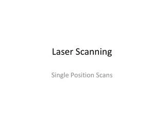
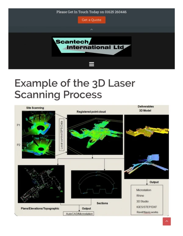
Working Methodology • 3D Laser Scanning from Faro Focus S Scanner • Registration of Scans using Autodesk Recap Pro • Point Cloud Model Creation from Laser Scans in Global Coordinates • Progress Model Creation from Laser Scanning • Construction QA/QC by Comparing the As-Built to As-Design Models • Stockpile Volume Measurement from Laser Scanning using CIVIL 3D & Bentley
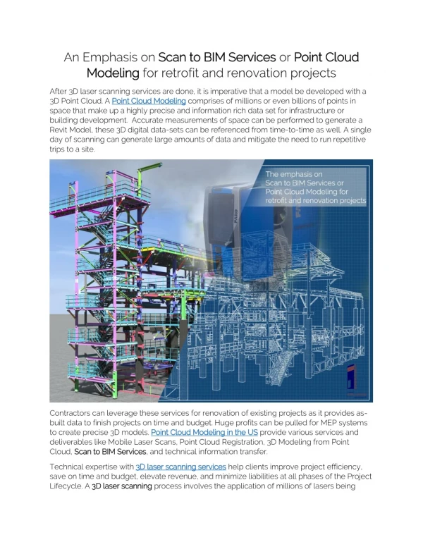
Strategy - Successful Implementation of LaserScanning to BIM Value Proposition/Technology Leverage • BIM Point Cloud helps accurate 3d model creation for renovation & extension from scan data, allowing reliability & quality assurance • During renovation, Construction Scan to BIM Model provides an enhanced platform for preparing detailed design work • Improved transparency & streamlined communication with 3D visualization facilitate decision making • Eliminates work stoppage & rework by checking accuracy & completeness of 3D Model from scan data, saving time & money for clients
Work Process – 3C Formula • CAPTURE- Using laser scanners, a site is scanned & detailed set of data or 'points' is captured for further processing • COMPUTE- Using laser scanning to BIM software, scan data is automatically registered, stitched into coordinate system, cleaned up & analyzed. The final product is a point cloud ready for BIM authoring tools • CREATE-Design, knowing that the base information is a model up-to-date data of actual site conditions
Progress Model Creation from Laser Scanning Construction QA/QC Comparing As-Built to As-design Models • The uses of point cloud model have drastically increased the QA/QC process of construction with As-design models. • As-Design & As-Built Models in Autodesk Navisworks are compared with 2 methods- • Manual Comparison of Both Models • Using Some Advance Plugin(ClearEdge3D) to check Standard Deviation between Both Models
Process & Solution Stockpile Volume Measurement from Laser Scanning using CIVIL 3D & Bentley • Measurement of Stockpile Quantity using Laser Scanning plays an important role in Tracking Project Cost on Timely Basis • Invoicing of Aggregate Stock Processed as per Volume by Laser Scanning • Internal Schedule for Scanning Includes Stockpile Scanning at the end of every month to check the Quantity of Stock
Triangulation Surface & Volume of Stockpile • Civil 3D software creates surfaces with the orientation of points in 3 Dimensional Point Cloud Model • Calculates Volume with Triangulation Algorithm
Issue - Challenges Faced by Current Construction Professionals • The current practice for capturing existing field conditions is tedious, manual, analog and inaccurate, leading to costly rework • Be it a building renovation or large-scale infrastructure project, the surveying & documentation cannot be accurately captured in a simple & efficient way • This is a time-consuming, manual & inefficient process, where one is left with site sections site that cannot be measured accurately
Overcoming Challenges with Point Cloud BIM, Meeting Industry Needs • With an increase in BIM usage, there will be a knock-on effect, generating more requests for 3D surveys, resulting in more laser scanner use with point cloud deliverables • The growth of BIM will play a significant part in the adoption of point clouds across non-survey disciplines • Laser Scanning can help to create on an older structure with static image documentation of existing conditions. It is difficult to check & update the old blueprints manually. Laser scanning can help to work on these projects with an alternative and better approach
Key Takeaways • ACCURACY - With photo-to-point cloud creation & laser scanning, Realty Capture delivers incredible detail, preventing costly rework later. Each point captured is mapped on to a coordinate system, for an intelligent survey output, ready to export as per need • BUILT-IN EFFICIENCY - A site scan immediately creates digitized 3D replica accelerating the surveying & documentation, reducing labor costs. Reality Capture creates efficient workflows, enhancing productivity & reducing time & manual effort • LESS MANUAL WORK - Digitized data provides analytical connected insight, surveying specialists can use time to point out opportunities/pain points of design & construction teams • DESIGNING IN 3D - Realty Capture is a bridge between raw site conditions & intelligent BIM, helping project teams to avoid manual design & documentation rework, reducing delay in construction & design schedules by 30%
Long Term Benefits - Sustainability Gains the Initiative could bring • 3D scanning provides average person an ability to customize almost anything they want • With more affordable price points, 3D scanning will become more accessible to consumers for personal use • Future Outlook - Global 3d Laser Scanning is set to boom in the coming years -The 3D scanner market is expected to grow from USD 3.41 Billion in 2016 to USD 5.90 Billion by 2023, at a CAGR of 7.8% during the forecast period.
Presentation By… Tejjy Inc. • Website - https://www.tejjy.com • +1 202-465-4830 • info@tejjy.com • 1201 Seven Locks Road, Suite 360 Rockville, MD 20854