Download
1 / 17
170 likes | 497 Views
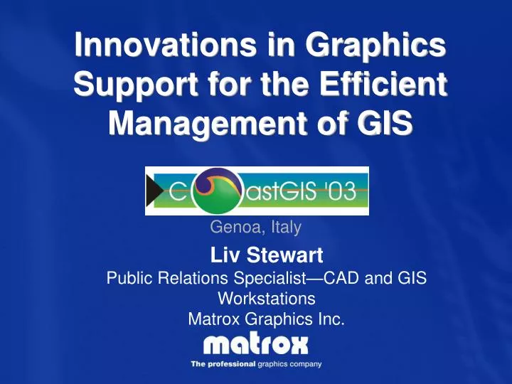
Innovations in Graphics Support for the Efficient Management of GIS. Liv Stewart Public Relations Specialist —CAD and GIS Workstations Matrox Graphics Inc. Company Overview. Established in 1976 Fully integrated graphics card manufacturer with offices worldwide

E N D
Innovations in Graphics Support for the Efficient Management of GIS Liv Stewart Public Relations Specialist—CAD and GIS Workstations Matrox Graphics Inc.
Company Overview • Established in 1976 • Fully integrated graphics card manufacturer with offices worldwide • Designs ASIC, board and drivers • Dedicated technical support • The established market leader ofmulti-display graphics • Designs graphics solutions for the requirements of GIS professionals
Innovations in Graphics Support for the Efficient Management of GIS It can become cumbersome to efficiently manage GIS data on a single display: • overlapping windows hide important information • time is wasted toggling between applications and windows, and by frequent zooming and panning through large maps and detailed imagery
Innovations in Graphics Support for the Efficient Management of GIS A traditional single desktop becomes too small for all of the information that needs to be managed. Matrox has developed 2 solutions to the cluttered screen: • Extending the desktop across multiple displays • Supporting larger, higher resolution displays These provide more desktop real estate, enabling you to efficiently manage the data you work with.
Innovations in Graphics Support for the Efficient Management of GIS #1:Extending the desktop across multiple displays: • benefits geotechnology professionals from all industries (including coast, marine & oceans and natural resources). Surround Design, a unique Matrox innovation, seamlessly extends your desktop across multiple displays: • providing greater perspective • making analysis more intuitive and efficient • facilitating collaboration • reducing chances of errors • etc.
Innovations in Graphics Support for the Efficient Management of GIS Surround Design increases your workspace letting you see and do more at once. ESRI ArcView 8.X Display 1 Display 2 Display 3 Facilitates dragging & dropping Terrain can be inspected with map overviews open concurrently OpenGL available on all 3 screens
Innovations in Graphics Support for the Efficient Management of GIS Technical Challenges overcome todevelop Surround Design: While creating this technology, Matrox made sure that it was possible: • to have up to 3 outputs (digital and/or RGB) from a single chip and single memory frame buffer • for the graphics card to have exceptional performance, be efficient and compatible with various platforms • to enable full OpenGL acceleration on all 3 displays • to have Stereo support • for end users to be able to control where windows and dialog boxes appear across the extended desktop • for fluid performance when panning and zooming • to have stable support for many popular CAD and GIS applications
Innovations in Graphics Support for the Efficient Management of GIS # 2: Going to a larger display that supports higher resolutions: • is ideal for enhanced visualization of maps, computer cartography, and satellite imagery. With optimal support for 3840 x 2400 panels @ 200 dpi and full refresh rates, it enables you to: • see more in much greater detail • easily pan through, and zoom in and out of, large images More resolution and pixel density
Innovations in Graphics Support for the Efficient Management of GIS This is the optimal solution for those using high resolution panels. At 200 dpi, the quality of images is greatly enhanced. But, at this enhanced resolution everything is reduced. Fonts, toolbars and menus, become small, so some prefer to add additional displays for manipulation of their CAD/GIS tools.
Innovations in Graphics Support for the Efficient Management of GIS Technical Challenges overcome toprovide higher resolution support: In developing this technology, Matrox ensured that it would provide optimal support for specialty, multi-input, 9 MP panels providing: • four digital channels (via 2 LFH-60 outputs) from a single chip and single memory frame buffer • a direct connection to the display, with no adaptors, • fluid performance when panning and zooming • stable support for many popular applications for enhanced visualization
Innovations in Graphics Support for the Efficient Management of GIS Product details: Parhelia™ Series • Surround Design • Stereo support • Leading image quality • Unique dual certification program for drivers • PCI and AGP versions available (possibility of running multiple boards in 1 system) Parhelia™ HR256 • optimal support for enhanced visualization on 9 MP panels • certified drivers for popular applications for enhanced visualization • genlock and frame lock available as options • PCI bus (possibility of running multiple boards in 1 system)
Innovations in Graphics Support for the Efficient Management of GIS For specialized usage scenarios requiring enhanced visualization as well as additional monitors: • a Parhelia™and Parhelia HR256 can be used alongside each other in the same system. In this example, aerial imagery of the same area can be seen simultaneously. Autodesk Map
Innovations in Graphics Support for the Efficient Management of GIS For even more specialized requirements, Matrox has designed the Parhelia™ Precision SGT (Satellite Grayscale Technology) • Supports one grayscale channel (stereo) and one color channel (stereo) • Can be used along side a 9 MP display for Stereo Analysis on a color or grayscale monitor • Can be used as a stand-alone solution to compare grayscale and color imagery in Stereo
In Summary Matrox has developed innovative graphics solutions, with unique, specialized features, that address the specific needs of GIS professionals.
In Summary Surround Design enables you to see more details at once… • Here, you can see a top view of this 3D ortho model on one screen, while getting a much wider perspective of the area across the other two
In Summary …Facilitates analysis, ESRI ArcView 8.X Display 1 Display 2 Display 3 and…
In Summary …2D and 3D data can be seen simultaneously. ESRI ArcView 8.X Display 1 Display 2 Display 3