Download
1 / 32
320 likes | 609 Views
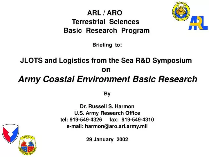
ARL / ARO Terrestrial Sciences Basic Research Program. Briefing to : JLOTS and Logistics from the Sea R&D Symposium on Army Coastal Environment Basic Research By Dr. Russell S. Harmon U.S. Army Research Office tel: 919-549-4326 fax: 919-549-4310

E N D
ARL / ARO Terrestrial Sciences Basic Research Program Briefing to: JLOTS and Logistics from the Sea R&D Symposium on Army Coastal Environment Basic Research By Dr. Russell S. Harmon U.S. Army Research Office tel: 919-549-4326 fax: 919-549-4310 e-mail: harmon@aro.arl.army.mil 29 January 2002
OVERVIEW • ARO • The ARO Terrestrial Sciences Program • Current Coastal Basic Research • Future Research Directions
HQ DA Army S&TOrganization User Rep (TRADOC) Operators ASAALT PEOs Strategic Defense Infrastructure/ Environmental Materiel Medical Personnel HQ AMC HQ MRMC HQ USACE SMDC DCSPER Army Research Laboratory Soldier & Biological Chemical Command SBCCOM Aviation and Missile Command AMCOM Communications - Electronics Command CECOM Tank-Automotive & Armaments Command TACOM Edgewood Chem- Biological Center Natick Soldier Cntr Communications & Electronics RDEC Tank-Automotive RDEC Armament RDEC Missile RDEC Aviation RDEC Simulation, Training & Instrumentation Command STRICOM U.S. Army Security Assistance Command USASAC Operations Support Command OSC
Army Basic Research Resource Allocation$205 Million FY01 AMC RDE Centers ARI (Behavioral Science) MRMC (Medical Science) Army Research Laboratory ACOE- ERDC Army Materiel Command has about 70% of the Army Basic Research Budget
Army Research LaboratoryOrganizational Structure Director Army Research Office Deputy Director Dep. Director for Research Associate Dir. for PP&B European Research Office Far East Research Office Computational & Information Sciences Directorate Vehicle TechnologyDirectorate Sensors &ElectronDevicesDirectorate Weapons &MaterialsResearchDirectorate HumanResearch &EngineeringDirectorate Survivability/LethalityAnalysisDirectorate
The Role of the Army’s Corporate Laboratory Contracts Cooperative Ventures (e.g. FedLab) Support to Principal Customers Single Investigators Centers of Excellence, URIs, MURIs Technology Transfer DEAs, TTCP, NATO Panels Science Technology Analysis MATERIEL READINESS Technology Application Technology Enhancement Technology Generation Technology Gathering
The Army Research Office (ARO) • With... • An Army Investment of $58M and... • A Workforce of 99 Highly Educated • and Motivated Staff Seeding Army Research at over 300 Academic Institutions Managing ACT II and SBIR to Transfer Technology to the Army User ARO... Assessing Scientific Opportunities to Achieve Army Vision Focuses a Total 6.1 Program of $166M from all Sources plus$134M from SBIR and ACT II in Support of Army Technology Objectives Manage ARL-ERO and ARO-FE International Offices Strengthening the research infrastructure at HBCU/MIs Educating a Superior Workforce in Army-Critical Technologies ARO heavily leverages the resources of other agencies to support the Army mission.
ARO Basic Research Pursuits • Communications & Information • Processing Research • Information fusion • Wireless distributed communications • MMW integrated devices • Mathematical Sciences • Knowledge-based systems • Intelligent systems • Complex systems and control • Biological Sciences • Microbiology & Biodegradation • Physiology & Performance • Nanoscale biomechanics • Portable power • Low power • Intelligent • Microsized • Multifunctional • Autonomous • Lightweight • Logistics ease • Chemical Sciences • Electrochemistry • Fast, energetic materials • Dendritic polymers • Physics • Image analysis • Nanoscience • Photonics • Mechanical Sciences • “Smart” structures • Rotorcraft aeromechanics • Combustion/Propulsion • Materials Science • Biomimetics • Hierarchical materials • Smart materials • Atmospheric and Terrestrial Sciences • Atmospheric lower boundary layer • Remote sensing/terrain & topography • Surficial Processes • Environmental modeling • Electronics • Low power/noise electronics • Optoelectronic hybrids • Quantum & High Frequency Electronics
ARO - TERRESTRIAL SCIENCES • THE GRAND CHALLENGE Terrain and the terrestrial environment impact Army training and testing; the planning and execution of military operations and logistics activities. • The probable Army battlespace for the future • will be extended, highly complex, variable, • and dynamic. • Under such conditions, effective warfighting • will require: • Superior terrain knowledge and battlespace visualization capabilities • Fundamental understanding of (i) terrain character, (ii) dynamic constitutive behavior of natural and engineered materials, and (iii) terrestrial processes under different environmental conditions, that is needed to develop new modeling and simulation capabilities that will enable the Army to foresee and exploit terrain and environmental complexity and variability to achieve a tactical and strategic warfighting advantage • Cost-effective approaches to sustainable training and testing lands, the Army mission of environmental stewardship, and military civil engineering
ARO - TERRESTRIAL SCIENCES MAJOR PROGRAM AREAS (from Jan ‘01 Environmental Sciences Triennial Strategy Planning Meeting) • Terrain Properties and Characterization • The natural and human-affected landscape • The subsurface environment • Terrestrial Processes and Dynamics • Physical and ecological processes • Hydrologic and geomorphic processes • Geomechanics and constitutive relations • Extreme environments • Terrestrial System Modeling and Analysis • Vehicle-terrain interaction • Geophysical modeling • Landscape impact response and sustainability • Geospatial and environmental model development
ARO - TERRESTRIAL SCIENCES TERRAIN PROPERTIES & CHARACTERIZATION • AREAS OF INTEREST • Terrain information generation, • characterization, and analysis • Battlefield visualization and environmental simulation • Subsurface characterization • OBJECTIVES • Provide a foundation for the development • of new terrain characterization and feature • extraction and analysis capabilities • Undertake field and laboratory studies to • obtain the fundamental material properties • data necessary for the development of • physical process models • Development of novel environmental site • characterization technology utilizing the • SBIR/STTR program • PAYOFF • Improved terrain extraction, characterization, • and analysis capabilities for battlespace • visualization, multi-resolution geospatial • reasoning tools, and robotics applications • Realistic, dynamic synthetic virtual simulation • environments for training and mission rehearsal • New capabilities for the in-situ determination • of subsurface character and toxic substances • in the environment
ARO - TERRESTRIAL SCIENCES TERRESTRIAL PROCESSES & DYNAMICS • Pre-storm Shoreface • transverse bars • troughs with mud surface August 26, 1999 • AREAS OF INTEREST • Physical and ecological processes • Hydrologic and geomorphic processes • Nearshore processes • Geomechanics and constitutive relations • Extreme Environments core locations • OBJECTIVES • Undertake field and laboratory studies to • understandsurface processes in different • environments that affect military operations • at a fundamental level • Development and validation of dynamic, • multi-scale physical process algorithms • and numerical models Post-storm Shoreface • planar surface • no mud at surface September 29, 1999 • PAYOFF • Improved process models and terrain realism • for interactive simulation in the virtual world • New and enhanced physical process models • for environmental forecasting and prediction • (e.g. “real-time” hydrologic and coastal dynamics • forecasting, mobility prediction, and contaminant • transport and remediation efficacy modeling)
ARO - TERRESTRIAL SCIENCES TERRESTRIAL SYSTEM MODELING & ANALYSIS AREAS OF INTEREST • Vehicle-terrain interaction • Geophysical modeling • Landscape impact response and sustainability • Geospatial and environmental model development • OBJECTIVES • Integration of terrain character, material property information, and surficial process process and landscape dynamics models • into new /enhanced environmental • simulators for Army applications • Field and laboratory and field studies • for model validation • PAYOFF • Improved capabilities for: • the Army COESYNTHERM cold climate model • the Army Engineer Obstacle Planning System • the Army COE Watershed Model System • the NATO Reference Mobility Model • the DOD Groundwater Model System • the Army COE Land Management System
ARO - TERRESTRIAL SCIENCES NEARSHORE PROCESSES RESEARCH AREAS • Dynamic variability of coastal geomorphology and nearshore sediment transport • Wind-generated surface waves • Coastal circulation • Water-level and water property variations • Research models to treat individual and coupled aspects of coastal and substrate character (composition and topography), waves, currents, and water levels
ARO - TERRESTRIAL SCIENCES RECENT & CURRENT NEARSHORE BASIC RESEARCH • Bottom Topography in the Nearshore Environment (J. McNinch - ARO NRC Fellow at FRF) • Field and Modeling Studies of Nearshore Morphology (T. Drake - North Carolina State U) • Boussinesq Modeling of Waves in Harbors and Tidal Waves (J. Kirby - U Delaware) • Multisensor Approach to Mapping of 2-D and 3-D Geologic Features from Remotely Sensed Imagery (M. Crawford - U Texas) • Onshore Sand Bar Migration (S. Elgar - Woods Hole Oceanographic Institute) • A Computational Model for the Hydrodynamics and Littoral Processes at the Large- Scale Sediment Transport Facility at WES (I. Svendsen - U Delaware) • Multi-Scale Characterization and Simulation of the Nearshore Environment Using • Open Source GIS Technology (H. Mitasova - ARO NRC Fellow at North Carolina State U)
Characterizing the Beach Zone via AirborneLidar • PERFORMER: • Dr. Melba Crawford, U Texas (cooperative with ONR ) houses road • OBJECTIVES: • Characterize the beach, dune, and wetland environments of barrier islands using airborne Lidar dunes vehicles on beach wave crests channel jetty • Acquire and analyze airborne Lidar data over the barrier island environments on the Texas coast • Develop algorithms and techniques for Lidar processing, filtering, and feature mapping • Develop applications for characterizing barrier island geomorphology and sedimentary environments • Develop automated algorithms for detecting and quantifying change from multiple Lidar surveys Gulf of Mexico • APPROACH: • Analyze existing beach/dune Lidar data acquired along the Texas Gulf of Mexico shoreline • Acquire new Lidar data that includes back barrier environments • Build on earlier UT Lidar classification research and apply to barrier island environments • Evaluate results of algorithms and applications using extensive knowledge of the environments developed from prior research and new ground surveys
Wetland swale High dunes withdense vegetation Low dunes withsparse vegetation Gulf of Mexico Beach Color IR draped on Lidar Topography
Houses House removed by storm Shore BEFORE Tropical Storm Frances Gulf of Mexico Shore AFTER Tropical Storm Frances Topographic Change from Lidar
Field and Modeling Studies of Nearshore Morphology • PERFORMER: • Dr. Tom Drake - North Carolina State U • (cooperative with USACE-FRF ) COE-FRF amphibious vehicle for side-scan radar imaging • OBJECTIVES: • To understand and predict the evolution of surf-zone • and shallow-water bathymetry and sedimentation • relate evolution of nearshore bottom morphology • tofluid-motion measurements and to determine • which, if any, morhological features can be used • as surrogate sensors of fluid motion • To describe and quantitatively model, for the first • time, the sediment transport processes that occur • in the nearshore environment • APPROACH: • Field studies: repeated mapping of the swash zone at • the USCAE FRFat Duck, NC to -15m depth • Model studies: computer modeling of bathymetric • evolution over sub-meter to kilometer length scales on • time frames of a single wave to several years using • cellular automata simulations COE-FRF “CRAB” for small-scale bathymetric mapping
Isolated 1m-Spaced Megaripples at Duck • QUESTIONS: • What nearshore bed features evolve rapidly during • storms? • Can such changes be rapidly and remotely assessed? • What is the effect of insufficient sand supply on the • genesis and migration of offshore bars and other bed • features? • Underlying geology? • Current and wave patterns? • Grain-size control of bedforms? Do patches indicate: • ACCOMPLISHMENTS: • Conducted high-resolution mapping of nearshore bottom topography • Developed a cell-based numerical model for • sand transport under waves and currents in • the nearshore and coastal environments • Assimilated bathymetric data into a cellular • automata models for bottom topography • morphologic evolution “CRAB” profile mapping vs high-resolution swath bathymetry (10cm vertical resolution) showing deep (>8m) scour holes under FRF pier
Onshore Sand Bar Migration • PERFORMER: • Dr. Steve Elgar (Woods Hole Oceanographic Institute) • OBJECTIVES: • To determine the mechanisms of of nearshore sediment transport in order to develop models the predict the evolution of sandbar-scale topography in response to forcing by waves and currents • APPROACH: • Incorporation of sediment transport monitoring data in the mixed wave zone of the nearshore and surf zone into state-of-the-art numerical models to predict the evolution of beach topography • Sandbar movement causes: • large changes in topography • object burial and exposure • changes in breaker location
Bottom Topography in the Nearshore Environment 50 cm Trackline of seismic survey along coast at Duck, NC • PERFORMER: • Dr. Jesse McNinch - ARO NRC Post- • Doctoral Fellow resident at USACE-FRF • (collaborative with Dr. T. Drake, NCSU) • APPROACH: • Field studies: repeated mapping of the swash • zone at USCAE FRF at Duck, NC to -15m depth • Model studies: computer modeling of bathymetric • evolution at different length scales Track line of seismic survey, Duck, NC Transverse bar (sand) Mud/gravel substrate Bottom multiple Mud/gravel substrate • Only thin veneer of sand found in surf zone • Sandbars alternate with areas of exposed mud or gravel Seismic profile (chirp) along track line, Duck, NC
1600 2000 1500 1700 1800 1900 2100 2200 2300 2400 Oblique image Rectified image • Beaches that experience rapid and repeated cycles of erosion and accretion are linked to the presence of: • exposed non-sandy sediment • transverse bars high variance exposed mud/gravel transverse bar Variance in shoreline position Alongshore (m, FRF)
Multi-Scale Characterization and Simulation of the Nearshore Environment PERFORMER: • Dr. Helena Mitasova - ARO NRC Post- Doctoral Fellow resident at NCSU • (collaborative with Dr. T. Drake, NCSU) • OBJECTIVE: • Coastal field measurements and models involve processing, analysis and visualization of large volumes of georeferenced data, often in different computational environments and formats. To fully support coastal research and management GIS needs to be enhanced to provide better support for working with large, heterogeneous, spatio-temporal data sets at multiple scales. • APPROACH: • Enhance and develop methods and tools for Open source GIS GRASS in the following areas: • multivariate interpolation with simultaneous geometrical analysis of near-shore sedimentary structures and geomorphology • dynamic cartography for visualization of measured data, interpolated surfaces and volumes as well as results of simulations • GIS support for simulation of transport and fate of suspended substances
ACCOMPLISHMENTS: • RST method with simultaneous topographic analysis was applied to several types of data used for characterization of nearshore environment: • LIDAR: Jockey's Ridge was interpolated at 1m resolution with analysis of surface geometry at various levels of detail. Improvements of performance for high density data points is being implemented. The 3D view of Jockey's Ridge with draped IR-DOQQ was created using GRASS GIS tool NVIZ. • LARC and RTK GPS measurements were interpolated to evaluate the RST capabilities to generate surfaces from profile data with directional over-sampling. The anisotropy is being implemented to preserve the maximum detail in the profile data. The shoreline data from December (orange) and January (blue) were visualized in NVIZ to assess the eroding shoreline • TECHNOLOGY TRANSFER: • Jockey’s Ridge LIDAR was included in the book on Open source GIS: the GRASS GIS approach, to be published in 2002. • Once improvements are tested, they are immediately released into the developmental version of GRASS GIS Jockey’s Ridge LIDAR-based DEM with IR-DOQQ (Data NOAA/USGS) Bald Head Island shoreline (Data T. Drake, D.Bernstein) Duck: rasterized sonar data , interpolated LARC data, profile curvature (Data FRF Duck, T.Drake)
Boussinesq Modeling of Waves in Harbors and Inlets Refraction of waves off Long Branch beach due to the Hudson Canyon • PERFORMER: • Prof. James Kirby - U Delaware • OBJECTIVE: • Develop a nearshore water and wave • model using generalized coordinates in • the horizontal plane, to extend Boussinesq • model calculations to complex, irregular • coastal geometries • PROBLEM DEFINITION: • Existing models used by the Corps of Engineers and the civilian sector mostly assume straight • shorelines, yet most realistic shorelines have a variety of features including inlets, embayments, • and harbors • The model being developed -an extended Boussinesq model that is the most sophisticated • model for wave problems - will include wave breaking, nonlinear effects, refraction, diffraction
APROACH: • Derive the extended Boussinesq equations • in a generalized coordinate system, including • both orthogonal and non-orthogonal grid • applications • Develop a numerical code for these equations • based on the high-order schemes presently • used in Cartesian grid applications • Develop a pre-processor to generate coordinate • grids for realistic coastlines • Test the model against available data sets Wave propagation in a curved channel • ACCOMPLISHMENTS: • Extended Boussinesq equations in generalized • coordinate system, including fully nonlinear • effects and enhanced frequency dispersion, • have been derived • Successful testing of simple curvilinear geometries • PAYOFF: • A new computational tool for the DOD • (Army & Navy) to predict wave and • wave-induced current motions in • complex coastal environments
A Computational Model for the Hydrodynamics and Littoral Processes at the COE-ERDC LSTF • PERFORMER: • Prof. Ib Svendsen (University of Delaware) • OBJECTIVE: • To simulate flows and sediment motions in the COE-ERDC Large-Scale Sediment Transport Facility (LSTF) Layout of the LSTF. The four wave makers generate large-scale waves moving toward and breaking on the beach at the bottom of the figure. In the processes, strong longshore currents are generated. • APPROACH: • Extensive measurements of waves and currents form the basis for the model comparisons.
RIGHT: Computed 3-D profiles of the horizontal current velocities along the inner part of a cross-shore transect of the beach in the middle of the basin. The currents are twisted shoreward near the surface and seaward near the bottom due to the undertow. LEFT: Computed distribution of wave generated current velocities in the basin at mid-depth. The distribution is nearly longshore uniform as desired. The slight offshore direction of the velocity vectors is due to the undertow, which is strongest near mid-depth of the water column.
Nearshore Processes Research FUTURE RESEARCH DIRECTIONS Decadal Outline for Military Nearshore Environment Research Discussion paper from the Coastal Processes and Dynamics Workshop held at USACE Engineer Research and Development Center Coastal and Hydraulics Laboratory, Field Research Facility Duck, NC 22-23 January 2001
Nearshore Processes Research FUTURE RESEARCH DIRECTIONS • A Nearshore Prediction System For Short-Term (<Month) Dynamic Bathymetry • Requires: - Initial conditions • - Forcing conditions • - Observations (past or present from area of interest or a similar area) • - Verification/assimilation (indicators of model performance) • Predicts: - Important Characteristics (e.g. for the surf zone, width, bar position, and flow) • - Initial Conditions: • - Bathymetry (resolution 1 m horizontal), Geologic Framework (1m horizontal resolution • vertical TBD), Sediment Characteristics, Bedforms/Roughness, Water Temperature • and Salinity, Suspended Sediments • - Forcing Conditions: • Winds, Offshore Directional Wave Spectra, Tidal/Ambient Currents, Inlow/Outflow • Observations: • Currents, Waves, Bathymetry • Other: • - Quantify skill in model results, and sensitivity to model input • - Reconnaissance capability for local geologic framework (of special concern are areas where • model should adapt to a different framework) • - Directional Wave Input (temporally varying wave groups) • - Determine Model Sensitivity (importance of the variability of each parameter)
Nearshore Processes Research FUTURE RESEARCH DIRECTIONS Operational Requirements for the Nearshore Prediction System For Short-Term Dynamic Bathymetry Predictions must be: • relocatable globally • accurate to a defined level of confidence • timely • substantive (i.e. complete in terms of describing potential small-scale spatial • or short-term temporal variations) • integrated to work with other modeling systems (including data collection, processing, and disseminating systems) Areas of Research Focus: • model development • observation and remote sensing • coastal processes