Download
1 / 35
350 likes | 723 Views
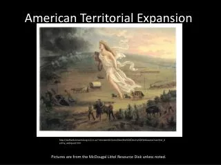
Physical Map of the U.S.. . Political Map of U.S.:. . How did we get from here

E N D
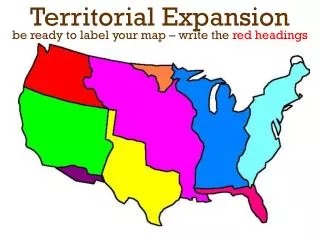
1. U.S. Territorial Expansion Map Project
3. Political Map of U.S.:
4. How did we get from here�
5. EXPANSION
6. Expansion: The act or process of expanding: the new nation�s expansion westward.
7. Through what process was the United States able to expand?
ACQUISITION
8. Acquisition: Something acquired or gained: added two new acquisitions (states) to our country.
9. Layer 1 (Bottom):
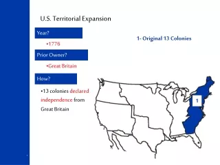
10. Original 13 Colonies
12. The Thirteen Colonies: The thirteen colonies occupied what became the original area of the United States. The 13 original states and parts of Maine, Vermont, and West Virginia were formed from this area.
14. Addition of 1783
15. Addition: Something added, such as a room or section appended to a building.
16. Addition of 1783 The addition of 1783 extended the nation�s boundaries north to the Great Lakes, south to the 31st parallel, and west to the Mississippi River. All or most of nine states were formed from this region, which more than doubled the territory of the United States.
17. Addition of 1783:
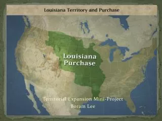
18. Louisiana Purchase - 1803
19. Purchase: To obtain in exchange for money or its equivalent; buy.
20. Louisiana Purchase The Louisiana Purchase of 1803 added 827,987 square miles of land to the United States. The federal government paid France about $15 million for the territory. Part or all of 15 states were formed from the area.
21. The Louisiana Purchase:
22. Red River cession:
23. Cession: A ceding or surendering, as of territory to another country by treaty.
24. Cede: To surrender possession of, especially by treaty. Synonym: relinquish
25. Red River cession � 1818: The Red River cession was included in a treaty between the United States and Great Britian in 1818. Parts of Minnesota, North Dakota, and South Dakota were formed from this area. The treaty also made the 49th parallel the northern boundary of the United States.
26. Florida Cession - 1819
27. Florida Cession:
28. Florida cession - 1819 The Florida cession of 1819 gave the United States the areas then called east Florida and West Florida. Parts of Louisiana, Mississippi, and Alabama and all of Florida were formed from this territory, which was ceded by Spain.
29. Texas Annexation - 1845
30. Annexation: To incorporate (territory) into an existing political unit such as a country, state, county, or city.
31. The Texas annexation:
32. The Texas annexation � 1845: The Texas annexation of 1845 added what was then the nation�s largest state. Most of the present boundaries of Texas were established in 1850, when the state gave up claims to western lands.
33. Oregon Country Cession -1846
34. The Oregon Country cession: The Oregon Country cession extended the western border of the United States to the Pacific Ocean in 1846. This cession also established the 49th parallel as the nation�s northern boundry in the area west of the Continental Divide. Idaho, Washington, and Oregon were formed from the Oregon region.
35. Mexican Cession - 1848
36. The Mexican cession -1848:
37. The Mexican cession � 1848: The Mexican cession of 1848 added over 525,000 square miles of land to the United States. The government paid Mexico $15 million for a region that became the states of California, Nevada, and Utah. Parts of four other states were also formed from this region.
38. Gadsden Purchase - 1853
39. The Gadsden Purchase - 1853:
40. The Gadsden Purchase � 1853: The Gadsden Purchase of 1853 gave the United States 29, 640 square miles of land in what is now Arizona and New Mexico. The United States paid Mexico $10 million for the land.
41. Alaska Purchase - 1867
43. The Alaska Purchase - 1867:
44. The Alaska Purchase � 1867: The Alaska Purchase of 1867 added 586,000 square miles of territory to the United States. The government paid Russia $7,200,000 for this region.
45. Hawaii Annexation - 1898
46. Hawaii annexation - 1898:
48. Hawaii Annexation � 1898: The Hawaiian annexation of 1898 gave the United States its largest present overseas possession. The Hawaiian Island cover 6,450 square miles.
49. Layer 2:
50. Addition of 1783:
51. Layer 3:
52. The Louisiana Purchase:
53. Layer 4: