Download
1 / 34

E N D
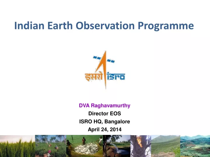
Indian Earth Observation Programme DVA Raghavamurthy Director EOS ISRO HQ, Bangalore April 24, 2014
Indian EO Programme: The Uniqueness • Vibrant Space Segment: Constellation of Satellites • Resourcesat, Cartosat, Oceansat • Strong Ground Mechanisms • Institutional Framework: NNRMS… • Ground support: Enabling techniques • Diversity of Applications • Natural Resources: Land & Water • Infrastructure : Physical & Social • Livelihood : PFZ, Bharat Nirman • Disaster Management Support • Reaching to Community • Addressing Nation’s developmental priorities
THE EVOLUTION INSAT-3D SARAL 2013 RISAT-1 : C-SAR 2012 25 Years since IRS-1A 2011 RESOURCESAT-2: LISS 3, LISS 4, AWiFS MEGHA-TROPIQUES: SAPHIR, SCARAB & MADRAS CARTOSAT-2B : PAN 2010 IMS-1: Mx, HySI RISAT-2 : X-SAR 2009 CARTOSAT-2A : PAN 2008 OCEANSAT-2: OCM, SCAT, ROSA 2005 CARTOSAT-1: PAN stereo 2001 TES : PAN 2007 2003 CARTOSAT-2: PAN 1997 IRS-1D : LISS-3, PAN & WiFS 1999 RESOURCESAT-1 : LISS 3; LISS 4; AWiFS OCEANSAT-1 : OCM & MSMR • Thematic Satellites Series • Operational Indian Remote Sensing Satellites • National missions on various themes • GIS databases for decision support • Integrated mission for sustainable development • IRS utilisationprorgramme • Joint experiments programme • Bhaskara utilisation - first user programme • Landsat data utilisation - experimental applications • Landsat station – 1979 • Coconut wilt - helicopter images 1996 1995 IRS-P3 : WiFS, MOS, X-Ray IRS-1C : LISS-3, PAN & WiFS 1994 1991 IRS-P2: LISS- 2 IRS-1A : LISS-1 & 2 1988 IRS-1A : LISS-1 & 2
Indian Earth Observation (in-orbit satellites) (3 satellites) 2012 RISAT-1 C-SAR 2007 CARTOSAT-2 PAN (2 satellites) 2011 RESOURCESAT-2 LISS 3; LISS 4; AWiFS 2005 CARTOSAT-1 Stereo PAN, F/A Land & Water 2003 RESOURCESAT-1 LISS 3; LISS 4; AWiFS (6 satellites) Cartographic 2013 INSAT-3D IMAGER, SOUNDER Ocean & Atmosphere 2009 OCEANSAT-2 OCM , SCAT, ROSA 2003 INSAT- 3A VHRR, CCD 11 2013 SARAL ALTIKA, ARGOS 2011 MEGHA-TROPIQUES MADRAS, SAPHIR, SCaRaB 2002 KALPANA-1 VHRR
Resourcesat-1 / 2 (2003, 2011) Land and Water Resources applications Natural Resources Mapping & Monitoring AWiFS • LISS-4 Mx: 5.8m Resolution and 70 km swath • LISS-3 : 23.5m Resolution and 141 km Swath • AWiFS :56m Resolution and 740 km Swath • Repetitivity: 5 days (AWiFS) to 24 days (LISS 3) & • Revisit : 5 days (LISS 4) with tilting 26 deg tilt LISS-III LISS-IV
Cartosat-1 and 2 (2005, 2007) Large scale mapping and Cartographic applications • Cartosat-1 • 2.5 m resolution, 30 km Swath • Stereo mission; +26° / -5° forward/ Aft view • Revisit : 5 days • Along Track Stereo viewing - first of its kind in the world • Cartosat-2 • Swath (km) : 10 • SNR : 180 • IGFOV (m) : 0 .8 • SWR (%) : 10 Cartosat-2 Data Products • Handling of unique imaging modes • paint brush • multi-view in step and stare • spot scenes
Oceansat-2 A global mission, providing continuity of ocean colour data and wind vector in addition characterization of lower atmosphere and ionosphere from ROSA payload. • Global data acquisition of Ocean colour • High Resolution Data - NRSC and INCOIS • 1 km resolution global products through NRSC Website • Global Chlorophyll, Aerosol Optical Depth through NRSC Website • 3531 OCM data downloaded from NRSC Website • Scatterometer Wind Products • Reception Station at Svalbard • Real time transfer and processing • Uploading to Web within 3 hrs through EUMETCAST • 1.72 Lakhs data downloaded from NRSC Website • Data Dissemination Mechanism • Established Ground station at INCOIS • Ground station at Bharti, Antarctica is being commissioned. • EUMETCAST, NRSC Website for data and products
Radar Imaging Satellite (RISAT-1 ) 100 km (UNQUALIFIED) 608 km FRS1/FRS2 MODE HRS MODE 200 km CRS MODE 400 km (QUALIFIED) MRS MODE Space borne SAR in C-band at 5.35 GHz Single/ Dual / Quad Polarisation imaging with 3 - 50 m Resolution & 10 - 240 km Swath • Stripmap FRS-1 / FRS-2 (Range Doppler/ Chirp Scaling) • ScanSAR MRS & CRS (Range Doppler/Specan) • Spotlight (modified sub-aperture) modes. 100 km (UNQUALIFIED)
SARAL: Satellite with Argos and Altimeter Altika/SARAL mission belongs to the global altimetry system for the precise and accurate observations of ocean topography, circulation and sea surface monitoring ISRO & CNES Collaboration • Mission: • Sun-synchronous, polar orbiting satellite • Inclination: 98.38 Deg. • Altitude: ~800 km • Repeat cycle: 35 days • Altika Payload: • Ka-band (35.75 GHz, BW 500 MHz) radar altimeter • Dual-frequency microwave radiometer (23.8 & 37 GHz) • DORIS • Laser Retro-reflector Array SARAL/AltiKA SSHA observation overpass over Indian Ocean on Feb 28, 2013 and SLA from POM model at 0.5 degree resolution.
CARTOSAT-2E • Panchromatic camera: 0.65 m • Multispectral: 2 m • No. of Bands: 4 • Swath : 10 km • Radiometric Resolution: 11 bit • Steering up to ±26°/±45 • Event Monitoring Cameras: 2 Nos. EVM1: Res:0.5m Area: 1km x 1km; EVM2: Res:0.4m Area: 0.3x 0.2km • Altitude: 500 km • Solid State Recorder: 600 Gb • Local time: 0930 hrs • Revisit : 5 days • TDI Technology • Operational life: 5 Years • Major Objectives • To provide continuity of on-going data services of CARTOSAT-2 • To design and develop a highly agile and advanced satellite with high spatial resolution both in panchromatic and multi-spectral bands • To meet the increasing user demands for cartographic and cadastral level applications with improved revisit capability in tandem with Cartosat-2 missions.
CARTOSAT-3 • Panchromatic camera; 0.25 m • Multispectral (4 Bands): 1 m • Hyperspectral (200 Bands): 12 m • Swath : 16 km, 5 km (HySI) • Radiometric Resolution: 11 bit • Steering up to ±26° (±45° Possible) • Altitude: 450 km • Solid State Recorder: 2 Tb • Local time: 1030 hrs • Revisit : 5 days • TDI Technology • X and Ka Band Transmission • Operational life: 5 Years • Major Objectives • To design and develop an agile advanced satellite to obtain imagery with a very high spatial resolution of 0.25m Ground Sampling Distance (GSD) in panchromatic, 1m GSD in 4 band multi spectral; and selectable 12m GSD HySI with 50 VNIR bands or 12m GSD HySI with 150 SWIR bands with an operational life of 5 years. • To meet the increasing user demands for very high resolution Panchromatic, Multispectral and Hyperspectral imagery.
GEO IMAGING SATELLITE (GISAT-1) Geostationary orbit of 36,000 km Every 30 minutes observation over India LAUNCH:2016-17 • High resolution multi-spectral VNIR (HRMX-VNIR): 50m Resolution • Hyper spectral VNIR: 320m Resolution • Hyper spectral SWIR (HyS-SWIR): 192m resolution • High resolution Multi-spectral (HRMX-TIR): 1.5km Resolution
RESOURCESAT-2A • Major Objectives • To provide continuity of on-going services of Resourecesat-2 and ensure in-orbit redundancy of the satellite • Increased frequency of observations in tandem with Resourecesat-2 during overlap period • To explore newer application areas in Land and Water Resources monitoring & management LAUNCH:2015-16
OCEANSAT-3 Mission OCEANSAT-3 is a global mission and is configured to cover global oceans and provide continuity of ocean colour data with global wind vector and characterization of lower atmosphere and ionosphere. LAUNCH:2017-18 • Objectives: • Continuity of ocean colour data with improvements to continue and enhance operational services like potential fishery zone and primary productivity. • To enhance the applications by way of simultaneous Sea Surface Temperature (SST) measurements, in addition to chlorophyll, using additional thermal channels, is envisaged in this mission. • Continuity of wind vector data through repeat of Scatterometer for cyclone forecasting and numerical weather modelling. • The mission, in tandem with Oceansat-2 (on availability), will improve the repetivity of ocean colour measurements to every 24 hour and wind vector measurements to every 12 hour. • Payloads: • An 13-band Ocean Colour Monitor (OCM) in VNIR (400-1010 nm range) with 360 m spatial resolution and 1400 km swath for ocean Colour monitoring • 2-band Long Wave Infra Red (LWIR) around 11 and 12 μm for Sea Surface Temperature (thermal channels) at 1080 m resolution. • A Ku-Band Pencil beam SCATTEROMETER with a ground resolution of 50 km x 50 km for Continuity of wind vector data for cyclone forecasting and numerical weather modelling
INSAT - 3DR Advanced weather satellite of India configured with improved Imaging System and Atmospheric Sounder 6 Channel IMAGER • Spectral Bands (µm) • Visible : 0.55 - 0.75 • Short Wave Infra Red : 1.55 - 1.70 • Mid Wave Infra Red : 3.70 - 3.95 • Water Vapour : 6.50 - 7.10 • Thermal Infra Red – 1 : 10.30 - 11.30 • Thermal Infra Red – 2 : 11.30 - 12.50 • Resolution : 1 km for Vis & SWIR • 4 km for MIR & TIR • 8 km for WV LAUNCH:2016 19 Channel SOUNDER • Spectral Bands (µm) • Short Wave Infra Red : Six bands • Mid Wave Infra Red : Five Bands • Long Wave Infra Red : Seven Bands • Visible : One Band • Resolution (km) : 10 X 10 for all bands • No of simultaneous : 4 sounding • per band
NISAR (DESDynI) LAUNCH:2019-21 • Major Objectives • Design, develop and launch Dual frequency (L and S Band) Radar Imaging Satellite • Explore newer application areas using L and S band microwave data, especially in surface deformation studies, terrestrial biomass structure, natural resources mapping & monitoring and studies related to dynamics of ice sheets, glaciers, forest fire, oil slick, etc. I‐3K with Stowed Radar Payload in 4m GSLV Fairing
GEO (Navigation Payload) GPS GPS • 1320 • 340 • 830 • GEO • 0 • GSO User • 111.50 • 550 INRESs INRESs INLUS INMCC Satellite Navigation GAGAN: GPS & Geo-Augmented Navigation • Augmentation of existing Global system: Improved Positioning Accuracies (from 30m to 6m) • Technology Demonstrator Ground segment completed; Two payloads in GSAT 8 & GSAT 10 IRNSS: Indian Regional Navigation Satellite System • Indigenous Regional System • Constellation of 7 satellites in GSO/ GEO • Reliable Position, Navigation & Timing services over India & its neighbourhood • First satellite launched in 2013
Indian EO Scenario in near future Scatsat (2015) Resourcesat – 1 LISS III, LISS IV, AWiFS Oceansat-3 (2018) OCM, SCAT INSAT-3DR (2015) Imager, Sounder Cartosat-1 Resourcesat – 2 LISS III, LISS IV, AWiFS INSAT-3D Imager, Sounder Cartosat-2 RISAT-1A C-band GISAT-1 (2017) MX, Hyperspectral, Thermal Oceansat-2 OCM, SCAT, ROSA Megha -Tropiques SAPHIR, SCARAB & ROSA RISAT-1 C-band INSAT- 3A VHRR, CCD KALPANA-1 VHRR Cartosat-2E (2016) 0.65 m PAN, 2 MX Resourcesat -2A (2015) LISS III, LISS IV, AWiFS Cartosat-3 (2017) 0.25 m PAN, 1m MX, HYSI SARAL Altika & Argos In-orbit Approved Considered Resourcesat-3 LISS III, LISS IV, AWiFS
Application Projects in Diversified areas Agriculture & Soils Bio Resources & Environment • Crop Production Forecast • Saline/ Sodic Soils mapping • Agro-Met Services & Disaster Surveillance (pest, floods, drought) • Horticulture development • Forest Cover & Type mapping • Wetland Inventory & Conservation plans • Biodiversity Characterization • Desertification Status mapping • Coastal, Mangroves, Coral related • Snow & Glacier studies Geology & Mineral Resources Cartography • Landslide Hazard Zonation • Mineral/ Oil Exploration, Mining Areas, • Seismo-tectonic Studies • Engineering & Geo-Environmental studies • GCP Library for IRS Data correction • Large Scale Mapping • Topo-map updation - Satellite-based • Digital Elevation Model (Carto-DEM) • Cadastral Level mapping Rural Development Ocean and Meteorology • Ocean Primary Productivity • Ocean State Forecast (OSF) • Storm Surge Modeling • Regional Weather prediction • Tropical Cyclones & Mesoscale studies • Extended Range Monsoon Prediction • National Drinking Water Mission • Wastelands Mapping/ Updation • Watershed Development & Monitoring • Land Records Modernization Plan
Application Projects in Diversified areas Water Resources Urban Development • Irrigation Infrastructure assessment • Water Resources Information System • Command Area/ Irrigation Performance Evaluation • Snow-melt Run-off Estimation • Reservoir Capacity Evaluation • Site Selection for Hydro-Power • Urban Sprawl Mapping of Major Cities • Master/ Structure Plans • Comprehensive Dev. Plans (CDP) of selected Cities/ Towns • Base Map generation for Towns • National Urban Information System NR Census Disaster Management Support • Operationally addressing various natural disasters like Flood, Cyclone, Drought, Landslide, Earthquake and Forest Fire • R&D Studies on Early warning Systems, Decision Support Tools • Periodic Inventory of Natural Resources under NR Census Programme: • Land use/ Land Cover, Soil, Geomorphology, Wetland, Land degradation, Snow & Glaciers, Vegetation Climate Change Studies • Mapping the indicators, Monitoring the agents and Modelling the Impact • Characterisation of climate variables (Land, Atmosphere & Oceans) • Methane Emission, Timberline study, LU LC Change dynamics, etc.
Modest Beginning - Satellite Data Acquisition NRSA established Earth Station Complex at Annaram Village, Shadnagar, 59 km from Balanagar in 1979 to receive Landsat Data TERMINAL-1 (10M DIA)
Earth Station at NRSC Located at Shadnagar, 59 km from HyderabadEstablished in 1979 with Landsat data reception 2011 Multi-mission IMGEOS Four 7.5m antennae 2007 2 x 320 Mbps SAR 7.5m Antenna, Dual Polarisation X band 2004 2 x105 Mbps LISS IV 7.5 metre (Indigenous) S, X Bands 1987 10 metre Antenna; S, X Bands With Indigenous Feed 2 x 84 Mbps PAN 1983 10 metre Antenna; S Band 84 Mbps LISS-2 15 Mbps 1979 10 metre Antenna; L,S Bands
Evolution of Data Product Generation Landsat 30 Prod. /day Processor Speed: 1.2 MHz Memory : 56KB IO: Unibus Processing: Rad/ Geo Corrected Product Output Media: CCT (40 MB) IRS-1A/1B 45 Prod. /day Processor Speed: 5 MHz Memory : 128KB IO: Massbus Processing: System corrected Scene Product Output Media: CCT/ Floppy (40/1.44 MB) IRS-1C/1D 50 Prod. /day Processor Speed: 40 MHz Memory : 16MB IO: QBus Processing: System corrected & Geo referenced Products Output Media: CCT /TapeCartdrige (40/ 150MB) IRS-1C/1D/P4 100 Prod. /day Processor Speed: 400 MHz Memory : 8GB IO: PCI Processing: System corrected, Geo referenced & value addition Products Output Media: 8mmDAT/CD (4GB/ 700MB) RS-1,2/C1,2/RISAT/OS 1000+ Prod. /day Processor Speed: 3 GHz Memory : 64GB IO: PCI-E Processing: System & Terrain corrected, Geo referenced, Orthorectified & value addition Products Output Media: DVD/USBDisk/FTP (700MB/4.7GB/500+GB Late ’70s -Early’80s Late’90s -2000 2003 - 2013 Mid ’90s Mid ‘80s -Early’90s
Trends in Data Dissemination • Offline user request placing (paper) to online request placing. (UOPS to IMGEOS) • Data utilization is increased from 2,000 products / year to 100,000 products / year • Turn around time decreased from • 10 days to 1 hour • Mode of dispatch from • Tape to CDROM to FTP • Change from the photo products to digital environment • Improved Location accuracies and radiometric resolution • Reduction in data pricing to the users • Free downloads ~ 2,00,000 Satellite Data Dissemination SLASH IN DATA PRICING
Antarctica Ground Station • Salient Points • Station at Bharathi (Larsmann Hills) • 1 Communication & 2 RS Terminals • Budget: 46 Cr • Visibility advantage (10 - 12 out of 14 passes/ day) • Remote Ops from NRSC Earth Station • Configuration • 7.5 m diameter antenna with G/T of 31dB/°K (including Radome Loss ) • 200 W SSPA for Communication terminal • 10 Mbps satellite link for data transfer • TTC operations • Upgradability for future Missions
ISRO’s Multilateral Cooperation • International Charter Space and Major Disasters - Initiated by CNES and ESA; ISRO joined in 2002 • Asia-Pacific Regional Space Agency Forum (APRSAF’s) Sentinel Asia • UNCOPUOS - Long term sustainability of Space activities • International Astronautical Federation (IAF) - India hosted the 58th IAF Congress in 2007 • International Academy of Astronautics (IAA) – Regional Chapter • Committee on Space Research (COSPAR) – India hosted the Scientific Assembly in 2012 at Mysore • Committee on Earth Observation (CEOS) – Plenary in October 2012 at Bangalore • Space System for the Search of Vessels in Distress (COSPAS) - Search and Rescue Satellite Aided Tracking (SARSAT) System
Major contributions of India to GEO activities • Participation in Global Earth Observation System of Systems (GEOSS) Societal Benefit Areas (SBAs) • Support to GEOSS Data Sharing Principles and co-chairing the Data Sharing Task Force (DSTF) – contributing data from Indian satellites • Secretariat for Global Agricultural Monitoring (GEO Task AG-07-03a) • Participation in Virtual Constellation of Satellites
Data Sharing by ISRO • Major data sharing from ISRO is under the initiatives of: • International Disaster Charter • Sentinel Asia initiatives with many countries • Oceansat-2 OCM, Scatterometer Global Chlorophyll-a image for January 2010 Web Portal of ISRO • Indian Data portals for sharing of data: • MOSDAC • NNRMS - NRDB • BHUVAN • …
Major contributions of ISRO to CEOS • ISRO Chaired the CEOS 12th Plenary & 26th Plenary and hosted its Plenary in Bangalore in 1998 and 2012 • Hosted the Working Group on Information System and Services (WGISS) meeting in 1997 and 2012 • Hosted Working Group on Calibration and Validation (WGCV) in 2012 • ISRO Chaired the CEOS Working Group on Education and Training (WGEdu) and defined its strategy • Support to CEOS data handbook • Co-chaired the Land Surface Imaging Study Group • Recent contribution: • Calibration and validation of ISRO satellite data through WGCV Cal/Val experiments using international well characterized sites) • 7 Virtual constellation of satellites – support to 5 Virtual constellation through 5 EO satellite instruments • Support to global initiatives like Global Forest Observation Initiative, G20 Global Agricultural Monitoring”, Geohazard Supersites • Data for filling the gaps for geophysical parameters. • Capacity building support for WGCapD • Contribution to UNFCCC, Rio+20
Major contributions of ISRO to WGEdu / WGCapD • 13th CEOS Plenary meeting in November 1999 held at Stockholm formed the CEOS Working Group on Education and Training (WGEdu) with ISRO as its Chair and UNOOSA as vice chair • Organised its first meeting of WGEdu at IIRS, Dehradun, India • Prepared the 3 year action plan for implementing WGEdu strategy • Organised the international workshop on EO Education/Training jointly by ISRO/CEOS-WGEdu and UN-CSSTE-AP in IIRS, Dehradun, India • Participated in the first meeting of WGCapD in Brazil
www.isro.gov.in Thank You