Download
1 / 52
530 likes | 1.1k Views
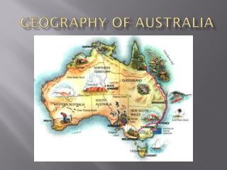
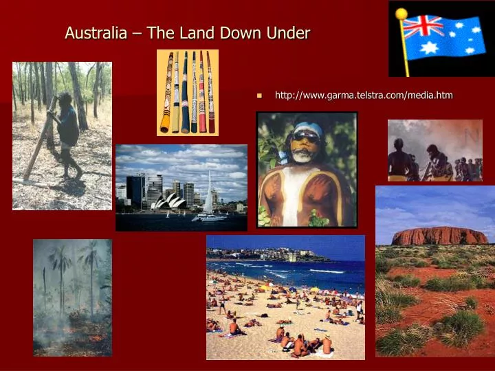
Australia – The Land Down Under. http://www.garma.telstra.com/media.htm. History. Lake Mungo- age of Mungo Man. between 30,000 years & 60,000. . Before the arrival of European settlers, Aboriginal and Torres Strait Islander peoples inhabited most areas of the Australian continent.

E N D
Australia – The Land Down Under http://www.garma.telstra.com/media.htm
History Lake Mungo- age of Mungo Man. between 30,000 years & 60,000. • Before the arrival of European settlers, Aboriginal and Torres Strait Islander peoples inhabited most areas of the Australian continent. • Each people spoke one or more of hundreds of separate languages, with lifestyles and cultural traditions that differed according to the region in which they lived. • Their complex social systems and highly developed traditions reflect a deep connection with the land and environment. • Asian and Oceanic mariners and traders were in contact with Indigenous Australians for many centuries before the European expansion into the Eastern Hemisphere. • Some formed substantial relationships with communities in northern Australia.
The first recorded European contact with Australia was in March 1606, when Dutch explorer Willem Janszoon (c.1570 - 1630) charted the west coast Queensland. • Over the next two centuries, European explorers and traders continued to chart the coastline of Australia, then known as New Holland. • In 1688, William Dampier became the first British explorer to land on the Australian coast. • It was not until 1770 that another Englishman, Captain James Cook, aboard the Endeavour, extended a scientific voyage to the South Pacific in order to further chart the east coast of Australia and claim it for the British Crown. • Britain decided to use its new outpost as a penal colony; the First Fleet of 11 ships carried about 1500 people—half of them convicts. • The fleet arrived in Sydney Harbour on 26 January 1788, and it is on this day every year that Australia Day is celebrated.
In all, about 160 000 men and women were brought to Australia as convicts from 1788 until penal transportation ended in 1868. • The convicts were joined by free immigrants from the early 1790s. • The wool industry and the gold rushes of the 1850s provided an impetus for free settlers to come to Australia. • Scarcity of labor, the vastness of the land and new wealth based on farming, mining and trade made Australia a land of opportunity. • Yet during this period, Indigenous Australians suffered enormously. Death, illness, displacement and dispossession disrupted traditional lifestyles and practices. Port Arthur, Tasmania was Australia's largest penal colony
The Commonwealth of Australia was formed in 1901 through the federation of six states under a single constitution. • The non-Indigenous population at the time of Federation was 3.8 million (Indigenous=93,000). Half of these lived in cities, three-quarters were born in Australia, and the majority were of English, Scottish or Irish descent. • The founders of the new nation believed they were creating something new and were concerned to avoid the pitfalls of the old world. • They wanted Australia to be harmonious, united and egalitarian, and had progressive ideas about human rights, the observance of democratic procedures and the value of a secret ballot. • While one of the first acts of the new Commonwealth Parliament was to pass the Immigration Restriction Act 1901, which restricted migration to people of primarily European origin, this was dismantled after the Second World War. • Today Australia has a global, non-discriminatory policy and is home to people from more than 200 countries. • From 1900 to 1914 great progress was made in developing Australia’s agricultural and manufacturing capacities, and in setting up institutions for government and social services. • 2006 -= 20,629,787 • INDIGENOUS POPULATION =427,094 A poster entitled 'Advance Australia' produced in 1901
Overall, the Australian Aborigines went through stages of being conquered through an 'invasion' and taking of their lands. • Many adapted to the new lifestyle (when many became reliant on alcohol, tobacco and handouts of food and clothing. However the settlers were often contemptuous of the Aborigines and separated them from their society and the people became the fringe dwellers of society. Often they were killed as a nusiance. • Others were removed from their families and placed into institutions. • From the late 1830s the remnants of the tribes in the settled areas were moved onto Reserves and Missions where they were 'managed' by Whitemen and were forbidden from teaching their children their language and customs. • During the 1900s separation was an official government policy which lasted for many decades. • Today, many Aboriginal people do not know their origins. In other words, which tribe they are descended from or the names of their parents and or grandparents. They are a lost generation. • Source http://www.crystalinks.com/aboriginals.html
In 1967 the Australian people approved in a national referendum to give the federal government the power to pass legislation on behalf of Indigenous Australians and to include Indigenous Australians in future censuses. • The referendum result was the culmination of a campaign by both Indigenous and non-Indigenous Australians. • It was widely seen as affirmation of the Australian people’s wish to see its government take direct action to improve the living conditions of Aboriginal and Torres Strait Islander peoples.
In March 1967 striking Aboriginal pastoral workers changed political history by extending a demand for equal wages to a declaration of their rights of ownership of traditional lands. • This became one of Australia’s first successful land claims by its indigenous people. • In this photograph Mervyn Bishop captures the moment when the country is symbolically handed back to Vincent Lingiari, one of the traditional land owners of Dagu Ragu (Wattie Creek), by the Prime Minister of the day, Gough Whitlam. • Prime Minister Gough Whitlam pours soil into hands of traditional landowner Vincent Lingiari, Northern Territory 1975
Australia has unique land, water, vegetation and biodiversity resources. The Australian continent of 7.6 million km2 supports a wide range of agricultural and forestry industries. The 16.1 million km2ocean supports a wide range of marine species. • The management of their natural resources is one of Australia’s greatest challenges. • Production from natural resources earns over $30 billion a year in exports from the agriculture, fisheries and forestry industries. • Responsibility for natural resources generally rests with the States and Territories, however the Australian Government is responsible for some fisheries, primarily offshore or cross-State fisheries.
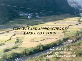
Australia is a dry continent where rainfall is unreliable compared with Europe and North America. • Recurring droughts and floods are a natural feature of the landscape. • The Australian continent has a number of distinct climatic zones: • the summer dominant tropics and sub tropics to the north; • the Mediterranean climates to the south; • the arid and semi arid regions in the middle of the continent; • areas of high rainfall on coastal fringes and in the ranges of the east of Australia. • Agricultural land use is heavily influenced by this climatic regime. Generally, the tropical north is suited to grazing (principally cattle) as well as the production of fruit and sugarcane. 1200=47” 800=31” 500= 20”
Water availability • Australia has an average rainfall of only 469mm/year, with annual averages ranging from 127mm in south east South Australia to 3,163mm in north east Queensland. • Evaporation rates are extremely high with only 12% of rainfall collecting in rivers, compared with a world average of 65%. • Of all the inhabited continents, Australia has the least amount of water in its rivers. The rivers have more than twice the flow variation of those of Europe, second to southern Africa. • Water storage capacity is over 4,000KL per person, the highest water storage capacity per capita in the world. • There are 447 large dams supplying 79,000 GL (Gigalitres*) of water for irrigation, industrial, hydo-electricity and urban use. • Estimated total water supply in 1996-97 was 80,363 GL. • Source: http://www.affa.gov.au/content/output.cfm?ObjectID=F283DB44-6641-4723-8D4CC6B45E49F3A0
Irrigation is well established and is an important feature of the agricultural landscape. • Widespread irrigation and extraction by other water uses has placed the natural ecosystems that rely on the nation's water resources under considerable pressure. • The challenge for resource managers is to ensure balance between the use of water for production purposes and conservation of riverine environments Percentage run off for each Basin Drainage basins in the central Australian mountain ranges, have rapid response times and floods may rise quickly, blocking roads in Alice Springs. This image shows a flood on the Todd River at the Heavitree Gap Causeway.
Soils of Australia • The agricultural landscapes of Australia are supported by a wide range of soil types. • Most, soils are ancient, strongly weathered and infertile. • Old soils along with the natural limitations of many soils and their interactions with climate, have made it more challenging to develop sustainable systems for agriculture. • Limitations to productivity have also been induced through human impacts on soils. • While some forms of degradation such as nutrient deficiencies can be corrected, others, such as soil erosion, compaction and acidification are difficult to remedy. • Australian soils tend to be: • old • salty • clayey – except in the west of the continent where they tend to be sandy • acidic • nutritionally and organically impoverished • structurally challenging. Source: http://www.affa.gov.au/content/output.cfm?ObjectID=F9AB31F2-E3AB-4CC1-B5D07FDE0A82E197 & http://humanities.cqu.edu.au/geography/GEOG11023/week_8.htm
Australian soils have less organic matter and poorer structure than soils in the Northern Hemisphere. • They tend to be quite clayey just below the surface which restricts drainage and impedes root growth. • Some of the clay characteristics cause problems for engineering and farming because of their ‘shrink and swell’ nature. • Australia’s rate of soil formation is low by world standards taking 1,000 years, in many parts of the country, for 3 cm of soil to form. • Dust storms can cause large losses of soil, for example the 1983 Melbourne dust storms resulted in a loss of more than two million tons of soil. Source: http://www.affa.gov.au/content/output.cfm?ObjectID=F9AB31F2-E3AB-4CC1-B5D07FDE0A82E197
Source of Soils Information • http://www.clw.csiro.au/aclep/asc/asc.htm • http://www.dpi.vic.gov.au/dpi/vro/vrosite.nsf/pages/gloss_DG • http://humanities.cqu.edu.au/geography/GEOG11023/week_8.htm • http://www.grdc.com.au/growers/oft/soiltype.htm
FERROSOLS: Soils with B2 horizons which are high in free iron oxide, and which lack strong texture contrast between A and B horizons. The B2 horizon has structure more developed than weak and a fine earth fraction which has a free iron oxide content greater than 5% (as opposed to a Dermosol). Some Tasmanian soils, particularly the ferrosols (the red soils of the north-west and north-east) are of world class quality because of their free drainage and good structure, but they can be easily degraded. This soil profile is an example of a soil with a gradational profile (clay content increasing gradually down the profile). Source: Richard Doyle Source: Soil Orders-Australia = http://www.dpi.vic.gov.au/dpi/vro/vrosite.nsf/pages/gloss_DG
Organosol: This class caters for most soils dominated by organic materials. • Although they are found from the wet tropics to the alpine regions, areas are mostly small except in south west Tasmania. • There have been few previous attempts to subdivide these soils and data are limited in Australia. • Organosol soil profile from Tasmania.
Dermosols :Soils with structured B2 horizons and lacking strong texture contrast between A and B horizons. • Although there is some diversity within the order, it brings together a range of soils with some important properties in common. • This example is of a Red Dermosol that occurs on a lower river terrace of the Tallangatta Creek in north-east Victoria Red Dermosols occur on a range of landscapes in the North East region of Victoria - from lower river terraces to mountainous areas.
Kandosols :This order accommodates those soils which lack strong texture contrast, have massive or only weakly structured B horizons, and are not calcareous throughout. • The soils of this order range throughout the continent, often occurring locally as very large areas. • Kandosol soil profile from Western Australia. • Red Kandosoldeveloped on granite
Rudosols :This order is designed to accommodate soils that have negligible pedologic organisation. • They are usually young soils in the sense that soil forming factors have had little time to pedologically modify parent rocks or sediments. • The component soils can obviously vary widely in terms of texture and depth; many are stratified and some are highly saline. • Data on some of them are very limited. • Rudosol soil profile from Queensland.
Hydrosol: This order is designed to accommodate a range of seasonally or permanently wet soils and thus there is some diversity within the order. • The key criterion is saturation of the greater part of the profile for prolonged periods (2-3 months) in most years. • The soils may or may not experience reducing conditions for all or part of the period of saturation, and thus manifestations of reduction and oxidation such as 'gley' colors and red mottles may or may not be present. Exotic Pine Trees at the Redoxic Hydrosol Site
Tenosols :This order is designed to embrace soils with generally only weak pedologic organisation apart from the A horizons. • It encompasses a rather diverse range of soils, which are nevertheless widespread in many parts of Australia. • Tenosols have a weakly developed soil profile which is typically very sandy and without obvious horizons. • Tenosols form from highly salicious parent material and where rainfall is from 0 to 1400mm. • Generally, tenosols have a very low agricultural potential with very low chemical fertility, poor structure and low water-holding capacity. • Ground-water contamination can be a potential problem due to the high permeability of these soils.
Vertosol: Clay soils with shrink-swell properties that exhibit strong cracking when dry and at depth have slickensides and/or lenticular structural aggregates. • Although many soils exhibit gilgai microrelief, this feature is not used in their definition. • Australia has the greatest area and diversity of cracking clay soils of any country in the world. • Vertosol soil profile from Queensland.
GILGAI MICRORELIEF: Gilgai's are common where they are Grey Vertosol soils. • The land surface is irregular with alternating mounds and depressions and is commonly referred to as 'crab hole' country. • Gilgai microrelief in a paddock in the Horsham region. Note the well defined mounds. • Gilgai microrelief is formed due to clay horizons shrinking and swelling with alternate drying and wetting cycles (vertic properties). • This forces 'blocks' of subsoil material gradually upwards to form mounds. • The resultant soil on the mounds have properties which are more like Grey Vertosol subsoils (i.e lighter colour, more alkaline, presence of carbonate, higher salinity). • Source http://www.dpi.vic.gov.au/dpi/vro/vrosite.nsf/pages/gloss_DG#factual
CRUSTY: Soils with a massive or weakly structured surface crusty horizon (3 cm or less thick). • It is often lower in clay content than the underlying non-self mulching structured clay. • This term is used as a Great Group definition for Vertosols • CONCHOIDAL FRACTURING: A mass of soil which has obvious concave fracturing (ball and socket appearance). • This is associated with severe compaction and remoulding (disturbed in a moist to wet conditon.). • It is best seen in a soil pit exposure when material is removed with a mattock or pick and has the appearance of fractured bluestone. Conchoidal fracturing is most likely to occur just beneath the surface of clay soils (Vertosols) and if the soil has been compacted (e.g. vehicular traffic) whilst in a moist to wet condition (i.e. wetter than the plastic limit) for prolonged periods.
Kurosols : Soils with strong texture contrast between A horizons and strongly acidB horizons. • Many of these soils have some unusual subsoil chemical features (high magnesium, sodium and aluminium). • Red Kurosol on granite near Springhurst Surface (A) horizons:loam or sandy loam texture; 15-20 cm thick; shallow hardsetting A1 overlying bleached A2 horizon; clear to abrupt change to:Subsoil (B2) horizon:clay texture; well developed fine subangular blocky peds; strongly acid
Sodosols : Soils with strong texture contrast between A horizons and sodicB horizons which are not strongly acid. • Australia is noteworthy for the extent and diversity of sodic soils • Sodosol soil profile from Western Australia
COLUMNAR STRUCTURE: Soil particles are arranged around a vertical axis with flat faced peds. • The tops of the columns have clearly defined domes. • Columnar structure is often associated with subsoil sodicity. • Columnar structure in the subsoil of a Corangamite Sodosol.
Chromosols : Soils with strong texture contrast between A horizons and B horizons. • The latter are not strongly acid and are not sodic. • The soils of this order are among the most widespread soils used for agriculture in Australia, particularly those with red subsoils. • Chromosols display a significant texture change from loamy upper horizons to clay subsoils which are neither sodic nor strongly acidic. • Examples can be found on hillslopes in the uplands and on volcanic plains. • Subsoils are strongly mottled and strongly structured with shiny clay peds suggestive of early Pleistocene weathering. • Red Chromosol on alluvial deposits near Navarre. • Yellow Chromosol
CALCRETE: A layer where cemented carbonate accumulation has occurred. • The material must be hard in a pan or in the substrate. • This definition does not describe the common soft carbonate nor the carbonate accumulated in nodules or concretions. • This term is used to describe a number of soils in the Australian Soil Classification
Calcarosols :As the name suggests, the soils in this order are usually calcareous throughout the profile, often highly so. • They constitute one of the most widespread and important groups of soils in southern Australia. • Limitations for agriculture include shallow depth, low water retention and wind erosion on the sandier forms. • High salinity, alkalinity and sodicity may also be a problem. Soil fertility deficiencies are widespread • Calcarosol soil profile from South Australia.
COFFEE ROCK: A compacted, cemented or indurated layer within the profile that is comprised of humus and iron oxides. • Thick coffee rock layer (Bhs horizon) from 80 cm depth in a Cranbourne Podosol. • Thinner irregular coffee rock layer (Bhs horizon) at 80 cm depth in a Cranbourne Podosol.
Podosols • Soils with B horizons dominated by the accumulation of compounds of organic matter, aluminium and/or iron. These soils are recognised world-wide, and Australia is particularly noted for its 'giant' forms. • Podosols are the dominant soil in the CranbourneBotanic Gardens and support heathland communities. • Elsewhere in the region they have largely been cleared ofnatural vegetation and support land uses such as horticulture.
Groundwater • Without groundwater much of inland Australia could not have been developed. • The Great Artesian Basin (GAB) is Australia’s biggest source of groundwater and extends under 1.7 million km2 (22%) of Australia • The Basin ranges in depth from less than 100 metres at the edge to over 3km in places. • The GAB contains 64.9 million GL of water, making it the world’s largest artesian groundwater basin. • Average groundwater flow is from 0.2 to 2.5 metres/year. It can take two million years for water to cross the Basin.
The Murray-Darling Basin in the south-east of the continent has a large irrigation infrastructure, supporting the production of fruit, vegetables, rice and many other intensive agricultural activities. • A better understanding of groundwater flow systems will help manage salinity in the Murray-Darling Basin. • source: http://www.ndsp.gov.au/catchclass/
Agriculture in the arid zone involves extensive grazing, where sheep and cattle are reared at relatively low densities of less than one sheep per 10ha. • The higher rainfall zones are suitable for dairying, as well as more intensive grazing enterprises that produce meat.
The National Action Plan is a strategy for tackling two of Australia's most serious natural resource management issues; increasing salinity levels and declining water quality.