Download
1 / 41
410 likes | 426 Views
History about the Conquest och California, war US and Mexico.

E N D
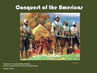
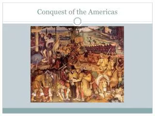
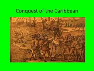
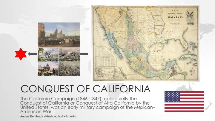
CONQUEST OF CALIFORNIA The California Campaign (1846–1847), colloquially the Conquest of California or Conquest of Alta California by the United States, was an early military campaign of the Mexican– American War Anders Dernback slideshow, text wikipedia
Indigenous peoples of California The indigenous peoples of California (known as Native Californians) are the indigenous inhabitants who have lived or currently live in the geographic area within the current boundaries of California before and after the arrival of Europeans. With over forty groups seeking to be federally recognized tribes, California has the second largest Native American population in the United States. The California cultural area does not conform exactly to the state of California's boundaries. Many tribes on the eastern border with Nevada are classified as Great Basin tribes, and some tribes on the Oregon border are classified as Plateau tribes. Tribes in Baja California who do not cross into California are classified as indigenous peoples of Mexico. The Winnemem Wintu ("middle river people" or "middle water people") are a band of the Native American Wintu tribe originally located along the lower McCloud River, above Shasta Dam near Redding, California.
A Pomo dancer by Grace Hudson The Pomo are an indigenous people of California. The historical Pomo territory in Northern California was large, bordered by the Pacific Coast to the west, extending inland to Clear Lake, and mainly between Cleone and Duncans Point. One small group, the Northeastern Pomo of the Stonyford vicinity of Colusa County, was separated from the core Pomo area by lands inhabited by Yuki and Wintuan speakers. Total population 1770: 8,000 1851: 3,500-5,000 1910: 777-1,200 1990: 4,900 2010: 10,308
A war president A caricature of Democratic candidate Lewis Cass, a general in the War of 1812, suggesting that his expansionist leanings would lead the United States into war. Cass (dubbed "General Gas" by the unfriendly press) is pictured as a veritable war machine. He sits on a wheeled gun-carriage, with his various limbs and body parts in the form of cannon shells and barrels shooting "gas" and shot. Over his head he waves a bloody saber labeled "Manifest Destiny," while reciting, "New Mexico, California, Chihuahua, Zacatecas, MEXICO, Peru, Yucatan, Cuba." These reflect, with some exaggeration, Cass's ambitious agenda for territorial expansion in the wake of American victory in the Mexican War. In his left hand he holds a spear.
Mexico in 1824 with the boundary line with the U.S. from the 1818 Adams-Onis Treaty that Spain negotiated with the U.S. https://en.wikipedia.org/wiki/Mexican%E2%80% 93American_War#/media/File:Mexico_1824_(e quirectangular_projection).png
The 1832 boundaries of Comancheria, the Comanche homeland
President Polk
People James K. Polk Winfield Scott Zachary Taylor Stephen Kearney John Sloat William Worth Robert Stockton Joseph Lane Franklin Pierce David Conner Matthew Perry John Frémont Thomas Childs Henry Burton Edward Baker William Ide John Charles Frémont or Fremont (January 21, 1813 – July 13, 1890)
Santa Anna Mariano Arista Pedro de Ampudia José Flores Mariano Vallejo Nicolás Bravo José de Herrera Andrés Pico Manuel Armijo Martin de Cos Pedro de Anaya Agustín y Huarte Joaquín Rea Manuel Muñoz Gabriel Valencia † José de Urrea
Comanches of West Texas in war regalia, c. 1830.
The California Campaign (1846–1847), colloquially the Conquest of California or Conquest of Alta California by the United States, was an early military campaign of the Mexican–American War that took place in the western part of Mexico's Alta California Department, in the present-day state of California. The California Campaign was marked by a series of small battles throughout 1846 and early 1847.
Background When war was declared on May 13, 1846 between the United States and Mexico, it took almost three months for definitive word of Congress' declaration of war to reach the Pacific coast. U.S. consul Thomas O. Larkin, stationed in the pueblo of Monterey, was concerned about the increasing possibility of war and worked to prevent bloodshed between the Americans and the small Mexican military garrison at the Presidio of Monterey, commanded by José Castro. United States Army Captain John C. Frémont, on a survey expedition of the U.S. Army Corps of Topographical Engineers with about 60 well-armed men, crossed the Sierra Nevada range in December 1845. They had reached the Oregon Territory by May 1846, when Frémont received word that war between Mexico and the U.S. was imminent
On June 14, 1846, the Bear Flag Revolt occurred when some 30 rebels, mostly American immigrants, staged a revolt in response to government threats of expulsion and seized the small Mexican Sonoma Barracks garrison, in the pueblo of Sonoma north of San Francisco Bay. There they formed the California Republic, created the "Bear Flag", and raised it over Sonoma. Bear Flag Revolt Eleven days later, troops led by Frémont, who had acted on his own authority, arrived from Sutter's Fort to support the rebels. No government was ever organized, but the Bear Flag Revolt has become part of the state's folklore. The present-day California state flag is based on this original Bear Flag, and continues to display the words "California Republic." A replica of the first "Bear Flag" now at El Presidio de Sonoma (Sonoma Barracks)
Northern Alta California Prior to the Mexican–American War, preparations for a possible conflict led to the U.S. Pacific Squadron being extensively reinforced until it had roughly half of the ships in the United States Navy. Since it took 120 to over 200 days to sail from Atlantic ports on the east coast, around Cape Horn, to the Pacific ports in the Sandwich Islands and then the mainland west coast, these movements had to be made well in advance of any possible conflict to be effective. Initially, with no United States ports in the Pacific, the squadron's ships operated out of storeships that provided naval supplies, purchased food and obtained water from local ports of call in the Sandwich Islands and on the Pacific coast. Their orders were, upon determining "beyond a doubt" that war had been declared, to capture the ports and cities of Alta California.
John Drake Sloat Commodore John Drake Sloat, commander of the Pacific Squadron, on being informed of an outbreak of hostilities between Mexico and the United States, as well as the Bear Flag Revolt in Sonoma, ordered his naval forces to occupy ports in northern Alta California. Sloat's ships already in the Monterey harbor, the USS Savannah, USS Cyane, and USS Levant, captured the Alta Californian capital city of Monterey in the "Battle of Monterey" on July 7, 1846 without firing a shot. Two days later on July 9, USS Portsmouth, which had been berthed at Sausalito, captured Yerba Buena (present-day San Francisco) in the "Battle of Yerba Buena", again without firing a shot. On July 15, Sloat transferred his command to Commodore Robert F. Stockton, a much more aggressive leader. Convincing news of a state of war between the U.S. and Mexico had previously reached Stockton.
Marines and bluejackets (sailors) of Stockton's Pacific Squadron The 400 to 650 marines and bluejackets (sailors) of Stockton's Pacific Squadron were the largest U.S. ground force in California. The rest of Stockton's men were needed to man his vessels. To supplement this remaining force, Commodore Stockton ordered Captain John C. Frémont, on the U.S. Army Corps of Topographical Engineers survey, to secure 100 volunteers (he received 160) in addition to the California Battalion he had earlier organized. They were to act primarily as occupation forces to free up Stockton's marines and sailors. The core of the California Battalion was the approximately 30 army personnel and 30 scouts, guards, ex-fur trappers, Indians, geographers, topographers and cartographers in Frémont's exploration force, which was joined by about 150 Bear Flaggers.
Contemporaneous illustration of Sutter's Fort in the 1840s
The American marines, sailors, and militia easily took over the cities and ports of northern California; within days they controlled Monterey, San Francisco, Sonoma, Sutter's Fort, New Helvetia, and other small pueblos in northern Alta California. Nearly all were occupied without a shot being fired. Some of the southern pueblos and ports were also rapidly occupied, with almost no bloodshed.
Californios and the war Prior to the U.S. occupation, the population of Spanish and Mexican people in Alta California was approximately 1500 men and 6500 women and children, who were known as Californios. Many lived in or near the small Pueblo of Los Angeles (present-day Los Angeles). Many other Californios lived on the 455 ranchos of Alta California, which contained slightly more than 8,600,000 acres (35,000 km2), nearly all bestowed by the Spanish and then Mexican governors with an average of about 18,900 acres (76 km2) each. Most of the approximately 800 American and other immigrants (primarily adult males) lived in the northern half of California, approved of breaking from the Mexican government, and gave only token to no resistance to the forces of Stockton and Frémont.
Siege of Los Angeles The plan for the the Los Angeles Harbor (later the Port of Los Angeles), 1900. I have marked the towns on the map (some of which are now neighborhoods within Los Angeles)
The Siege of Los Angeles was a military response by armed Mexican civilians to the occupation, which had begun August 13, 1846, by the United States Marines of the Pueblo de Los Angeles during the Mexican–American War. It is also known as the Battle of Los Angeles. In Southern California, Mexican General José Castro and Alta California Governor Pío Pico fled the Pueblo of Los Angeles before the arrival of American forces. On August 13, 1846, when Stockton's forces entered Los Angeles with no resistance, the nearly bloodless conquest of California seemed complete. The force of 36 that Stockton left in Los Angeles, however, was too small and, in addition, enforced a tyrannical control of the citizenry. On September 29, in the Siege of Los Angeles, the independent Californios, under the leadership of José María Flores, forced the small American garrison to retire to the harbor.
Soon afterward, 200 reinforcements sent by Stockton and led by U.S. Navy Captain William Mervine were repulsed on October 8 in the one-hour Battle of Dominguez Rancho on Rancho San Pedro, with four Americans killed. In late November, General Stephen W. Kearny, with a squadron of 100 dragoons, finally reached the Colorado River at the present-day California border after a grueling march across the province of Santa Fe de Nuevo México and the Sonoran Desert. Then, on December 6, they fought the botched half-hour Battle of San Pasqua east of San Diego pueblo, where 21 of Kearny's troops were killed, the largest number of American casualties in the battles of the California Campaign. Stockton rescued Kearny's surrounded forces and, with their combined force totaling 660 troops, they moved northward from San Diego, entering the Los Angeles Basin on January 8, 1847. On that day they fought the Californios in the Battle of Rio San Gabriel and the next day in the Battle of La Mesa. The last significant body of Californios surrendered to American forces on January 12, marking the end of the war in Alta California.
Treaty of Cahuenga The Treaty of Cahuenga was signed on January 13, 1847, and essentially terminated hostilities in Alta California. The treaty was drafted in English and Spanish by José Antonio Carrillo and approved by American Lieutenant- Colonel John C. Frémont and Mexican Governor Andrés Pico at Campo de Cahuenga in the Cahuenga Pass of Los Angeles. It was later ratified by Frémont's superiors, Commodore Robert F. Stockton and General Stephen Kearny (brevet rank).
Pacific Coast Campaign In July 1846, Colonel Jonathan D. Stevenson of New York was asked to raise a volunteer regiment of ten companies of 77 men each to go to California with the understanding that they would muster out and stay in California. They were designated the 1st Regiment of New York Volunteers and took part in the Pacific Coast Campaign. In August and September 1846 the regiment trained and prepared for the trip to California. Three private merchant ships, Thomas H Perkins, Loo Choo, and Susan Drew, were chartered, and the sloop USS Preble was assigned convoy detail. On September 26 the four ships sailed for California. Fifty men who had been left behind for various reasons sailed on November 13, 1846 on the small storeship USS Brutus. The Susan Drew and Loo Choo reached Valparaíso, Chile by January 20, 1847 and they were on their way again by January 23. The Perkins did not stop until San Francisco, reaching port on March 6, 1847. The Susan Drew arrived on March 20 and the Loo Choo arrived on March 26, 1847, 183 days after leaving New York. The Brutus finally arrived on April 17.
After desertions and deaths in transit the four ships brought 648 men to California. The companies were then deployed throughout Upper Alta California and Lower Baja California on the Baja California Peninsula (captured by the Navy and later returned to Mexico), from San Francisco to La Paz. The ship Isabella sailed from Philadelphia on August 16, 1846, with a detachment of one hundred soldiers, and arrived in California on February 18, 1847 at about the same time that the ship Sweden arrived with another detachment of soldiers. These soldiers were added to the existing companies of Stevenson's 1st New York Volunteer Regiment. These troops essentially took over nearly all of the Pacific Squadron's onshore military and garrison duties and the California Battalion's garrison duties. In January 1847, Lieutenant William Tecumseh Sherman and about 100 regular U.S. Army soldiers arrived in Monterey. American forces in the pipeline continued to dribble into California.
Treaty of Guadalupe Hidalgo The Treaty of Guadalupe Hidalgo (Tratado de Guadalupe Hidalgo in Spanish), officially titled the Treaty of Peace, Friendship, Limits and Settlement between the United States of America and the Mexican Republic, is the peace treaty signed on February 2, 1848, in the Villa de Guadalupe Hidalgo (now a neighborhood of Mexico City) between the United States and Mexico that ended the Mexican–American War (1846– 1848). The treaty was ratified by the United States on March 10 and by Mexico on May 19. The ratifications were exchanged on May 30, and the treaty was proclaimed on July 4, 1848. Cover of the exchange copy of the treaty of Guadalupe Hidalgo
"Mapa de los Estados Unidos de Méjico by John Disturnell, the 1847 map used during the negotiations
Results The land that the Treaty of Guadalupe Hidalgo brought into the United States became, between 1850 and 1912, all or part of ten states: California (1850), Nevada (1864), Utah (1896), and Arizona (1912), as well as, depending upon interpretation, the entire state of Texas (1845), which then included part of Kansas (1861); Colorado (1876); Oklahoma (1907); and New Mexico (1912). The area of domain acquired was given by the Federal Interagency Committee as 338,680,960 acres. The cost was $16,295,149 or approximately 5 cents an acre. The remainder (the southern parts) of New Mexico and Arizona were peacefully purchased under the Gadsden Purchase, which was carried out in 1853. In this purchase the United States paid an additional $10 million (equivalent to $240 million in 2018), for land intended to accommodate a transcontinental railroad. However, the American Civil War delayed construction of such a route, and it was not until 1881 that the Southern Pacific Railroad finally was completed as a second transcontinental railroad, fulfilling the purpose of the acquisition.
The Mexican Cession agreed with Mexico (white) and the Gadsden Purchase (brown). Part of the area marked as Gadsden Purchase near modern-day Mesilla, New Mexico, was disputed after the Treaty.
Gadsden Purchase The Gadsden Purchase (Spanish: la Venta de La Mesilla "The Sale of La Mesilla"), is a 29,670-square- mile (76,800 km2) region of present-day southern Arizona and southwestern New Mexico that the United States acquired from Mexico by the Treaty of Mesilla, which took effect on June 8, 1854. The purchase included lands south of the Gila River and west of the Rio Grande where the U.S. wanted to build a transcontinental railroad along a deep southern route, which the Southern Pacific Railroad later completed in 1881–1883. The purchase also aimed to resolve other border issues. Lieutenant James Gadsden, U.S. Army, later American ambassador/ minister to Mexico The first draft was signed on December 30, 1853, by James Gadsden, U.S. ambassador to Mexico, and by Antonio López de Santa Anna, president of Mexico.
Timeline of events Summer 1841 John C. Frémont was part of a U.S. Army topographical expedition to survey Iowa Territory. 19 Oct 1841 married. Frémont and Jessie Benton, daughter of U.S. Senator Thomas Benton of Missouri, were Summer 1842 13 May 1843 Oregon Territory. Frémont led an expedition to survey the Oregon Trail in what is now Wyoming. Frémont departed St. Louis on a survey expedition to the mouth of the Columbia River in Nov 1843 Jan 1844 Mar 1844 ………….. …………. ……………… …………….. ……………… ……………….. ……………………. 15 Jan 1847 Stockton approved the Treaty of Cahuenga in a message sent to Navy Secretary Bancroft. Frémont's expedition reached Fort Vancouver. Frémont's expedition crossed the Sierras into present-day California. Frémont reached Sutter's Fort, near present-day Sacramento. 14 Sep 1847 The U.S. Army stormed Chapultapec Castle, the last major military action of the war. In winning the war, 13,000 Americans died during its 17 months, 1700 of them from wounds sustained in battle. 11,300 others died mainly from disease.
Overview of the war including engagements of the Pacific Coast Campaign The Pacific Coast Campaign refers to United States naval operations against targets along Mexico's Pacific Coast during the Mexican–American War. It excludes engagements of the California Campaign in areas of The Californias north of the Baja California Peninsula. The objective of the campaign was to secure the Baja Peninsula of Mexico, and to blockade/capture west-coast ports of Mexico--especially Mazatlan, a major port-of-entry for imported supplies.
World War I cartoon shows a hand in a gauntlet (decorated with the imperial German eagle) carving up a map of the Southwestern United States. Arizona, New Mexico, and Texas are labeled "For Mexico." California is labeled "For Japan(?)" The rest of the country is labeled "For Myself." In the spring of 1917, the British government intercepted and turned over to the United States a message from German Foreign Secretary Arthur Zimmerman to the Government of Mexico, urging Mexico to join with Japan and declare war on the United States. Zimmerman suggested that this would be a way for Mexico to reclaim the Southwestern states lost during the Mexican War. American outrage following the publication of the Zimmerman Telegram was one of the factors causing the U.S. to declare war on Germany. Berryman follows the popular notion that the German Kaiser was the force behind
Cotton camp near Exeter, California. The woman is a native of California Created / Published 1936 Nov. Photo Library of Congress
Home of a family of native Californians, migratory workers. Near Porterville, California Lange, Dorothea, photographer Created / Published 1936 Nov.
Migratory workers harvesting peas near Nipomo, California 1937 Lange, Dorothea, photographer
Migrant Mother 1936 (age 32)
Migrant agricultural worker's family. Seven children without food. Mother aged thirty-two. Father is a native Californian. Nipomo, California Photograph shows Florence Thompson. Lange, Dorothea, photographer (1936)
1936 I saw and approached the hungry and desperate mother, as if drawn by a magnet. I do not remember how I explained my presence or my camera to her, but I do remember she asked me no questions. I made five exposures, working closer and closer from the same direction. I did not ask her name or her history. She told me her age, that she was thirty-two. She said that they had been living on frozen vegetables from the surrounding fields, and birds that the children killed. She had just sold the tires from her car to buy food. There she sat in that lean- to tent with her children huddled around her, and seemed to know that my pictures might help her, and so she helped me. The photograph that has become known as "Migrant Mother" is one of a series of photographs that Dorothea Lange made of Florence Owens Thompson and her children in March of 1936 in Nipomo, California. Lange was concluding a month's trip photographing migratory farm labor around the state for what was then the Resettlement Administration. In 1960, Lange gave this account of the experience:
Dorothea Lange, Resettlement Administration photographer, in California 1936