Download
1 / 1
10 likes | 15 Views
Land survey methods have evolved over the years, and the most established California land surveying companies are updated with the latest developments and techniques.

E N D
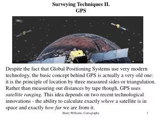
Explore the Advanced and Updated Land Surveying Techniques Used in California Land survey methods have evolved over the years, and the most established California land surveying companies are updated with the latest developments and techniques. They use the most advanced methods, too, so they can deliver faster and accurate results that can allow their clients to save a lot of time and speed process of finishing the project. One of the most up-to-date techniques for surveying California is 3D laser scanning, a high-definition survey method that is swifter and more accurate than traditional survey techniques. The most discerning builders, architects, project developers, and other stakeholders depend on 3D laser scanning for various surveying applications in California. The technology is particularly useful when analyzing land that has already been built, but would require further examination for demolition, renovation, remodeling, and other purposes. The high definition scanning technique encompasses an up-to-date scanning system that is accurate, versatile, and fast. A high-end software is used for exploring the scanned three-dimensional images. Panoramic views are possible, even 360 by 320-degree photo-realistic panoramic images, which deliver exclusive and highly precise three- dimensional look on the property to surveyors. There are many other applications for the 3D laser scanning technique. California land surveyingfirms can work with you to create or update as-built documentation or for damage and condition assessment. The platform enables data exchange with CAD platforms, as well as 3D semi-automated modeling. Results are also useful in clash/interference checking, deformation analysis, and tank/vessel volumetric information. The survey technique is applicable to any project in various developmental phases, including planning, initiating, upgrade, and conclusion. GPS is another high-end surveyingmethod used in California. This time, it employs the global positioning system to determine and evaluate 3D or terrestrial space position of points and distances, with the angles between each of them. Reputable California land surveying companies use it as a means to precisely identify the positioning of points. The technique relies on satellites to deliver signals to the receiver, which transmits the signal to the data collector. It is essential to hire a skilled and up-to-date land surveying firm in California that has these technologies on-hand, but be sure to check their credentials and credibility as surveyors. Prefer a company that gets a lot of repeat business, as well as referrals from their existing clients.