Download
1 / 12
180 likes | 462 Views
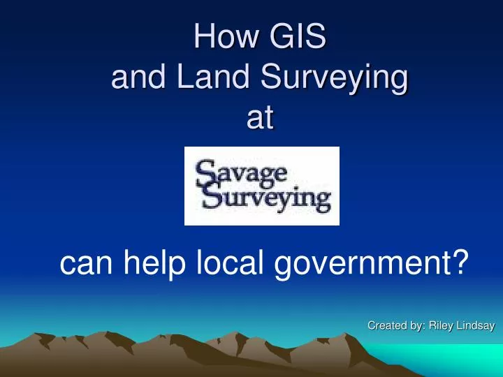
How GIS and Land Surveying at. Created by: Riley Lindsay. can help local government?. Savage Surveying.

E N D
How GIS and Land Surveying at Created by: Riley Lindsay can help local government?
Savage Surveying • Savage Surveying has been serving Central Utah since 2005. We offer state of the art advances in Land Surveying and GIS. We are staffed with two Licensed Land Surveyors, a certified GIS Technician and other highly trained employees. We are committed to providing the best possible product to our clients.
GPS • The Global Positioning System (GPS) uses satellites orbiting in space to calculate it’s exact location on the earth. • Savage Surveying has the top of the line GPS equipment including high accuracy survey grade GPS units. • Trimble 5800 GPS • + - 2 cm accuracy • L1/L2 dual frequency • Topcon GMS-2 for GIS • Integrated Digital Camera & Electronic Compass • + - 1 meter accuracy
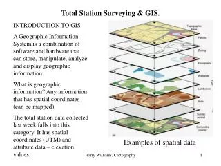
GIS • A geographic information system (GIS) is a computer-based tool for mapping and analyzing things that exist on and events that happen on Earth • Savage Surveying uses the top of the line ESRI ArcGIS software.
GPS and GIS • GPS and GIS allows us to collect high accuracy data, analyze it and depict the data with a powerful software. • How can we use GPS and GIS for your organization?
Geodetic Control Section Corner Recovery and Maintenance Section Corners are survey monuments established by the Bureau of Land Management ( BLM) as part of the Public Land Survey System (PLSS). These monuments play a vital role for surveyors in determining ones property boundary. How can we help? • Search for and recover section corners • Take a GPS observation on the monument and assign a State Plane Coordinate to the monument • Take a high quality photo of the monument • Create a tie sheet for each monument • Create and maintain a GIS database with all section corner data • Hyperlink tie sheet and photo to GIS database Section Corner monument Survey monument at 4corners
Utility Network Create and maintain a Utility Network A Utility Network in GIS allows you to show utility locations such as water valves, sewer manholes, laterals etc. It also allows to you to attach features to it such as pipes size, flow direction, and inverts. How can we help? • Locate utilities within a specific area • Take a GPS observation and assign a coordinate to each utility • Make a field sketch of utilities with information to the invert, flow direction, pipe size, type and year installed. • Create and maintain a GIS utility network Benefits • Great tool for utility organization • Great aid for relocating utilities in the future (Blue stakes) • GIS will help you in determining when utilities need to be replaced GIS utility network screen view
Record of Survey Interactive Map Record of Survey Plat Record of Survey Every property survey completed by a Licensed Land Surveyor is required by state statute to be recorded at the county surveyors office. This record allows the county surveyor to review and archive each survey. I propose to create an interactive map that shows the location of each record of survey completed for easy retrieval. A PDF of the plat will be hyperlinked to each property. Someone can spend hours searching for surveys at the county office. This interactive map will allow surveyors to access and retrieve these records and avoid making a trip to the county office. A small monthly fee could be implemented to cover the costs of maintaining the map. GIS Record of Survey Database
Parcel Map Parcel Map By locating all section corners, utilities and showing all records of survey, we will have the data needed to create a parcel map. This map will show all deed lines, easements and section lines. This map will become a huge asset for the county assessor. Each parcel will show its acreage, property value and owner’s name. This will allow the assessor to have a dynamic record of all property assessed each year. This could save the county thousands of hours and dollars each year. GIS Parcel Map
So why should you use GIS in your organization? • According to Dartech, a research firm that tracks GIS/geospatial market dynamics, GIS sales to all government entities worldwide have grown at a 7.2 percent compound annual rate over the last 8 years. • Government Grants for GIS are available • Save thousands of hours • Ability to keep and add onto your records • A dynamic map that will allow you to find feature data faster and easier • Save thousands of dollars • Faster and more proficient record system • A huge benefit to the public • The public can access these records through a web Interactive map
Salt Lake County’s Example Salt Lake County is the perfect example of how GIS can benefit both local government and the entire public. Our ultimate goal is to implement GIS in your organization so that one day everybody can enjoy the benefit of GIS. Check out these websites to see how Salt Lake County is using GIS to benefit the public. Record of Survey Interactive Map- Find a survey http://www.surveyor.slco.org/gis/map/index.html Assessor Interactive Map- See your parcel http://www.surveyor.slco.org/gis/map/index.html Interactive Zoning Map http://www.pwpds.slco.org/zoning/html/maps.html
1925 South Industrial Park Road, Richfield, UT 84701 Phone:(435) 896-8635 Riley Lindsay Survey Crew Chief/Certified GIS Technician Cell: 435-201-1242 Email: riley.lindsay@savagesurveying.net