Download
1 / 21
210 likes | 863 Views
Satellite-based MCS-tracking methods. Association is based on overlap between MCS at ... Tracking for large scales only, but permits hurricanes and smooth ...

E N D
Slide 1:Valliappa.Lakshmanan@noaa.gov Bob.Rabin@noaa.gov National Severe Storms Laboratory & University of Oklahoma http://cimms.ou.edu/~lakshman/
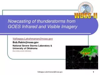
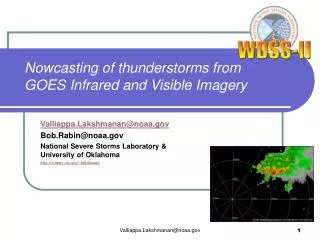
Nowcasting of thunderstorms from GOES Infrared and Visible Imagery
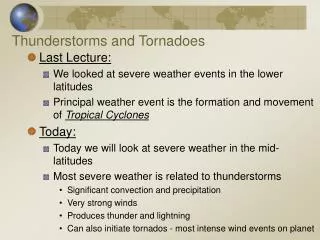
Slide 2:Nowcasting Thunderstorms From Infrared and Visible Imagery
KMeans Technique Detection Technique Results
Slide 3:Methods for estimating movement
Linear extrapolation involves: Estimating movement Extrapolating based on movement Techniques: Object identification and tracking Find cells and track them Optical flow techniques Find optimal motion between rectangular subgrids at different times Hybrid technique Find cells and find optimal motion between cell and previous image
Slide 4:Some object-based methods
Storm cell identification and tracking (SCIT) Developed at NSSL, now operational on NEXRAD Allows trends of thunderstorm properties Johnson J. T., P. L. MacKeen, A. Witt, E. D. Mitchell, G. J. Stumpf, M. D. Eilts, and K. W. Thomas, 1998: The Storm Cell Identification and Tracking Algorithm: An enhanced WSR-88D algorithm. Weather & Forecasting, 13, 263�276. Multi-radar version part of WDSS-II Thunderstorm Identification, Tracking, Analysis, and Nowcasting (TITAN) Developed at NCAR, part of Autonowcaster Dixon M. J., and G. Weiner, 1993: TITAN: Thunderstorm Identification, Tracking, Analysis, and Nowcasting�A radar-based methodology. J. Atmos. Oceanic Technol., 10, 785�797 Optimization procedure to associate cells from successive time periods Satellite-based MCS-tracking methods Association is based on overlap between MCS at different times Morel C. and S. Senesi, 2002: A climatology of mesoscale convective systems over Europe using satellite infrared imagery. I: Methodology. Q. J. Royal Meteo. Soc., 128, 1953-1971 http://www.ssec.wisc.edu/~rabin/hpcc/storm_tracker.html MCSs are large, so overlap-based methods work well
Slide 5:Some optical flow methods
TREC Minimize mean square error within subgrids between images No global motion vector, so can be used in hurricane tracking Results in a very chaotic wind field in other situations Tuttle, J., and R. Gall, 1999: A single-radar technique for estimating the winds in tropical cyclones. Bull. Amer. Meteor. Soc., 80, 653-668 Large-scale �growth and decay� tracker MIT/Lincoln Lab, used in airport weather tracking Smooth the images with large elliptical filter, limit deviation from global vector Not usable at small scales or for hurricanes Wolfson, M. M., Forman, B. E., Hallowell, R. G., and M. P. Moore (1999): The Growth and Decay Storm Tracker, 8th Conference on Aviation, Range, and Aerospace Meteorology, Dallas, TX, p58-62 McGill Algorithm of Precipitation by Lagrangian Extrapolation (MAPLE) Variational optimization instead of a global motion vector Tracking for large scales only, but permits hurricanes and smooth fields Germann, U. and I. Zawadski, 2002: Scale-dependence of the predictability of precipitation from continental radar images. Part I: Description of methodology. Mon. Wea. Rev., 130, 2859-2873
Slide 6:Need for hybrid technique
Need an algorithm that is capable of Tracking multiple scales: from storm cells to squall lines Storm cells possible with SCIT (object-identification method) Squall lines possible with LL tracker (elliptical filters + optical flow) Providing trend information Surveys indicate: most useful guidance information provided by SCIT Estimating movement accurately Like MAPLE How?
Slide 7:Technique
Identify storm cells based on reflectivity and its �texture� Merge storm cells into larger scale entities Estimate storm motion for each entity by comparing the entity with the previous image�s pixels Interpolate spatially between the entities Smooth motion estimates in time Use motion vectors to make forecasts Courtesy: Yang et. al (2006)
Slide 8:Why it works
Hierarchical clustering sidesteps problems inherent in object-identification and optical-flow based methods
Slide 9:Advantages of technique
Identify storms at multiple scales Hierarchical texture segmentation using K-Means clustering Yields nested partitions (storm cells inside squall lines) No storm-cell association errors Use optical flow to estimate motion Increased accuracy Instead of rectangular sub-grids, minimize error within storm cell Single movement for each cell Chaotic windfields avoided No global vector Cressman interpolation between cells to fill out areas spatially Kalman filter at each pixel to smooth out estimates temporally
Slide 10:Technique: Stages
Clustering, tracking, interpolation in space (Barnes) and time (Kalman) Courtesy: Yang et. al (2006)
Slide 11:Example: hurricane (Sep. 18, 2003)
Image Scale=1 Eastward s.ward
Slide 12:Typhoon Nari (Taiwan, Sep. 16, 2001)
Composite reflectivity and CSI for forecasts > 20 dBZ Large-scale (temporally and spatially) Courtesy: Yang et. al (2006)
Slide 13:Nowcasting Thunderstorms From Infrared and Visible Imagery
KMeans Technique Detection Technique Results
Slide 14:Satellite Data
Technique developed for radar modified for satellite Funding from NASA and GOES-R programs Data from Oct. 12, 2001 over Texas Visible IR Band 2 Because technique expects higher values to be more significant, the IR temperatures were transformed as: Termed �CloudCover� Would have been better to use ground temperature instead of 273K Values above 40 were assumed to be convective complexes worth tracking Effectively cloud top temperatures below 233K C = 273 - IRTemperature
Slide 15:Detecting Overshooting Tops
Looked for high textural variability in visible images These are the thunderstorms to be identified and forecast Shown outlined in red Detection algorithm now running in real-time at NSSL Bob, provide website URL here!
Slide 16:Processing
IR to CloudCover Clustering, Motion estimation Motion estimate applied to overshooting tops
Slide 17:Nowcasting Thunderstorms From Infrared and Visible Imagery
KMeans Technique Detection Technique Results
Slide 18:Nowcasting Infrared Temperature
How good is the advection technique What is the quality of cloud cover nowcasts? Effectively the quality of forecasting IR temperature < 233K Blocks represent how well persistence would do The lines indicate how well the motion estimation technique does 1,2,3-hr nowcasts shown
Slide 19:Nowcasting Overshooting Tops
The detected overshooting tops are not persistent Need to examine whether it�s because the tops do move around a lot Or whether the detection technique is not robust with respect to position For example, the IR temperature nowcast towards end of sequence was CSI=0.6 But overshooting tops nowcast has CSI around 0.05!
Slide 20:Couplets
Another technique to identify thunderstorms developed by John Moses of NASA Looks for couplets of high and low temperatures Data from 2200 UTC from the same Oct. 12 case The pink tails indicate the past position of these detections As with our overshooting tops technique, persistence of detection is a problem No. 17 jumps all over the place No. 36�s direction is wrong No. 39, 40, 41 have no real history No. 37 is being tracked well
Slide 21:Couplets vs. Overshooting Tops
Fewer detections with the overshooting tops technique than with the couplets one Perhaps the overshooting tops technique�s thresholds are too stringent Both techniques need to be improved Identification mechanism not robust across time 7 couplets 1 overshooting top