Download
1 / 32
320 likes | 532 Views
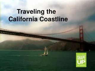
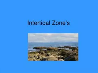
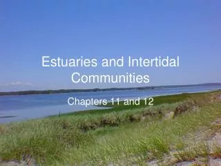
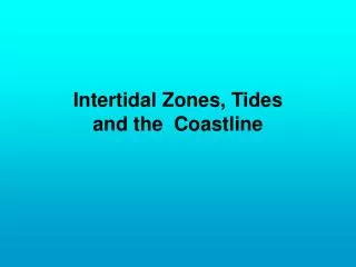
Intertidal Zones, Tides and the Coastline. Overview:. Coastline Tidal Cycle Intertidal Zones Sand Flow Coastal Strand Community. California Coastline. 1100 miles long. With varying inland climates from warm by San Diego to Cool in Humboldt.

E N D
Overview: • Coastline • Tidal Cycle • Intertidal Zones • Sand Flow • Coastal Strand Community
California Coastline • 1100 miles long. • With varying inland climates from warm by San Diego to Cool in Humboldt. • Coast rarely freezes, or exceeds 100 °F. Temperature moderate year-round. • San Francisco January 51 °F average, and in September 62 °F. • Water is cold around 50 °F. Down South warms to about 60 °F. • Summer fog, fog drip. • Nutrient rich Upwelling off shore
Coastline Geology • Coastal rocks are uplifted from sea floor. (Emergent Coastline) • North Coast Franciscan sedimentary Rocks about 100-150 MYA. • South 60 MYA sedimentary rocks. • Easily eroded, soft rocks. Cuts deep surf-cut shelves or benches. • With uplifting these shelves become terraces, but also erode away. • River mouths cut through valleys, form wide lagoons with a sand bars. • Form shoreline lakes dammed by sand
Tidal Cycle • Approximately Every “day” (24 hrs. 48 mins.) has two high tides and two low tides. • One high tide is higher than the other: Hi-Hi • One low tide is lower: Lo-Lo • Daily Tidal cycle: • Hi-Hi; Lo-Lo; Hi-Lo; Lo-Hi repeat……. • tides change every 6 hrs. 12 mins. • full cycle in 24 hrs. 48 mins. (one Lunar orbit) • offset by about an hour per day
Sea level • Means slightly different things depending on how precise you need to know. • Mean Sea level- the average between hi’s and lo’s of tides over 19 years, measured in the water compared to land based points of reference • Surface of open ocean (used to calculate altitude for aviation) satellite • Also used is Mean Lower Low Water (MLLW) average lo-lo tide
Tidal Sequence Higher-High tide Lower-High Sea level Higher- Low tide Lower-Low tide
Tides • Influence of gravitational pull from Sun and Moon. Moon’s pull is stronger because it is closer. • Centrifugal force also important. • Spring tides (Upwelling) every two weeks or so • Sun’s pull adds to moon’s pull • Neap tides (Scarce) every two weeks or so. • Moon’s pull partially counteracts sun’s pull. • Sun’s influence changes with season, • closer in June and December stronger tides. • Moon’s distance varies by 15,000 miles over a month • Perigee (2x month) is when moon is closest makes stronger tides • perigee with a spring tide increases by 40% • At Apogee (2x month) moon is farthest and weakens tides • Most extreme spring tides are at perigee in June and December !!
Spring tide • Spring and Neap Tides Neap tide
Friday April 20th • Low tide is at 8:13 a.m. • Meet at Schoolhouse beach, 7:45 a.m., need to leave DVC at 6:00 a.m. • At Beach till 8:45 • Dunes from 9:00- 10:00 • Home by noon !!!
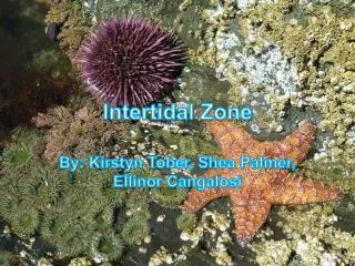
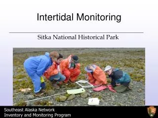
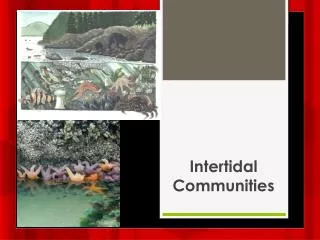
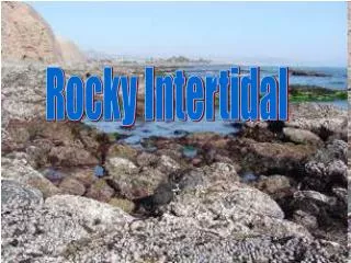
Intertidal Zones(from highest above to lowest in water) • Splash / Spray Zone wetted by surf • crustose lichens, sea lice • High Tide Zone - covered at high tide exposed most of the day • Limpets, sea lettuce, acorn barnacles, rockweed • Middle Tide Zone -exposed only for short periods • barnacles, mussels, sea stars, chitons, urchins • Low Tide Zone -exposed only at lowest tides • Top of lower intertidal is sea level for that area. • sea palm, surf grass • Sub-tidal Zone - never exposed • Highly productive
Vertical Zonation • Total number of hours exposed to air increase towards top of rock • Predation changes • Heat • Desiccation • Wave action
Intertidal Succession • Sever competition for space • Rocks over-turned over in storms, leave bare areas. • Filamentous and foliose green algae colonize bare rock • Crustose and Coralline algae take over • Acorn barnacles colonize by prying off algae as they take over • Gooseneck barnacles and mussels take over, growing over an preying off acorn barnacles. • Gooseneck barnacles and mussels remain as climax, unless predator invades or rock is over turned. • One-year sequence.
Keystone species • Pisaster (Sea Star) defends tide pool from being taken over by mussels, barnacles.
Sea Otters maintain Kelp forest • Otters are a Keystone species • Kelp are the base of the kelp forest community • Urchins eat kelp at their base • Otters eat urchins, keeping their numbers low. • Otter numbers along California are dropping. • Alaska- Orcas starting to eat otters, because seal numbers are dropping • No fish for seals
Competition for space on the rocks Weak competitors stuck higher up in the intertidal
Sand flow • Sand from weathered rocks up in mountains. • banks of Merced River in Yosemite • Moves out to sea - westward • Waves come form the NW moving sand southward and back towards shore. • Zig- Zag flow with seasonal cycles - beach erosion with storms. • In winter • beach (more narrow) smaller, • more sand moved farther off shore • In summer • Wide beaches • Sand pushed back on to shore, now farther south.
Erosion & Beach decline • River of sand slows: damming up stream, beaches disappear • Bodega head pushes out into sea, traps southward sand flow forming dunes • Sea walls impede southward flow of sand from north. • Headlands erode in surf, waves wrap around and hit sides • Resistant rocks remain longer forming stacks and arches.
Coastal Strand Communities • Dunes • Three zones: • Fore dune – the beach area • Crest – highest point on dunes • Back dune- protected areas behind front dunes
Dune Plant adaptations • prostrate growth- rhizomes • gray hairs on leaves deflect light, air • nitrogen-fixing bacteria • thick waxy cuticle • deep roots • mycorrhizae
Fore dune • shifting sands • heavy winds and sand-blasting • Lots of sun-light, uv radiation • drains quickly, dry substrate • Not salty! Rain, fog wash out salt spray residue (doesn’t bind to sand)
Crest and Back dune • Crest • Strongest wind • European beach grass • Back dune- • sheltered by crest • warmer • calm, less breeze • beginnings of soil (organic debris) • mature trees, shrubs