Download
1 / 8
80 likes | 131 Views
Desarrolladora California SA de CV. San José de cajoncito. San José de Cajoncito. UBICATION

E N D
Desarrolladora California SA de CV San José de cajoncito
San José de Cajoncito • UBICATION • San José de Cajoncito’s Land is a rectangular property with a surface approximately 49 Ha with 426 m of beachfront and 508 m of highway front. It’s located at km 89 Todos Santos to Cabo San Lucas' highway. The property has a surface approximately of 48.9 Ha (120 acres) is located in the Peninsula of Baja California, México at the middle point between Cabo San Lucas (23 miles to South) and magical town of Todos Santos (23 miles to North). • It has a white sand beach peerless along the Pacific Ocean, Wich is guarded at each end by hills or crags embedded in the sea giving it privacy to its beachfront approximately 426 m (±1420 pies) with Pacific Ocean. Also as reference point in the observation of the visit and the passing of gray whales. • TOPOGRAPHY: • San José de Cajoncito’s Land has a almost rectangular flat surface of 500 m x ± 900 m = 48.9 Ha (1,600” x ±3000” = 120.83 acres) with natural slope toward Pacific Ocean approximately 22°. Taken together the plain, slope and rectagular polygon minimize costs of any development. and guarantees from its rear side of a perfect view to sea and use 100% of the land. • COMMUNICATION • San Jose de Cajoncito is communicate terrestrial, air and maritime way. • Terrestrial Way • Currently, the Transpeninsular Highway is widening from 2 to 4 lanes in the stretch Cabo San Lucas – Todos Santos – La Paz. The stretch Cabo San Lucas to La Paz passing Magical Town Todos Santos are in the next stages: La Paz – Todos Santos stretch is finished at 100% and Todos Santos – Cabo San Lucas stretch has advanced at 95% . The Highway of 4 lanes Cabo San Lucas – San Jose del Cabo is finished and operating
San Jose de Cajoncito • Air way: • For the heavy traffic and the exponential increase each year the secretary of tourism launched two projects on your list. The first is aimed at the expansion of the existing airport to provide multiple tracks and increase the number of direct flights to Europe and Asia. The second project involved the reclassification of operations and raise the private jet airport, to commercial airport for the purpose of providing residents and tourists in Cabo San Lucas the opportunity to directly reach Cabo San Lucas and the also possibility to get by either commercial airports located in Los Cabos. • The International Airport of San Jose del Cabo is located a approximate distance of 70 km to South. It's largest giving service to over 15 airlines with direct flights to over 18 destinations of USA and Canada. Being the busiest for private aircrafties and the 3th at the world. • The international airport of La Paz City, the capital, is located an approximate distance of 118 km finding in the path to magical town of Todos Santos. • Maritime Way • The Harbor of Cabo San Lucas’ city is located to approximate distance of 37 km, it receives currently commercial shipping fleets and specially large touristic ships • International Seaport of Pichilingue in La Paz City is located an approximate distance of 135 km.
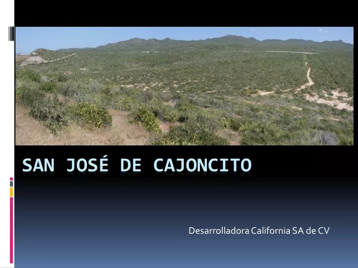
San José de Cajoncito Panoramic view since Highway front
San José de Cajoncito View to beach from one the crags Walking to beach from highway front
San José de Cajoncito Surface: 48.9 Ha, slope: 22° San Jose de Cajoncito to Cabo San Lucas
San Jose de Cajoncito • Conclusion: • The Pacific coastal area located between Cabo San Lucas and the magical town of Todos Santos is considered as the next tourist corridor with an approximate length of 74 km (46 miles), which are already present developments as Hacienda Cerritos, Punta Diamante , Tortuga del Sol, among others. So Cajoncito San Jose with its 508 m (1600 ft) of road front and a beach front of 426 meters (1400 feet) is located exactly at the center point between these two locations. This peaceful property Provide as much natural beauty as privacy, relaxing atmosphere and the possibility of use to 100% of the property that new and large investors look today. • INFORMES • DESARROLLADORA CALIFORNIA SA DE CV • ALVARO OBREGON 1775, COL. CENTRO • LA PAZ, B.C.S. MEXICO • TEL (612) 123-2499 • calisureo@gmail.com