Download
1 / 19
190 likes | 319 Views
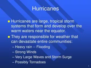
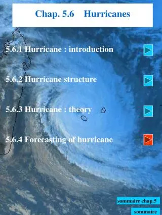
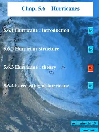
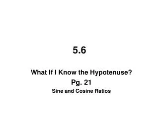
Chap. 5.6 Hurricanes. 5.6.1 Hurricane : introduction 5.6.2 Hurricane structure 5.6.3 Hurricane : theory 5.6.4 Forecasting of hurricane. Sommaire chap.5. sommaire. 5.6.2 Hurricane structure. Source : Cyclone Edwina, le 28/01/93 à 0146 UTC; Satellite NOAA 10.

E N D
Chap. 5.6 Hurricanes 5.6.1 Hurricane : introduction 5.6.2 Hurricane structure 5.6.3 Hurricane : theory 5.6.4 Forecasting of hurricane Sommaire chap.5 sommaire
5.6.2 Hurricane structure Source : Cyclone Edwina, le 28/01/93 à 0146 UTC; Satellite NOAA 10 • Cloudy rolling of deep organized convection , with nearly • circular shape, which can extent to 1000 km of diameter, • generally associated with an eye, without frontal system, • and occurred in the summer hemisphere • Cyclone with hot core • Balanced fluid (Rossby radius of 20 km) • with - cyclostrophic equilibrium < 40 km • - gradient wind balanced > 40 km
Spiral bands Spiral bands Eyewall D Vr < 0 Vr < 0 5.6.2 Hurricane structure Northern Hemisphere Source : from Stormfury, 1970 • In low troposphere : • The airstream is spiraling inwards the cyclone centre with : - a tangential flow cyclonic : > 0 • - a radial inflow whence convergence : < 0) • Convection is organized into, long, narrow rainbands • (5 to 50 km large), known as ‘spiral bands’ (visible • through RADAR) • Speed velocity, rain, Hu, increase as and when the • airstream approaches theeyewall of the hurricane
H 5.6.2 Hurricane structure Source : from Stormfury, 1970 Northern Hemisphere • From a certain distance of the cyclone centre (from 10 • to 40 km), the airstream is suddenly rejected upwards = • initiation of the eyewall • In upper troposphere • ⒈one part of the airstream is spiraling outward the • eyewall with : • - a tangential flow anticyclonic : < 0 • - a radial outflow whence divergence : > 0 • ⒉the other part of the airstream is subsiding inward • the eyewall originating the eye
: center hurricane : radial and vertical section 5.6.2 Eyewall structure Source : Cyclone Edwina, le 28/01/93 à 0146 UTC; Satellite NOAA 10 • Eyewall : maximum intensity of hurricane with • ‣ circle of CB with top around 12 to 15 km and • torrential rain • ‣ maximum of horizontal and vertical wind
5.6.2 Eyewall structure Source : from Jorgensen, 1984 • Horizontal scale of the eyewall ~ 10 to 20 km large • The eyewall tilts outwards with altitude : • ‣ the max. of horizontal wind is tilted outwards • ‣ the max. of vertical wind is tilted outwards (-7 to –9 m/s) • ‣ the precipitations fall outwards the cone • Bigger the eye is, more tilted the cone is
5.6.2 Eye structure Source : Cyclone Edwina, le 28/01/93 à 0146 UTC; Satellite NOAA 10 Eye
5.6.2 Eye structure Source : from Jorgensen, 1984 • Diameter of the eye ~ 30 to 60 km (mini 8 km , max. 200 km) • strong subsidence (~ + 3 m/s) especially along the inward side of the • eyewall and between PBL - upper tropo • subsidence explains that eye temperature is warmer than the • surrounding environment (10°C at 12km, 0 to 2°C at surface)
5.6.2 Eye structure Source : from Jorgensen, 1984 D • Weather associated : • ‣ minimum of mean-sea level pressure observed at center • ‣ no rain and light wind • ‣ variable cloudiness : sky clear with cirrus but sometimes • overcast with low clouds (Sc/St) when the low-level is • moist with a thermal inversion above • Shape of the eye : circular or elliptic • : no relation or very light correlation established between size of the eye and intensity of hurricane • Speed phase of the eye ~ 20 km/h Chap 5.6.3
eye eyewall Spiral bands eyewall eye 5.6.2 Hurricane structure : radar Source : from Burpee and Marks, 1984
Radial outflow Radial inflow 5.6.2 Structure du cyclone tropical Radial wind Tangential wind Source : from Gray, 79 Anticyclonic circulation Bell-shaped Cyclonic circulation Source : from Burpee and Marks, 84. Horiz. wind som. chap.5
z r λ 5.6.2 Hurricane structure : a balanced fluid For hurricanes, equations are written in cylindrical co-ordinates (r, λ ,z) around the cyclone centre (axis-symmetric flow). • For a rotating fluid, the wind can be divided into : relative tangential wind component : relative radial wind component • Radial equation of motion (above PBL) Outward Acceleration null Pressure force Centrifugal force Coriolis Force Outer eyewall (R>40 km) = gradient-wind balanced Inner eyewall (R<40 km) = cyclostrophic balanced
z Centrifugal Force Coriolis Force Pressure force 5.6.2 Hurricane structure : a balanced fluid Outer eyewall (R>40 km) = gradient-wind balanced Northern Hemisphere r λ Chap. 5.6.3
z Centrifugal Force Pressure force 5.6.2 Hurricane structure : a balanced fluid Inner eyewall (R<40 km) = cyclostrophic balanced Northern Hemisphere r λ
5.6.2 Hurricane structure : spirals bands Source : image from satellite NOAA10 of 28/01/93 at 0146TU. Cyclone Edwina over Indian Océan ‘Spiral bands’
5.6.2 Hurricane structure :upper outflow Source : image issue du satellite à défilement NOAA 10
5.6.2 Hurricane structure : radar Circular eye Source : d’après Burpee et Marks, 84 Elliptic eye
5.6.2 Hurricane structure : hot core +15° at 250 Hpa Source : from Hawkins and Rubsam, 68. +3° at surf. Vertical cross-section of temperature anomaly for hurricane Inez
Burpee, R. W., and F. D. Marks, Jr., 1984 : Analyses of digital radar data obtained from coastal radars during Hurricanes David (1979), Frederic (1979), and Alicia (1983). Preprints, 10th Conference on Weather Forecasting and Analysis, Clearwater beach, Fla., American Meteorological Society, Boston, 7-14 • Gray, W. M., 1979 : ‘Hurricanes, their formation, structure , and likely role in the tropical circulation’. Pp. 155-218 in : Shaw, O. B., ed., Meteorology over the tropical oceans, Conference, August 1978, Royal Meteorological Society, Bracknell, 278 pp. • Hawkins, H. F., and D. T. Rubsam, 1968 : Hurricane Hilda, 1964, II : Structure and budgets of the hurricane on October 1, 1964. Mon. Wea. Rev., 96, pp. 617-636. • Jorgensen David P., 1984 : ‘Mesoscale ans convective-scale characterictics of mature hurricane , Pt.2, Inner core structure of hurricane ‘Allen’ (1980)’. J. of Atm. Sci., vol. 41, n°8, pp. 1287-1311. • Merrill, R. T., 1993 : ‘Tropical Cyclone Structure’ –Chapter 2, Global Guide to Tropical Cyclone Forecasting, WMO/Tropical Cyclone- N°560, Report N° TCP-31, World Meteorological Organization; Geneva, Switzerland • STORMFURY, 1970 : Projet international sur les cyclones tropicaux. NOAA Technical Memorandum ERL NHRL N° 95, 57 pages : Experiments which provide theorical guidance for project STORMFURY are summarized. References