Download
1 / 15
150 likes | 259 Views
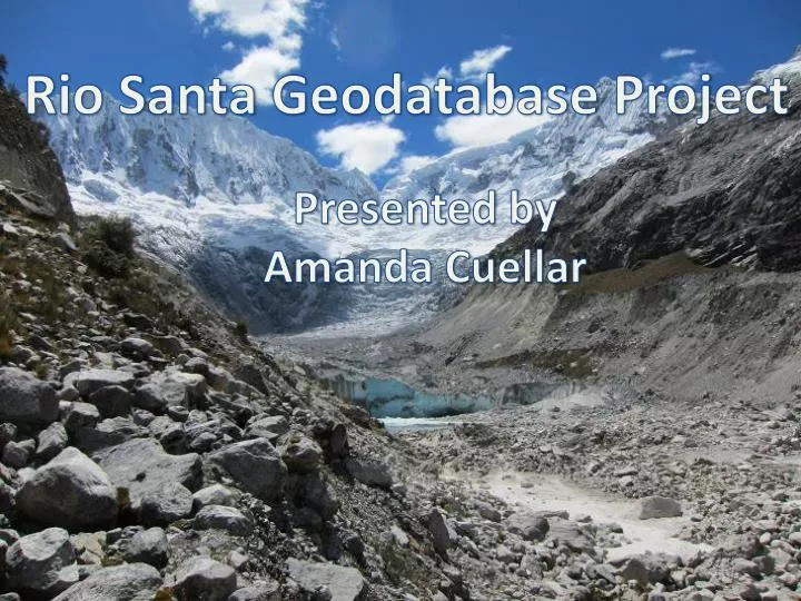
Rio Santa Geodatabase Project. Presented by Amanda Cuellar. Where is the Rio Santa Basin?. Rio Santa Basin. Project Background. Expanding high altitude glacial lakes pose risks to downstream communities Various organizations are collaborating to study the lakes in the Rio Santa basin

E N D
Rio Santa Geodatabase Project Presented by Amanda Cuellar
Where is the Rio Santa Basin? Rio Santa Basin
Project Background • Expanding high altitude glacial lakes pose risks to downstream communities • Various organizations are collaborating to study the lakes in the Rio Santa basin • Each organization records, processes, and keeps their own data • Researchers are in Peru, Texas, Massachusetts
Project Objective • Create a GIS map database for the data gathered by the McKinney group and collaborators for the Rio Santa Basin • Easy to share and view remotely • Data available for download • Researchers can upload their own data to share
First task: Gather data • Collect data held by the McKinney group fromcurrent and prior members • Collect data from collaborators at The Mountain Institute in Peru • Collect data from Peruvian government • Collect data from the community of practice
Second task: Design organization structure -Logical, easy to understand structure to organize data
Third task: Integrate data into one geodatabase • Complicated by inclusion of raster data sets • Combined various data into two geodatabases– Raster and vector • All datasets in WGS_1984 coordinate system
Fourth task: Create new layers • Present tabular social data as vectors • Unfortunately social data did not have sufficient geographic information or resolution to create a meaningful map • Use remote sensing data to fill in any missing information • Downloaded Landsat images for the Rio Santa Basin • Calculated NDVI and working on classifying ground cover
NDVI unsupervised classification -What do the classifications mean? -ArcGIS tool gives 2-4 classifications
Fifth task: Share geodatabase • Task is complicated because many researchers have slow internet or don’t have ArcGIS • Working with other group members to find a low bandwidth sharing platform
Future Work • Experiment with literature NDVI classifications for different land cover • Compare classification results to known land cover • Trip to Peru in January to work directly with TMI and government researchers
Acknowledgements • Daene McKinney, Denny Rivas, David Rounce • Kate Voss, Jorge Recharte, Oscar Roman • Dr. Maidment