Download
1 / 2
20 likes | 128 Views
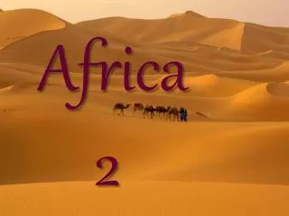
2 Africa Maps BP#126F & B. POLITICAL Map Contents: Draw in and label 10 African countries Label the locations of other continents surrounding Africa. Landforms (9) Sahara Desert Kalahari Desert Namib Desert Congo Basin (Rain Forest) Mt. Kilimanjaro Atlas Mts. Ethiopian Highlands

E N D
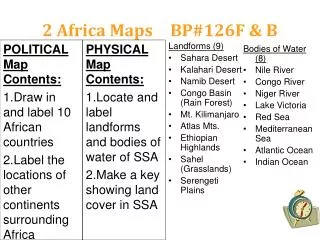
2 Africa Maps BP#126F & B POLITICAL Map Contents: • Draw in and label 10 African countries • Label the locations of other continents surrounding Africa Landforms (9) • Sahara Desert • Kalahari Desert • Namib Desert • Congo Basin (Rain Forest) • Mt. Kilimanjaro • Atlas Mts. • Ethiopian Highlands • Sahel (Grasslands) • Serengeti Plains Bodies of Water (8) • Nile River • Congo River • Niger River • Lake Victoria • Red Sea • Mediterranean Sea • Atlantic Ocean • Indian Ocean PHYSICAL Map Contents: • Locate and label landforms and bodies of water of SSA • Make a key showing land cover in SSA
1. Zimbabwe 2. Sudan 3. South Africa 4. Egypt 5. Dem. Rep. of Congo 6. Somalia 7. Nigeria 8. Libya 9. Rwanda 10. Ivory Coast BP#123 Map: Use a book - In which African sub-region is?