Download
1 / 105
1.1k likes | 1.38k Views
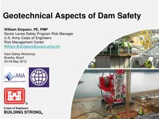
Scoggins Dam Geotechnical Analysis and Risk Analysis. July 18, 2012. Overview and General Topics. Facility Description Types of Reclamation Dam Safety Studies 2004 Comprehensive Facility Review 2008 Issue Evaluation 2010 Issue Evaluation Ongoing Corrective Action Study.

E N D
Scoggins Dam Geotechnical Analysis and Risk Analysis 1 July 18, 2012
Overview and General Topics • Facility Description • Types of Reclamation Dam Safety Studies • 2004 Comprehensive Facility Review • 2008 Issue Evaluation • 2010 Issue Evaluation • Ongoing Corrective Action Study 2
Detailed Analysis Topics • Geotechnical Analyses • Field Investigations • Embankment Analyses • Risk Analysis in Reclamation • Potential Failure Modes • Estimation of Failure Consequences • Estimation of Annual Probabilities of Failure • Summary of Risks • Conclusions • SOD Recommendation • Corrective Action Study 3
Scoggins Dam • Scoggins Dam is an earthfill embankment located on Scoggins Creek about 25 miles west of Portland, Oregon • Dam construction was completed in 1975 • Reservoir (Henry Hagg Lake) has a capacity of 53,323 acre-ft at the top of joint use capacity, elev. 303.5 ft • Structures at this facility include: • Embankment dam • Gated spillway • Tunnel outlet works
Location 6
Embankment Dam • Dam has length of 2,700 ft • Maximum structural height of 151 ft (Crest El. 313) • Zoned embankment • Due to presence of soft foundation soils, dam was designed with two foundation (cutoff) trenches
Appurtenant Structures • Outlet works consists of a tunnel through the left abutment, with a capacity of 400 ft3/s • Spillway is a gated structure located on left abutment, with a capacity of ~14,000 ft3/s
Types of Reclamation Dam Safety Studies • Comprehensive Facility Review (CFR) • Every 6 years • “Screening” level • Issue Evaluation Study (IE) • Detailed • Range in scope • Corrective Action Study (CAS) • Modification Final Design 12
Risk Analysis UsedThroughout These Studies • Potential Failure Mode (PFM) analysis conducted at all phases • CFR risks are estimated by simple means, and typically use “best estimates” with limited uncertainty analysis • Include all loading conditions (static, hydrologic, seismic) • For all higher level studies, risk analysis is accomplished by a facilitated team • Likely to focus only on specific loading conditions 13
Scoggins Dam - 2004 CFR • Concluded that static and hydrologic risks do not exceed Reclamation Public Protection Guidelines (PPG) thresholds and thus provide decreasing justification for any additional actions • This finding verified in recent 2010 CFR • Concluded that latest earthquake loadings were higher than used in previous engineering analyses, and that seismic risks may exceed guideline values, justifying additional actions to better define risks 14
Scoggins Dam - 2004 CFR • Resulted in one new Safety of Dams (SOD) recommendation • 2004-SOD-A: After the study to update the potential seismic hazards has been finalized, evaluate the need to perform additional investigations and dynamic analyses • This led to IE studies 15
Scoggins Dam – 2008 IE • Updated the PSHA, but did not develop site-specific ground motions • No new explorations or investigations • Simplified engineering analyses, including: • Screening-level spillway analyses with earth pressures • Foundation “triggering” analyses • Post-EQ stability analyses • Newmark analysis using ground motions from other sites 16
Scoggins Dam – 2008 IE • Conducted team risk analysis • Concluded that estimated risks from dam overtopping or internal erosion due to seismic loading justified further risk reduction actions • Concluded that estimated risks from spillway wall failure or separation at embankment-structure interface due to seismic loading justified further risk reduction actions 17
March 2008 Decision • Although risks appear to justify corrective actions, need additional study since findings were based on “preliminary” studies • Essentially, conclusion that a well-built dam could fail under subduction zone earthquake, with no assumed strength loss, is a critical conclusion, and needs verification • To withstand scrutiny, perform a more detailed Issue Evaluation study to fully verify risks • Gather additional embankment/foundation data • Update seismic loading • Perform state-of-practice engineering analyses 18
Scoggins Dam – 2008 IE • 2008-SOD-A: Develop and perform a field exploration program for Scoggins Dam that will obtain information that will better define the earthquake loading and the site’s response to large earthquakes. • 2008-SOD-B: Perform detailed stability and numerical dynamic analyses using the information obtained in the field exploration program, updated (if necessary) seismic hazard analyses and ground motions. 19
Scoggins Dam – 2008 IE • 2008-SOD-C: Perform an issue evaluation risk analysis for Scoggins Dam using the information obtained from the field exploration program and dynamic analyses. 20
Scoggins Dam – 2008 IE • 2008-SOD-D: Have all work done for this issue evaluation reviewed by a Consultant Review Board (CRB). 21
Scoggins Dam – 2010 IE • This latest round of IE studies resulted from the preceding SOD recommendations, and included the following activities: • Updated PSHA and development of ground motions • Extensive field program and geologic/testing reports • Evaluation of in situ and laboratory testing of embankment and foundation soils • Detailed engineering analyses of embankment and spillway (strength loss triggering, post-EQ stability, Newmark deformations, FLAC deformations, LS-DYNA spillway analysis • Facilitated, team risk analysis 22
Scoggins Dam – 2010 IE • Concluded that estimated mean seismic risks from dam overtopping or internal erosion brought about by earthquake-induced slope failures and cracking justify further risk reduction measures • Concluded that estimated mean seismic risks from failure of spillway wall, which could lead to an erosional failure of the embankment, justify further risk reduction measures • Concluded that seismic risks from spillway pier failure did not justify additional action 23
Scoggins Dam – 2010 IE • 2010 IE led to one new SOD recommendation • 2010-SOD-A: Initiate a Corrective Action Alternatives Study to evaluate potential alternatives to mitigate the high risks of seismic failure modes of the embankment and spillway at Scoggins Dam 24
Scoggins Dam – Ongoing CAS • Initiated, based on findings of 2010 IE • Conducted concurrently with finalization of IE studies, and convening of a Consultant Review Board • In progress, with ongoing analyses and design work 25
Field Investigations Program • CPT testing along downstream toe and beneath shell • Screening exploration to better locate additional borings • Determine peak/remolded undrained strength of clayey overburden • Strength loss potential of clays/silts • SPT testing in basal sand/gravel unit • Liquefaction potential of sands/gravels • Vane shear testing in overburden • Peak and remolded undrained strengths of clayey overburden • Four shear wave velocity crossholes • Also have seismic cone downhole data • Plus a line of surface shear wave data at toe • Undisturbed sampling holes • Used shear wave holes for undisturbed sampling 28
Observations from Field Investigations • Strengths of foundation soils are generally higher than as measured in pre-construction explorations • Foundation soils to the right of Scoggins Creek still appear to be of generally lower strength and also contain more sandy, silty materials • Foundation soil strengths increase under the dam footprint • There was relative agreement between strengths measured by the CPT and by vane shear tests, although the CPT values were typically lower • Clay sensitivity, or ratio of peak undrained to remolded strength, typically ranges from 2 to 3 30
Laboratory Testing • Contracted with then-URS lab in New Jersey • Both embankment and foundation samples were tested, but focus was on strength of foundation clays • Tests included: • 1-D consolidation • U-U triaxial shear (peak undrained strength of clays) • C-U triaxial shear • DSS (both peak and remolded undrained clay strengths) • Lab vane shear (peak/remolded clay strength) • Cyclic triaxial • Cyclic DSS 31
Observations from Undisturbed Sampling and Lab Testing • Foundation clays are lightly overconsolidated, with OCR typically around 2 or 3 • Most foundation soils are plastic, with an average PI value of 22 • Laboratory testing of undisturbed foundation soil samples confirmed the presence of low strength soils (similar to what was determined by CPT and vane shear testing) 32
Embankment Analyses • Strength loss triggering in foundation • CPT, SPT, Vs, and vane shear test data • Looked at liquefaction in coarse-grained soils, strength loss in clayey overburden • Limit equilibrium post-EQ stability • “Squashed dam” analyses • Newmark analyses • Used both DYNDSP and QUAKE/W • FLAC analyses 34
Liquefaction Triggering in Coarse-Grained Foundation Soils • Focused on those foundation soils that had a plasticity index (PI) of less than 7 • Generally limited to the basal sand/gravel (Qalb) and the sandy soils to the right of Scoggins Creek • Potential for liquefaction of these types of soils was evaluated using Standard Penetration Test (SPT) blow counts and by shear wave velocities • Evaluated in accordance with state-of-the-practice procedures (Seed simplified method for SPT, Andrus and Stokoe for shear wave velocity) • Looked at both earthquakes – local and subduction zone earthquake, as well as several different return periods, ranging from 500 years to 50,000 years 35
Liquefaction Triggering in Coarse-Grained Foundation Soils • SPT blow count analysis and the shear wave analysis yielded similar findings • Both indicated that the silty and sandy soils at the toe and beneath the downstream slope of the embankment immediately right of Scoggins Creek were potentially liquefiable • Also, liquefaction could be triggered for the 500-year EQ • Weak zone of low plasticity soils was in the vicinity of Station 7+00 and was generally from elevation 170 to 185 • Liquefaction potential was limited in all other areas of the foundation. Basal sand/gravel appeared relatively dense based on both the SPT and shear wave tests, and there were no other continuous areas of coarse-grained soils. 36
Strength Loss Triggering in Fine-Grained Foundation Soils • The potential for strength loss or cyclic failure of the fine-grained soils which comprise the majority of the foundation overburden was evaluated by 3 methods -Boulanger and Idriss, Seed et al, and Bray and Sancio • The Boulanger and Idriss approach will indicate a potential for the soils to lose strength past the peak undrained strength, but not necessarily all the way to remolded strength • Appears that the Seed et al and Bray and Sancio methods may assess the potential that the soils will go to remolded strengths 37
Strength Loss Triggering in Fine-Grained Foundation Soils • Boulanger and Idriss • Utilized vane shear tests and CPT results to measure resistance to cyclic loading • Widespread cyclic failure across the entire valley • Strength loss would occur to some degree even during a 500-year earthquake • Most widespread during earthquakes with return periods of 5,000 years or more • Seed et al • Moisture content and Atterberg limits • 22 to 30 percent of all samples may be liquefiable • Bray and Sancio • About 20 percent of the samples would be potentially liquefiable 38
Assignment of Foundation Strengths • Considered strength results from field vane shear testing, CPT, and laboratory tests on undisturbed samples – focused on clay strengths • Used test data to estimate both peak undrained and remolded undrained strengths for clayey soils • Estimated strengths in terms of reasonable low, best estimate, and reasonable high values • Used different strengths for left and right sides of Scoggins Creek, as well as for different areas under the embankment - e.g. beneath crest, under downstream (and upstream) slope, and at downstream toe 39
Post-Earthquake Stability Analyses • SLOPE/W was used to assess post-earthquake stability • Stability evaluated at three different embankment cross sections (stations 9+00, 15+00, and 21+00) • Modeled several different assumptions of strength loss • Different foundation strengths were used under various portions of the embankment • Looked at deep-seated failure surfaces that would take out the crest (ignored shallow failure surfaces that may have lower factors of safety but would be less likely to lead to dam failure) 41
Post-Earthquake Stability Analyses – Typical Failure Surface 42
Post-Earthquake Stability Analyses –Results • Analyses consistently indicated that upstream failure surfaces resulted in higher factors of safety; thus, downstream failures pose greater risk of failure • Embankment is not stable if earthquake loading leads to remolded/residual strengths (sur) in either the fine-grained or coarse-grained foundation soils • Greatest chance for instability appears to be in that portion of the embankment located to the right of Scoggins Creek 43
“Squashed Dam” Analysis • A “squashed dam” analysis refers to a progressive analysis of the failed embankment using a limit equilibrium procedure • SLOPE/W was utilized to iteratively determine the stability of the dam by applying a pseudo-seismic load on the dam and deforming the dam along the resulting failure surfaces • After each failure, the dam geometry was changed to represent the estimated deformed dam, and the stability reanalyzed • This analysis suggested that progressive sliding under seismic load could ultimately lead to the embankment deforming to almost half its original height 44
Newmark Deformation Analyses • Newmark displacements were calculated using two methods – using QUAKE/W and using DYNDSP • Different time histories were used for the two types of earthquake (local and subduction zone) • Two different embankment cross sections were analyzed – Station 9+00 and Station 21+00 • Different foundation overburden strengths were modeled. Since Newmark analyses essentially require that the initial factor of safety must be above 1.0, not all strength assumptions (particularly the lower values) could be modeled • Critical failure surfaces were selected from the post-earthquake stability analyses. The failure surfaces were deep-seated, and located in the downstream slope of the dam. 46
Newmark Deformation Analyses - Results • Largest predicted Newmark deformations resulted from the lowest strength assumptions, which correspond to the lower safety factors and lower yield accelerations (Sta. 9+00) • Predicted deformations are much larger due to the subduction zone earthquake than due to the local earthquake • Predicted Newmark deformations were similar whether calculated by DYNDSP or by QUAKE/W • During the 50,000-yr subduction zone earthquake, very significant crest loss (on the order of 40 feet) is predicted even for a drained strength scenario - this is due to the long duration of severe shaking that results in frequent exceedance of the yield acceleration and thus makes large embankment deformations likely 47