Download
1 / 18
180 likes | 324 Views
The GlobWave project, funded by ESA and supported by CNES and others, focuses on improving the usage of satellite-derived wind, wave, and swell data across scientific, operational, and commercial sectors. During the recent meeting, project partners discussed strategies for developing a comprehensive web portal as a hub for satellite wave data, offering clear documentation, demonstration products, and enhanced user engagement. With over 1.2 million file downloads last month, the initiative aims to accommodate the needs of existing users while attracting new ones.

E N D
Project GlobWaveUser Meeting5th-6th October, 2011Geoff Busswell, GlobWave Project Managerwww.globwave.info
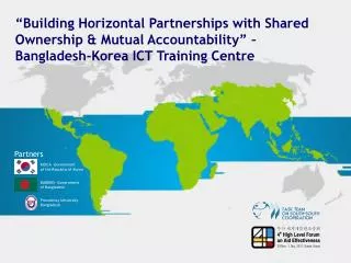
Partners • ESA: Funding the project through its Data User Element Programme • CNES: Providing co-funding and advice during the project • Logica: Prime Contractor – responsible for all development, delivery and public outreach of GlobWave for ESA. • Ifremer: Responsible for development of the portal, in situ database and hosting of the data and operational system • SatOC: Responsible for the Altimeter processing, error characterisation methodologies and documentation • CLS: Responsible for the SAR processing and error characterisation • NOC: Responsible for the Pilot Spatial WFVS and HR-DDS
Objective • Improve the uptake of satellite-derived wind-wave and swell data in the • Scientific, • Operational • Commercial • User Communities
Strategy • Develop a GlobWave web portal • A single point of reference for satellite wave data • Clear documentation about satellite data acquisition techniques • Allow access to on-line tools, reports, cal/val info, etc. • Provision of: • A multi-sensor set of satellite wave data in a common format and meta-data standard. • A set of demonstration data products • Inter-comparison of different wave data sources • SAR and altimeter wave data with collocated in-situ measurements • Cross characterisation between different satellite data streams
User Interaction • ESA received written commitments from 35 users before project kickoff • Presentation by GlobWave Team at conferences/workshops • SeaSAR, OceanSAR, OceanObs, IGARSS, Coastal Altimetry Workshop, Living Planet Symposium, MARCDAT III • As of yesterday the project team have signed up 100 additional users • Portal and ftp stats • Portal had 800 hits in January with average of ~2000 hits over last 4 months • Ftp site had 100,000 files downloaded in January and 1,200,000 last month • Two main aims going forward – deliver what existing users want and bring in more users. • GlobWave Wikipedia Page • GlobWave LinkedIn Networking Group • Summary of Services • Demo Products
Satellite Products • Available in a “common” L2P format • NetCDF-3 • Meta-data standard is CF-1.4 compliant ERS-1, ERS-2, ENVISAT, TOPEX/POSEIDON, Jason-1, Jason-2, GEOSAT, GFO Altimeter ERS-1, ERS-2, ENVISAT SAR • 26 Years of consistently calibrated multi-mission satellite wave data!! • NRT data available within 1-4 hours of observation from space • Supported by a Product User Guide and Wave Data Handbook • Support of further data streams when available; Cryosat-2, Altika ... and it’s free!!
Physical Parameters Common to SAR & Altimetry: • Backscatter Coefficient (Sigma0) • Altimeter/SAR Wind Speed • Quality Flags • Rejection Flags SAR Specific: • Swell Significant Wave Height • Dominant wavelength (per spectral partition) • Mean direction (per spectral partition) • Standard Errors for the above • Altimeter Specific: • Significant Wave Height (SWH) • SWH Standard Error • Ancillary data: • Model Wind Speeds • Bathymetry • Distance to Coast • Sea Surface Temperature • Surface Air Temperature • Surface Air Pressure
Data Dissemination • Email fpaf@ifremer.frwith the subject “GlobWave Data Access” • You will be issued with a username and password • Then just visit the ftp site or browse data files via your web browser File organisation: • Data files organised in a clear directory structure by mission, year, month, day Browsing the meta-data: • Panoply • HDFView
Online Tool for Satellite vs In Situ Matchup Database A satellite vs. in situ matchup database has been constructed using: • The full archive of GlobWave satellite data • A set of in situ data sources from: • POSEIDON • Puertos del Estado • NODC • UKMO • CDIP • MEDS - Query tool allows searches of matchups based on geo-location and time windows.
Error Characterisation Analysis: Accuracy of Satellite Data • ERS-1 vs NODC SWH • (1991-1996) • Derivation of: • Calibration equation • Standard error • 95% confidence limits
Error Characterisation Analysis: Accuracy of Satellite Data • Based on comparisons with NODC buoy data • Derived errors inserted back into satellite data • Users given complete transparency on data accuracy
Error Characterisation Analysis: Accuracy of Buoy Networks • Buoy network comparisons with Envisat
Data Sub-setting 3rd PartyTools already exist: Allows query and extraction: • Specified geo-location and time windows • Physical Parameters • Acquisition Type NAIAD – developed by Ifremer • Users able to visualize: • Physical Parameters • Data Volumes • Satellite Tracks World Wave Atlas – developed by Fugro Oceanor
Satellite vs Satellite Matchup Database • Database of satellite crossovers has been produced and analysed
Global Wave Statistics Goal is to compare measured quantities from different satellites over different regions • The following physical quantities have been compared: • Altimeter • Significant wave height • SAR • Swell wave height • Dominant swell direction • Dominant swell wavelength North Atlantic Region 180 90 0 90 180
SAR Cross Seas Analysis • Of key interest to maritime users
Pilot Spatial Extension to the WFVS and GlobWave DDS • DDS (for public use) • Specific geo-location regions have been defined around the world • Inter-comparison of: • Satellite vs. model data • Satellite vs. satellite data PS-WFVS(participating met centres) • Allow inter-comparison of satellite and model data • Ingesting model data on a monthly basis from participating organisations • Providing (configurable) offline reports on a monthly basis illustrating the previous months inter-comparisons
Feedback • We have made every effort to make our satellite wave data: • Easy to locate • Easy to retrieve • Easy to use • Our goal continues to be to increase the number of users of satellite wave data. • Please do use our data and let us know how you have used it • We are at your disposal to assist – contact geoff.busswell@logica.comwith any issues/questions. www.globwave.info