NYCDEP Evaluation of Watershed Management Programs
100 likes | 282 Views
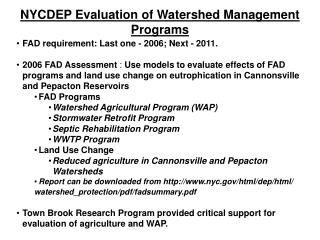
NYCDEP Evaluation of Watershed Management Programs. FAD requirement: Last one - 2006; Next - 2011. 2006 FAD Assessment : Use models to evaluate effects of FAD programs and land use change on eutrophication in Cannonsville and Pepacton Reservoirs FAD Programs

NYCDEP Evaluation of Watershed Management Programs
E N D
Presentation Transcript
NYCDEP Evaluation of Watershed Management Programs • FAD requirement: Last one - 2006; Next - 2011. • 2006 FAD Assessment : Use models to evaluate effects of FAD programs and land use change on eutrophication in Cannonsville and Pepacton Reservoirs • FAD Programs • Watershed Agricultural Program (WAP) • Stormwater Retrofit Program • Septic Rehabilitation Program • WWTP Program • Land Use Change • Reduced agriculture in Cannonsville and Pepacton Watersheds • Report can be downloaded from http://www.nyc.gov/html/dep/html/ • watershed_protection/pdf/fadsummary.pdf • Town Brook Research Program provided critical support for evaluation of agriculture and WAP.
Town Brook Studies Incorporated in Evaluation of Watershed Management Programs • Phosphorus Transport Mechanisms • Critical Management Zones = Co-occurrence of Runoff Source Areas and Concentrated Pollutant Sources • Runoff Source Areas occur where shallow groundwater table saturates to the surface, are dynamic and controlled by topography (Variable Source Areas – VSAs) • Incorporation of VSA hydrology in GWLF Watershed Model • Effectiveness of Agricultural BMPs to control Phosphorus • Incorporation of BMP effectiveness in GWLF model • WQ monitoring at various scales • Used for model calibration and testing
Wetness Index defines locations of Variable Source Areas (VSAs) Unsaturated Zone Saturated Zone Deep Saturated Zone • GWLF-VSA Model • Runoff Source Areas determined by wetness index corresponding to probability of saturation to the surface. • Field testing in Town Brook shows wetness index reasonably represents spatial patterns of soil moisture
Modeling Scheme to Evaluate Eutrophication Meteorology (34 yrs) Watershed Model (GWLF) Temperature Precipitation Baseline Reservoir Chl a Baseline Loads Baseline Loads Streamflow Streamflow Reservoir Management Model Dissolved P Dissolved P Particulate P Particulate P Landuse, Management Practices Baseline Chl a Frequency Distribution freq ug/l
Modeling Results: 2006 Evaluation of Watershed Management Programs and Eutrophication
2000s Land Use and Management Programs 1990s Baseline 2000s Land Use Model Predictions: Cannonsville Watershed Average Annual Dissolved Phosphorus Loads- Baseline vs. Scenarios Baseflow
Baseline Model with BMPs And Land Use Change Data Baseline Model Cannonsville Watershed Dissolved Phosphorus -Data vs. Model Predictions Annual Time Series Cumulative Difference (Model – Data)
Mean Annual Chlorophyll Concentration Epilimnion Cannonsville Reservoir Frequency (years) Chlorophyll (mg m-3)
2000 Landuse + Point Source Reduction 2000 Landuse + BMPs Implementation 2000 Landuse + Point Source + BMPs Year 2000 Landuse Base Run Chlorophyll (mg m-3) Median = 7.05 Median = 6.41 Median = 5.02 Median = 5.25 Median = 4.49 Daily Simulated Epilimnetic Chlorophyll Cannonsville Reservoir 1966-2004
Modeling Conclusions: 2006 Evaluation of Management Programs and Eutrophication The Eutrophication Modeling System was used to evaluate the effects of land use change and four watershed management programs (Watershed Agricultural, Stormwater Retrofit, Septic Remediation and WWTP Upgrades) on P export and reservoir average annual chlorophyll concentrations. The model system provided the following predictions: • Land use change (reduction in agriculture) results in significant reductions in dissolved P export and algal growth in Cannonsville Reservoir. • WWTP Upgrades and the Watershed Agricultural Program were the most effective management programs for reducing dissolved P loads. • Cumulative effect of land use change and management programs led to even larger reductions in reservoir average annual chlorophyll concentrations. • Reductions in dissolved P loading also led to reduced frequency of algal blooms.