Download

1 / 30
340 likes | 779 Views
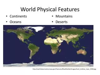
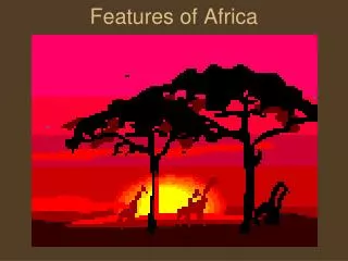
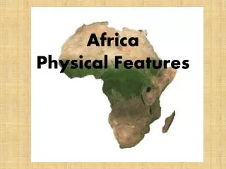
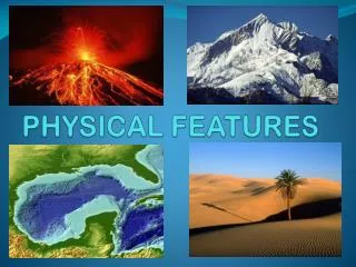
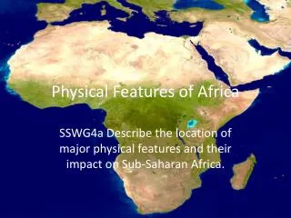
Africa Physical Features. Sahara Desert. Largest desert in the world. Covers almost all of North Africa Almost as large as China or the United States. Countries located in the Sahara include… Algeria , Chad, Egypt , Libya, Morocco , Niger, Sudan , and Western Sahara. Sahara Desert.

E N D
Sahara Desert • Largest desert in the world. • Covers almost all of North Africa • Almost as large as China or the United States. • Countries located in the Sahara include… • Algeria, Chad, Egypt, Libya, Morocco, Niger, Sudan, and Western Sahara.
Sahara Desert • The Sub-Saharan desert has poor soil and suffers from deforestation • The destruction of trees and other vegetation • Desertificationhas been a huge contribution towards the Sahara as well. • The process of the desert expanding into areas that had formerly been farmland • There are long periods of little to no rainfall which causes this problem. (called droughts) • People may cause it too by letting livestock overgraze the savanna and by cutting down trees.
The Kalahari Desert • A desert on the coast of the Atlantic Ocean • Located in Botswana, Namibia, and South Africa • It is a large semi-arid, sandy savanna • However, it supports more animals and plants than a regular desert • Small amounts of rainfall with hot summers
Sahel • A region in West/Central Africa • Between the Sahara in the North and savannas in the South • Desertificationhas contributed to the Sahel areas.
Savanna • A tropical grassland region. • During the rainy season the savanna gets 15-25 in. of rain. • During the dry season they get 4 inches. • The savanna is the area of Africa that you think of for having the wild animals (lions, giraffes, zebras, etc.) • People use the land for cattle grazing which kills the grass and turns the savanna into a desert. • People also poach (illegally kill animals)
Nile River The longest river in the world 4000 miles long! Flows through northeastern Africa into the Mediterranean Sea Flows through Ethiopia, Sudan, South Sudan, Egypt, Uganda, Kenya, Tanzania and Rwanda
Nile River • The Nile banks are heavily populated • Why? • People farm the land surrounding the Nile River • Floods leave a layer of silt • Fertile soil • The Nile ends in a large delta that ends in the Mediterranean Sea • What is the symbol used to represent a delta?
The Nile River The Nile River
Congo River • A river that flows through the rainforest of Central Africa. • 2900 miles long • Deepest river in the world • Flows through: • Angola, Burundi, Cameroon, Central African Republic, Democratic Republic of the Congo, Gabon, Republic of the Congo, Rwanda, Tanzania, and Zambia • Provides hydroelectric power, transportation and water for irrigation.
Niger River • Africa’s third longest river • It is 2600 miles long • It begins in Western Africa in Guinea • VIP river to Western Africa • Provides water for farms in the river valley. • It provides some relief for people in Sahel • Vital transportation route
Lake Tanganyika • Second LARGEST and LONGEST Freshwater lake • Located in four countries • Burundi, Democratic Republic of the Congo, Tanzania, and Zambia • The water flows into the Congo River and eventually into the Atlantic Ocean • Commercial fishing and industrial fisheries are all important on this lake. How the heck do I say that?!?!
Lake Victoria • Named after Queen Victoria of the United Kingdom • Largest tropical lake in the world • Receives most of its water from precipitation • Large amount of fishery’s
Atlas Mountains • Stretches across Northern Africa and extends about 2500 km through Morocco, Algeria, and Tunisia. • The Atlas separate the Mediterranean and Atlantic coastlines from the Sahara Desert • The mountains are home to many plants and animals(endangered)
Tropical Rainforest • An ecosystem around the equator. • Between the Tropic of Cancer and the Tropic of Capricorn • Located in Southern/Central Africa(Democratic Republic of Congo) • Experiences HIGH amounts of rainfall and HIGH temperatures
Mount Kilimanjaro • Dormant volcano located in Kilimanjaro National Park, Tanzania • Highest mountain in Africa (19,341 ft)
Serengeti National Park • Located in north Tanzania and southwest Kenya. • Serengeti means “Endless Plains” • Regarded as the best wildlife reserve in Africa • Animals found here include • Lion, African leopard, African elephant, black rhinoceros, African buffalo, cheetah, gazelle, hyena, baboon, giraffe, ostrich, stork, vultures, zebra