Download
1 / 32
320 likes | 474 Views
Sustaining Health and Human Services: Encouraging the Creative Application of GIS. Gregory Elmes, Gerard Rushton, and Robert McMaster University Consortium for Geographic Information Science. UCGIS. University Consortium for Geographic Information Science

E N D
Sustaining Health and Human Services: Encouraging the Creative Application of GIS Gregory Elmes, Gerard Rushton, and Robert McMaster University Consortium for Geographic Information Science EC 6th Workshop on GI and GIS
UCGIS • University Consortium for Geographic Information Science • Formed to serve as an effective, unified voice for the geographic information science research community in the US • To foster multidisciplinary research and education • To promote the informed and responsible use of geographic information science and geographic analysis for the benefit of society EC 6th Workshop on GI and GIS
UCGIS RESEARCH CHALLENGES • Spatial Data Acquisition and Integration • Distributed & Mobile Computing • Extensions to Geographic Representation • Cognition of Geographic Information • Interoperability of Geographic Information • Spatial Analysis & Modeling in a GIS • Future of the Spatial Information Infrastructure • Uncertainty in Spatial Data • Scale • GIS and Society EC 6th Workshop on GI and GIS
CROSS-CUTTING EXERCISE • Major application areas examined in light of the ten research challenges • Crime Analysis • Emergency Preparedness • Urban and Regional Planning • Water Resources • Transportation Planning and Monitoring • Public Participation GIS • Public Health and Human Services • Journal of Urban and Regional Information Systems Association, Spring 2000, Vol. 12, 2 EC 6th Workshop on GI and GIS
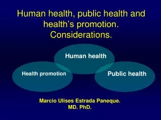
Objective: Improving Health and Human Services Using GIS • UCGIS analysis of health status and health care with particular regard to challenges being faced in researchand education (Rushton et. al, 2000). • Emphasize roles played by geomatics and spatial analysis in reducing burden of mortality and morbidity, and in improving the efficiency and equity of public health services. • Pose some educated guesses as to the emerging roles for GIS in the near future. EC 6th Workshop on GI and GIS
US National Significance • US ranked 37th in recent WHO assessment of national health care systems • Three classes: • Top 10% - afford any care available • Middle class – vulnerable to catastrophic costs • Bottom third – equivalent to health care conditions in many developing nations • Geography of disease incidence and care access – Appalachia, Mississippi Delta, First Nations • Excess disease burden in other regions - not well documented at local levels EC 6th Workshop on GI and GIS
Public Health and Human Services • Health care represents ~ 13 % US GDP • Effective application of GI to reduce expenditures on health through improved surveillance, health care delivery, access to care, or evaluation of outcomes of intervention projects will be of national significance. • Although technological benefits can be rapidly adopted world-wide, many barriers remain EC 6th Workshop on GI and GIS
National Security Issues • Health System vulnerability to globalization of disease • West Nile Fever, Encephalitis • Vulnerability to bio-terrorism, natural disasters • Vulnerability to polarization of health and health care • disease re-emergence • fragmentation of society EC 6th Workshop on GI and GIS
Background • Reviews of GIS in Public Health & Services • Clarke et al., 1996; Croner et al., 1996; Richards et al., 1999; Rushton et al., 1997; Rushton,1999; Vine et al., 1997; Yasnoff and Sondik, 1999 • Centers for Disease Control and Prevention • CDC supports development of GIS software (Dean, 1999) • National Cancer Institute • NCI supports development of software for disease cluster identification, (Kulldorff, et al., 1998). EC 6th Workshop on GI and GIS
Background (cont.) • CDC and ATSDR • Four annual meetings on GIS and Public Health. • CDC also collaborates with the National Center for Health Statistics and the US Department of Health and Human Services on an annual conference on health data and statistics • increasingly has geographic information and internet technology components. EC 6th Workshop on GI and GIS
Background (cont.) • National institute of Environmental Health Sciences (NIEHS), under US Public Law 103-43 requested proposals to develop a health-related GIS for Long Island, NY. • “The prototype health-related GIS will provide researchers a new tool to investigate relationships between breast cancer and the environment on Long Island, and to estimate exposures to environmental contamination.” (NCI, 1999, p.3). • Private sector • Contract awarded to AverStar Inc. EC 6th Workshop on GI and GIS
Background (cont.) • NIH - Spring 2000 call for proposals • First such call to emphasize integrating social environment • Add to traditional emphasis on clinical work • Recognition of geographic context and geographical tools and methods • High level of proof required for research ethics and practice of medical community EC 6th Workshop on GI and GIS
Research Issues • Improving Disease Surveillance Data Systems • Systematic studies of access, health treatment choice, and health outcomes • Spatial-Temporal Aspects of GIS and Health • Risk factors as contributors to disease and ill-health • Ecological Studies of Environmental Factors and Disease Transmission • Targeting health resources to demand, under-served • Communicating GIS results with the public • Maintaining the confidentiality of health records EC 6th Workshop on GI and GIS
GIS Research for Public Health and Human Services • Focus on advancing health analysis beyond the conventional areas of mapping, towards interactive models of analysis, visualization and multimedia, and sharing spatial information. EC 6th Workshop on GI and GIS
Communicating GIS • To Health Professionals • To Government • To Public EC 6th Workshop on GI and GIS
EQUALITY Between Regions
HOMOGENEITY Within Regions
Mortality Rate Black Males 65 yrs + Multiple Objective Region
Spatial-Temporal Aspects • National Institute of Environmental Health Sciences - Geospatial Lifelines (Mark and Egenhofer 1999) • Capture individuals' location at regular or irregular temporal intervals • methods to trace locations of individual patients or controls back in time, to discover spatial clusters or environmental exposures • designing, prototyping, and assess computational models for geospatial lifelines • examining the ethical and legal implications of recording individuals' geospatial lifelines in databases, and procedures for appropriate restrictions on data analysis and dissemination. EC 6th Workshop on GI and GIS
UCGIS-USGS Workshops • Universities, Federal Agencies, Pacific Ring Health initiative (UCSD) • Vector-borne disease • Spatial Analysis in GIS • Set of tools for professionals • Multiple disciplines • Best practice analysis in a GIS environment • Unresolved Research Issues EC 6th Workshop on GI and GIS
Geography of Disease How are vector-borne diseases unique? Environmental determinism Spatial Analysis MAUP Small Number Problem Spatial Autocorrelation Data Integration Data Structures Common data structures Interrelating multiple point themes Transformations Aggregation and disaggregation Best interpolation Techniques How to map ‘junk’ UCGIS-USGS Workshop: Proposed Topics EC 6th Workshop on GI and GIS
Spatial Modeling Spatial econometrics multicollinearity Spatial Metrics Spatial Factor Analysis Causal/Path Analysis Probabilistic Modeling Association Relating cases to land cover Decision Support Utility Risk: Harm, hazards, uncertainty Cost-benefit analysis of education, migration... Forecasting Accuracy Under and over-reporting Positional, temporal, etc. Disclosure reporting Proposed Workshop Topics (cont.) EC 6th Workshop on GI and GIS
EMERGING THEMES • Data integration • New sensors at every scale • New data sources and forms • Data mining and knowledge discovery • warehousing, selection, cleaning, transformation, geo-registration, mining, model selection, interpretation, and use. • Participatory GIS • Involving the public, local knowledge, new representations EC 6th Workshop on GI and GIS
Participatory GIS • Local groups to mission agencies • Agencies with overlapping or conflicting mandates • SCALE • Irregular development of capabilities • INEQUITY • Community Integrated GIS EC 6th Workshop on GI and GIS
Catholic University of Mozambique - Beira University of Pretoria Local CIGIS Collaboratory University West Virginia University
Data Acquisition • Characterized by massive increase in spatio-temporal resolution • Georeferenced mobiles and appliances • IKONOS and similar imagery • Remote monitoring of individual’s health • In Home • In Body • Nanotechnology EC 6th Workshop on GI and GIS
Recommendations • Recommendation #1 • Establish greater levels of professional interaction between medical professionals, epidemiologists, statisticians, and geographers. • Recommendation #2 • Establish international dialog on the improvement, standardization, and security of the quality and quantity of spatial information associated with health statistics EC 6th Workshop on GI and GIS
SUMMARY • Public Health and Health Services relatively late on GI adoption curve • Considerable professional and public resistance to GI • for very different reasons • GI has potential to contribute to health care cost containment in many ways • GI also has potential to exacerbate inequalities or reduce them • Policy is essential but extremely contentious EC 6th Workshop on GI and GIS