Enhancing Hydrological Forecasts for Water Management in Northwestern Mexico
This research investigates the hydrological variability and forecasting methods in the Imuris and Ixpalino basins of northwestern Mexico. Focused on precipitation, evapotranspiration, and runoff, it employs the University of Washington's West-wide Hydrological Seasonal Forecast System. The study emphasizes the challenges of forecasting in semi-arid regions influenced by the North American Monsoon. By analyzing ensemble members during various seasons, the work aims to optimize water resource management, particularly as it relates to agricultural productivity and reservoir management.

Enhancing Hydrological Forecasts for Water Management in Northwestern Mexico
E N D
Presentation Transcript
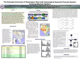
Cumulative Precipitation Evapotranspiration Cumulative Runoff Imuris Angostura Angostura Ixpalino Bavispe River Paso Nacori Guadalupe Moctezuma River Cubil LasPerlas Guadalupe 1 2 3 Huapaca Novillo 1 1 4 1 5 Novillo 1 Aros-Papagochi River 6 Oviachi 16 9 7 17 8 18 19 20 21 10 13 22 12 23 Yaqui River 11 Major Reervoirs 14 15 Irrigated areas Oviachic Hydropower Oviachic Hydrometric Stations Valle del Yaqui Hornos Nodes Colonias The Extended University of Washington West-wide Hydrological Seasonal Forecast System: Covering Mexican Territory 1Chunmei Zhu, 1Francisco Munoz-Arriola, 1Adrew Wood, 2Ana Wagner-Gomez, 2Rene Lobato-Sanchez and 1Dennis P. Lettenmaier 1) Department of Civil and Environmental Engineering, University of Washington, Seattle, WA, 98195 2) Instituto Mexicano de Tecnología del Agua, Jiutepec, Morelos, Mexico Large fluctuations in precipitation streamflow are common in Imuris and Ixpalino, This variability is also observed in evapotranspiration. Precipitation begins to accumulate relatively early in the year, which explains the relatively homogeneous hydroclimatological regime. However, a high dispersion in the evapotranspiration and precipitation ensemble members may reflect poor skill of the ESP forecast in these basins due to the incidence of winter precipitation and corresponding high hydrologic variability. In the Ixpalino basin, on the other hand, the dispersion of the hydrological ensembles is greatest during the summer. We are also evaluating the method in the Oviachic sub basin of the Rio Yaqui basin. This basin is highly significant to the agricultural productivity of northwestern Mexico. This area is located in a semiarid domain and is strongly influenced by the North American Monsoon System. In this basin, the largest dispersion in the ensemble members occurs during the summer and late winter. One target of our work is to understand the skill of the hydrological forecast as the monsoon season is approaching. We are also evaluating, through linkage between the forecasts and a water management model, the impacts of the forecasts for water resources management. ABSTRACT METHODS Hydrologic forecasting in areas constrained by the availability of hydrometeorological records is a notable challenge in water resource management. Techniques from the University of Washington West-wide Seasonal Hydrologic Forecast system (www.hydro.washington.edu/forecast/westwide) for generating daily nowcasts in areas with sparse and time-varying station coverage are being extended from the western U.S. into Mexico. The primary forecasting approach consists of a nowcast system that utilizes gridded station data provided by Servicio Meteorológico Nacional (SMN), with a “fallback” option that uses NCEP weather forecast model nowcast fields (NDAS). Seasonal forecasts will be based on the NWS ensemble streamflow prediction method (ESP; essentially resampling of climatology) and on NCEP Coupled Forecast System (CFS) outputs. These in turn are being used to force the Variable Infiltration Capacity (VIC) macroscale hydrology model to produce streamflow ensembles. One-year lead time streamflow forecasts at monthly time step are being produced at a set of major river locations in Mexico. A case study is utilizing the streamflow forecasts, along with forecasts of reservoir evaporation, as input to the Simulation-Optimization (SIMOP) model of the Rio Yaqui system, one of the major agricultural production centers of Mexico. This is the first step in an eventual planned water management implementation over all of Mexico. Hydrological Forecast Operation • The forecast system produces seasonal forecasts twice monthly using the Ensemble Streamflow Prediction (ESP) method applied to the Variable Infiltration Capacity (VIC) macroscale hydrology model. Forty streamflow ensemble members represent forecast scenarios for different stations located over 15 basins in Mexico. ESP ensembles are produced by VIC forced climatological data from 1960 to 1999. Key aspects of the implementation include: • The initial hydrologic state (at forecast time) is provided by the VIC nowcast. • The nowcast operates by retrieving precipitation and temperature data from more than 800 meteorological stations over Mexico (provided by the Servicio Meteorologico Nacional). When the station data are not available, we substitute NCEP NDAS and/or NARR data. • Streamflow and fluxes outputs are post-processed (as percentiles and means) and are provided as numeric data and plot formats that (will be) available on the web. Extended Domain The UW-West-wide Hydrological Forecast System produces hydrological nowcasts for the Western US and Mexico and is being expanded (in collaboration with Princeton University) to cover the Eastern US. as well Over the western U.S. portion of the domain, streamflow forecasts are made monthly (twice monthly in winter) at about 200 forecast points. The inclusion of Mexico will expand the forecast domain into Mexico, including watersheds characterized by the intensive use of water and lack of hydrological information. The extended domain includes 14 small basins characterized by relatively low natural streamflow, as well as one macro basin in which streamflow is intensively use for agricultural practices. Ongoing work: SIMOP and the Rio Yaqui Hydraulic System • As part of a project intended to evaluate the potential for improving water resources management in Mexico through use of climate forecasts, we are implementing an operational reservoir model in the Rio Yaqui river basin. The Simulator-Optimizer (SIMOP) was developed by the Instituto Mexicano de Tecnologia del Agua (IMTA) to create better predictions of water releases by the water storages. Key features of the model include: • Use of a genetic algorithm to optimize the water used for irrigation in a 1-year cycle using the maximum and minimum levels of different dams and runoff. Variables of the genetic algorithm include levels and slopes of the change between maximum and minimum reservoir levels. • The model accounts for the water uses in the basin (irrigation and potable) through the volumes of water available for certain activities at each dam. • Every reservoir is linked in the file called "definition of policies" which are the parameters that define the operation of the dam. • The hydrological forecast system will provide the variables needed for its operation, such as runoff and Evaporation. RESULTS and DISCUSSION Streamflow Forecast Forecast points within Mexico encompass different hydroclimatic regions, and water management considerations. In our initial evaluation, we evaluate parts of the implementation in three basins (Imuris, Ixpalino, and Las Perlas). For example, Imuris is located in an area that has frequently been affected by multiyear drought events, which have substantially impacted the region’s agriculture. On the other hand Las Perlas is located in southwestern Mexico, where anomalously high and continuous precipitation events produced flood ad land slides in the states of Chiapas and Tabasco in October of this year. Finally, Ixpalino is located the semiarid central part of Mexico at an altitude similar to Imuris but with an annual precipitation is intermediate between Imuri’s Las Perlas. CONCLUSIONS This project represents a first attempt to implement a seasonal hydrological forecast system over Mexico. Climatic and hydrological conditions contrast sharply with those in the western U.S., the location of most previous implementations of the ESP method. Hydrological forecasting over much of the domain is a challenge due to the highly variable precipitation regimes, and the extent to which hydrologic forecast skill can be achieved under these conditions is a research question that our implementation is expected to address. REFERENCES Wood, A.W. and D.P. Lettenmaier, 2006: A testbed for new seasonal hydrologic forecasting approaches in the western U.S., Bulletin of the American Meteorological Society, 87(12), 1699-1712, doi:10.1175/BAMS-87-12-1699 Zhu C.M. and D.P. Lettenmaier, 2007:Long-term climate and derived surface hydrology and energy flux data for Mexico,1925-2004, Journal of Climate, 20, 1936-1946. . Note: See the author for other references.