Download
1 / 16
160 likes | 293 Views
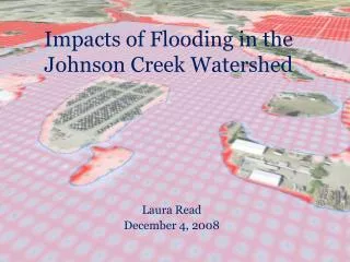
Impacts of Flooding in the Johnson Creek W atershed. Laura Read December 4, 2008. Study Region. Project Questions and Goals. Demographic description of Johnson Creek’s residents and land value Land use and changes How flooding may play a role in shaping the land usage in Johnson Creek.

E N D
Impacts of Flooding in the Johnson Creek Watershed Laura Read December 4, 2008
Project Questions and Goals • Demographic description of Johnson Creek’s residents and land value • Land use and changes • How flooding may play a role in shaping the land usage in Johnson Creek
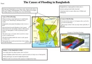
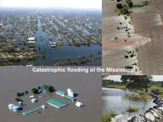
Multnomah County, Johnson Creek Watershed • 170,000 residents on 52 mi2 of land • WPA’s renovations altered stream without improving flood conditions • Urbanization increased flood prone area
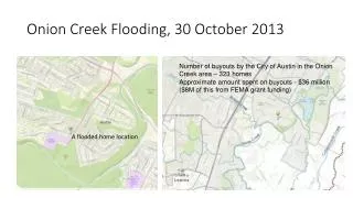
Flood Facts • Portland awarded $2.5 million from FEMA’s Pre-Disaster Mitigation Grant Program • East Lents: Flooded 39 times in the past 60 years Floodplain Floodway
Taxlots and Identification • A visual property information database • Collaboration between City Bureaus
Taxlot Attributes Zoomed In Sample Attribute Table
Census Analysis Census data for each tract
Finishing Touches • Created maps of demographic distributions: population, average house value, age, poverty, unemployment • Analyzed Land Cover and Usage for percentages • Still need to compare Multnomah Co. data to Johnson Creek
Data Sources • City of Portland: taxlots, streets, streams • U.S. Census Bureau TigerLine and PUMA files • USGS Seamless for 1 arc second DEM and Land Cover Data (NLCD) • Google Earth