Download
1 / 21
240 likes | 337 Views
Delve into the ICESat (Ice, Cloud, and land Elevation Satellite) and its key instrument GLAS (Geoscience Laser Altimeter System). Learn about their objectives, challenges, and solutions for accurate data collection on polar ice sheets. Discover how ICESat has revolutionized satellite observations and its significance for future research.

E N D
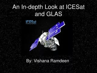
An In-depth Look at ICESat and GLAS By: Vishana Ramdeen
Abstract The ICESat (Ice, Cloud, and land Elevation Satellite) spacecraft was launched on January 12, 2003 into a near-circular, low Earth, Sun-Synchronous Orbit with a 94 inclination. Its objective is to quantify the mass balance of the polar ice sheets and observe the changes with time. The only scientific observation instrument onboard is the GLAS (Geoscience Laser Altimeter System) instrument. It consists of three lasers (Laser 1, 2, and 3) which operate one at a time for three 33-day campaigns per year. GLAS’s Lasers 1 and 2 experienced a rapid decrease in laser energy which was attributed to issues with the frequency doubler, a manufacture defect of the laser diode pump array, and trace levels of outgassing. One of the major shortcomings of ICESat is systematic pointing errors. Two of the calibration methods used to compensate for these errors are ocean scans and “round” the world scans. The ICESat has provided scientists with information that is unsurpassed by any existing satellite and expectations for the future are high.
Agenda • Introduction • Overview of the physical instruments • ICESat • GLAS • General and Orbital Characteristics • GLAS Lasers • Shortcomings • solutions • Conclusion
Introduction • ICESat = Ice, Cloud, and land Elevation Satellite • Launched into orbit on January 12, 2003 on a Boeing Delta II rocket from the Vandenberg Air Force Base in California
Introduction • Inclination: 94 • Retrograde Orbit • Near circular, low Earth orbit • Sun-Synchronous Orbit • Altitude: 590 km initially • currently at 600 km • Orbital period: 96.6 minutes • Two reference tracks: 8-day exact repeat (for calibration purposes) and 91-day exact repeat (for denser track coverage)
ICESat Schutz et al.: ICESat Overview
ICESat’s Mission Objectives • “The primary goal of ICESat is to quantify ice sheet mass balance and understand how changes in the Earth’s atmosphere and climate affect polar ice masses and global sea level.” • Measures height profiles of clouds, aerosols distribution, vegetation cover, and land elevations.
ICESat/GLAS ICESat (zenith view) GLAS www.csr.utexas.edu/glas and glas.gsfc.nasa.gov
GLAS • GLAS = Geoscience Laser Altimeter System • First LIDAR used for continuous global observations of the Earth • A combination of a precision surface LIDAR with a sensitive dual-wavelength cloud and aerosol LIDAR • Only scientific observational instrument on the ICESat spacecraft
GLAS • Consists of three lasers • referred to as Lasers 1, 2, and 3 • Mounted on a stationary optical bench • Laser measurement direction is nadir, but the spacecraft can perform roll maneuvers to point up to 5° off nadir • Only one laser is in operation at a time, pulsing at 40 Hz • Pulse width is 5 nanometers
GLAS Lasers Abshire et al.: Geoscience Laser Altimeter System (GLAS) • Each pulse has an averaged 65 m footprint • successive laser pulses spaced 172 m along-track • Area on the Earth’s surface covered by each pulse is not equal • Laser’s far field patterns are hypothesized to change due to the change of spatial distribution of light from the laser diode pump arrays over time; more generally with laser energy and time • laser diode pumps are used to produce very high power outputs such as that used for GLAS’s continuous pulses
GLAS Lasers • 2 out of the 3 lasers experienced more rapid energy loss than planned • After the first 10 days Laser 1’s transmitted energy began to rapidly decline • by day 38 it completely failed • caused by manufacture’s defect of laser diode pump array • To counter the effects of having less lasers, ICESat’s duty cycle was reduced from 100% to 25% • Lasers 2 and 3 are operating for three 33-day campaigns per year (Campaigns a, b, and c) • Laser 2’s decline is attributed to a process related to the frequency doubler and trace levels of outgassing. • To slow this fate, Laser 3 has been operating at a lower energy level Abshire et al.: Geoscience Laser Altimeter System (GLAS)
Coverage? http://en.wikipedia.org/wiki/ICESat
How’s it done? • GLAS emits a 1064 nm (for surface and cloud tops) and 532 nm (for atmospheric aerosols) laser pulse toward Earth’s surface. • time emitted is recorded • Upon impact to a surface, the photons are scattered back to the satellite. • When the photons come into contact with the receiver another timestamp is taken. • measurements of time of flight, emission angle relative to inertial space, transmitted pulse waveform, and echo pulse waveform are taken • the time of flight is divided by 2 and multiplied by the speed of light giving us the distance http://www.nasa.gov/vision/earth/lookingatearth/icesat_billion.html
Backscatter • Strong echo pulses indicate a region of flat, bright ice • 532 nm profiles (B) have better signal-to-noise ratios for weak aerosol backscatter because of their more sensitive photon counting detectors A B Abshire et al.: Geoscience Laser Altimeter System (GLAS)
An Example http://earthobservatory.nasa.gov/Library/ICESat/Images/greenland_icesheet.jpg
Shortcomings • Systematic pointing errors are preventing ICESat data from meeting its full potential • long-term trend bias • systematic variations with satellite orbital period revolution • These errors create elevation errors in the data and change with time • They pose problems since they are indiscernible from actual surface elevation change
Can we fix it? • Ocean scans • performed twice a day over the mid-Pacific • errors are estimated through the reduction of the ocean surface range deviations from each ocean scan • “Round” the world scans • performed every 8 days • estimates the systematic pointing errors as a function of orbital angle
ICESat Video http://www.nasa.gov/mission_pages/icesat/ Note: To see this video, go to the above website and click on the second video from the top.
Conclusion The ICESat has provided scientists with unprecedentedly accurate data of the globe’s polar regions. With the addition of a few calibrations the usefulness of its outputs would grow increasingly.
References • Abshire, J., et al. (2005), Geoscience Laser Altimeter System (GLAS) on the ICESat Mission: On-orbit measurement performance, Geophysical Research Letter, doi:10.1029/2005GL024028, 1534-1536. • ICESat (2008). In Wikipedia, The Free Encyclopedia. Retrieved 05:37, May 7, 2008, from http://en.wikipedia.org/w/index.php?title=ICESat&oldid=182396442. • Luthcke, S. B., D. D. Rowlands, T. A. Williams, and M. Sirota (2005), Reduction of ICESat systematic geolocation errors and the impact on ice sheet elevation change detection, Geophysical Research Letters, 32, L21S05, doi:10.1029/2005GL023689. • Schutz, B. E., H. J. Zwally, C. A. Shuman, D. Hancock, and J. P. DiMarzio (2005), Overview of the ICESat Mission, Geophysical Research Letters, 32, L21S01, doi:10.1029/2005GL024009.