Download
1 / 30
300 likes | 439 Views
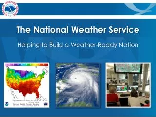
National Weather Service Products on the Internet. Erik Heden Meteorologist NWS Weather Forecast Office Binghamton, NY Patti Wnek Service Coordination Hydrologist NWS Middle Atlantic River Forecast Center. Watches/Warnings.

E N D
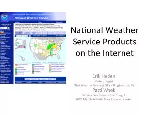
National Weather Service Products on the Internet Erik Heden Meteorologist NWS Weather Forecast Office Binghamton, NY Patti Wnek Service Coordination Hydrologist NWS Middle Atlantic River Forecast Center
Watches/Warnings - Map will highlight based on any active watches or warnings that are in effect • By clicking on your area of interest, you can view any valid watches or warnings that are in effect
Watches/Warnings - Map will highlight based on any active watches or warnings that are in effect • By clicking on your area of interest, you can view any valid watches or warnings that are in effect
Watches/Warnings - Map will highlight based on any active watches or warnings that are in effect • By clicking on your area of interest, you can view any valid watches or warnings that are in effect
AHPS • River levels, both past, present and future • Specific site information, including gauge location, history, and flood category • Precipitation amounts, including observed and departure from normal.
AHPS - Forecast for the river (green) - Quick view of the trend of the river (blue) - Flood category will be graphed as applicable
AHPS - Forecast for the river (green) - Quick view of the trend of the river (blue) - Flood category will be graphed as applicable
AHPS - Forecast for the river (green) - Quick view of the trend of the river (blue) - Flood category will be graphed as applicable
AHPS Observed Precipitation - Quickly view maximum and minimums in rainfall - Data intervals can be as little as a day or a week, or up to 180 days. - Data can be downloaded
AHPS Observed Precipitation - Quickly view maximum and minimums in rainfall - Data intervals can be as little as a day or a week, or up to 180 days. - Data can be downloaded
AHPS Observed Precipitation - Quickly view maximum and minimums in rainfall - Data intervals can be as little as a day or a week, or up to 180 days. - Data can be downloaded
AHPS Observed Precipitation - Archive data goes back to 2005 - Useful for historic events (June 2006) - Monthly archive data includes departure from normal and percent of normal - Daily archive data only includes observed
AHPS Departure from Normal - Similar to the observed precipitation, this data can be downloaded, viewed, etc.
Inundation Mapping - On the left hand side by scrolling up to “raise” the level of the river
Inundation Mapping - You can view what areas are predicted to be inundated at that stage.
Inundation Mapping - Detailed version will show you the depth of the water
Precipitation Forecasts (QPF) • Basis for river model forecast • Formats may vary from River Forecast Center, but you can view expected precipitation amounts out to 48 hours.
National Weather Service Products on the Internet Erik Heden Meteorologist NWS Weather Forecast Office Binghamton, NY Patti Wnek Service Coordination Hydrologist NWS Middle Atlantic River Forecast Center
Flash Flood Guidance • Amount of rain needed to push small streams out of their banks • Helpful in situational awareness – how much rainfall can we handle?
Headwater Guidance • Specific to a particular stream location with: • USGS stream gage • Official established NWS Flood Stage
See our handout for the addresses to these and otherhelpful NWS internet sites. erik.heden@noaa.gov patricia.wnek@noaa.gov