Download
1 / 50
500 likes | 591 Views
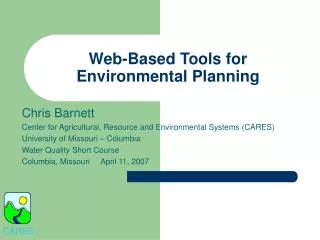
Web-based Tools for Accessing, Analyzing and Developing Environmental Data Products. Frank Schwing NOAA Fisheries Southwest Fisheries Science Center/ Environmental Research Division Pacific Grove CA NOAA NODC June 24, 2009.

E N D
Web-based Tools for Accessing, Analyzing and Developing Environmental Data Products Frank Schwing NOAA Fisheries Southwest Fisheries Science Center/ Environmental Research Division Pacific Grove CA NOAA NODC June 24, 2009
Web-based Tools for Accessing, Analyzing and Developing Environmental Data Products Roy Mendelssohn, Lynn deWitt, Bob Simons, David Foley, Jerome King (NMFS/SWFSC/ERD) Sharon Mesick, Rost Parsons, Eric Roby, Charles Carlton (NESDIS/NCDDC) Steve Hankin (OAR/PMEL) NOAA IOOS Program (Zdenka Willis, Becky Shuford) NOAA EGT (Steve Murawski, Mike Ford)
ERDDAP - Web-based Data Access Program http://coastwatch.pfeg.noaa.gov/erddap/index.html • ERDDAP provides a technological basis for translation between data transport protocols and the needs of data users • Aggregates data from remote and local sources • Search options • Standardized requests • Multiple format options • E-mail/URL notification of dataset changes • Web application (for humans) • Web service (single URL brings data into R, matlab, etc.)
ERDDAP - Web-based Data Access Program • providing data to researchers • animal tagging and tracking • chlorophyll bloom watches • stock assessment • ocean climate analysis • California Current pelagic IEA • used in Cyber Infrastructure of NSF-funded “Ocean Observatories Initiative”
JAVA [hyperwarp:/applications/ErdJava] rmendels% ./ConvertTable "http://oceanwatch.pfeg.noaa.gov/opendap/GLOBEC/GLOBEC_bottle?t0,oxygen&month=5" 2 result.nc 1 observation [hyperwarp:/applications/ErdJava] rmendels% ncdump -h result.nc netcdf result { dimensions: observation = 190 ; variables: double t0(observation) ; t0:long_name = "Temperature T0" ; double oxygen(observation) ; oxygen:long_name = "Oxygen" ; // global attributes: :id = "result" ; :observationDimension = "observation" ; } Java-based browsers Python web developers
CoastWatch Browser www.pfel.noaa.gov/coastwatch/CWbrowser.jsp
Viewing Anomalies Aug 2007 Prim. Prod. Aug 2007 Prim. Prod. or choose anomaly dataset from list Providing climatologies & anomalies made possible by NOAA’s R&O program
Viewing Time Series Simply clicking on any point on the map will generate a timeseries at that location. PP, Aug 2007 PP @ 38.5°N, -234.5°E PP @ 38.5°N, 234.5°E Science quality satellite timeseries are crucial to NMFS
Comparing Data Sets AVHRR SST from 4/27-5/04 2007 Overlay of in-situ SST data from NDBC buoys from the same time period Ability created in response to needs of IOOS RAs
Client-based tool to import 4-dimensional environmental data from web directly into selected working environments, including Matlab, R and IDL Key features: One option allows the selection of data in a user-selected region along arbitrary tracks. This allows the analyst to “swim” with the animals through data fields while reducing strain on bandwidth and other technical infrastructure. No fuss, no muss with file formats: the data is imported as a variable in the given workspace. Access to a variety of data is built in, but it can potentially access data served by any interoperable web service (e.g., WCS and OPeNDAP) as recommended by IOOS. http://coastwatch.pfel.noaa.gov/xtracto SST FPI Xtract-O-Matic Leatherback Turtles
Web-based Data Services
TAGGING OF PACIFIC PELAGICS Top Predator Exploration of the Pacific Ocean • 21 species; 4,000 tags; 2 Million profiles • Tracking, conservation, ocean observation
Public access to latest animal tracks along with environmental data: http://las.pfeg.noaa.gov/TOPP
Public access to latest animal tracks: http://las.pfeg.noaa.gov/TOPP Public access to latest animal tracks along with environmental data: http://las.pfeg.noaa.gov/TOPP
Public access to latest animal tracks: http://las.pfeg.noaa.gov/TOPP Public access to latest animal tracks along with environmental data: http://las.pfeg.noaa.gov/TOPP Leatherback Sea Turtle
Private (PI) access to all animal tracks along with environmental data 110 leatherback turtle tags with tracks Metadata and track download for each tag deployment timeline
Private (PI) access to all animal tracks along with environmental data Download a variety of environmental data along with the track as images or text SST
Private (PI) access to all animal tracks along with environmental data Download a variety of environmental data along with the track as images or Text View in Google Earth
Increase number of data sets served in a CC virtual Data Assembly Center (vDAC) Expand beyond IOOS core variables Modify ERDDAP software to provide enhanced integration with selected IOOS DIF and Regional Ecosystem Data Management (REDM) data services Prototype implementation of services into IEA models for the California Current and Gulf of Mexico Regions Expand CC LME “tool box” and expand to GoMx Use integrated data system to develop specific regional IEAs Puget Sound, CA Current pelagics, No. GoMx Dashboard features —> PDA apps Next Steps
Goal of an Integrated Data System IEAs must provide an efficient, transparent means of summarizing the status of ecosystem components, screening and prioritizing potential risks, and evaluating alternative management strategies against a backdrop of environmental variability. To accomplish this goal, need to access a wide-spectrum of ocean observing data, and transform these data into formats of use to the systems involved in the IEA analyses.
Rationale for an IntegratedData System • Vast and diverse data holdings and observing systems • Multiple partners/datasets/stakeholders/clients • Efficient and effective management of distributed data • Easy & customized access to/use of multi-disciplinary data sources • Common tool box for visualization & analysis products and delivery in easy-use formats • Need for a National Model (other regions, priorities) • NOAA, EGT, IOOS priority
Requirements for an Integrated Data System Large volumes of data in many formats and locations, many preferred applications and functions, serving a spectrum of users needs and abilities Requires a cost-effective interoperable system that is standardized yet flexible, easy to use yet capable of meeting a myriad of complex needs, and delivering timely and synthesized information
Temperature Salinity Sea Level Surface currents Ocean color Bathymetry Surface waves Ice distribution Contaminants Dissolved nutrients Fish species Fish abundance Zooplankton species Optical properties Heat flux Bottom character Pathogens Dissolved O2 Phytoplankton species Zooplankton abundance Integration Long-term data series, coordinated in space and time A NOAA Need to Integrate Data Problem Need Core Variables Decision Tools Hurricane Intensity Model Coastal Inundation Model Harmful Algal Bloom Model Integrated Ecosystem Assessment
Core Variable Integration Problem: Temperature (Example) PLATFORM Data Distribution Archive NOAA Ship Synoptic NCDC NOAA Ship Archive NOAA Ships ARGO Delayed data GDAC ARGO Profiling Tropical Moored Buoys Weather Buoys NODC NDBC Drifting Buoys DART C-MAN SWIM NCDDC SWMP NERRS CDMO VOS (xbt) OAR AOML CREIOS NMFS PACIFIC I. FSC NWLON CO-OPS CLASS Single Sat. Pass Data OSDPP Satellites Multiple Sat. Pass Data COAST WATCH