Download
1 / 32
320 likes | 601 Views
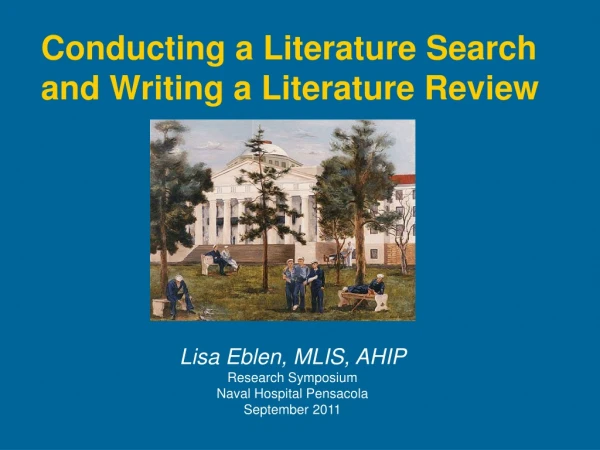
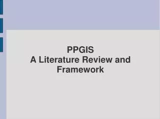
PPGIS A Literature Review and Framework. - Social History of PPGIS -Framework for a Coproduced PPGIS 1. Place and People 2.Technology and Data 3.Process 4.Outcomes and Evaluation Conclusion. Article Structure.

E N D
-Social History of PPGIS -Framework for a Coproduced PPGIS 1. Place and People 2.Technology and Data 3.Process 4.Outcomes and Evaluation Conclusion Article Structure
-The social application of (GIS) has captured the attention of researchers in diverse disciplines including urban planning, law, geography, library science, social work, landscape ecology, anthropology, agricultural economics, natural resources, and conservation biology. - Grassroots groups and community-based organizations (CBOs) use GIS as a tool for capacity building and social change - Through attributing empowerment of technology - Broadening access to GIS Introduction
GIS interest - more information use in policy making. - extending use of spatial information -analyses and spatial visualization of information -sheer volume of spatial data, increasingly affordable and easy to use systems. Introduction
Guarantee empowerment of -Decision making process -Spatial information -Instrument of capital control -Government surveillance -Reduces complex societal processes -points -lines -areas -attributes GIS and Empowerment
Because PPGIS is actively distributed among -disciplines -economic sectors -and formats This has provoked a crisis in PPGIS i.e Public and Participation Lack of comprehensive literature.
-A spatial decision support system that is designed by The Nature Conservancy for other nonprofit organizations, -A web-based municipal GIS that serves local real estate agents, -A GIS application that optimizes nuclear power plant siting, -A museum of technology that exhibits GIS tools and -A community mapping exercise that involves GIS software long after the exercise is completed and far away from the community. Disparate Application
-Originated at two meetings -National Center for Geographic Information and Analysis (NCGIA1996a, 1996b or GIS/2) -These meetings reported on a growing affinity of GIS practitioners with developing applications that ‘‘empowerless privileged groups in society’’ (NCGIA 1996b) and more inclusive of nonofficial voices Emergence of PPGIS
PPGIS was originally defined as ‘‘a variety of approaches to make GIS and other spatial decision-making tools available and accessible to all those with a stake in official decisions’’ Early Definition
Conferences and workshops -1998:U.S. National Center for Geographic Information and Analysis Varenius Workshop ; -2001:Workshop on Access and Participatory Approaches in Using Geographic information in Spoleto, Italy ; -2001-5; International PPGIS Conferences and Mapping for Change, Nairobi, Kenya 2005) Special journal issues of -Cartography and GIS (1998, vol. 25 [2]); -Environment and Planning B (2001, vol. 28 [6]); -Urban and Regional Information Systems Association Journal (2003, vol. 15, APA I, II); and -Cartographica (2001 [published 2004], vol. 38 [3&4]) Consequent Related PPGIS Meetings
The influence of early definition applications of GIS with the goals of improving the transparency of and influencing government policy led to two critiques - GIS and Society (GISoc) -Public Participatory GIS Early Seminally Influence
GIS and Society (GISoc), -reflect a more general interest in the social nature and impact of GIS—that is, the choices made and foregone in the development of the technology, the numerous conflicting agendas in its use, and the impact of GIS on representing spatial information. -asked the whether and why questions -concerned with the social theory of GIS whereas PPGIS relegated to the how—that is, how to employ the theories to most appropriately apply GIS for social endeavors -considered ‘‘GIS in practice.’’ Tension
-Led to recent calls to rename PPGIS to Participatory GIS (PGIS) Because Individuals at the initial meetings on PPGIS expressed some apprehension that applications were beginning to overrepresent the advantaged (e.g., the haves in U.S.suburbs) and underrepresent marginalized peoples(e.g.,the have-nots in communities without even the basics such as potable water) Creative Tension
-researchers have increased the number of nontraditional PGIS applications, primarily in developing countries -PGIS derives from community integrated GIS and - ‘‘counter mapping,’’- mapping to contest the status quo. However PPGIS continues to be the most widely used term, but each acronym brings its own contexts, methods, and actors to a collective understanding of PPGIS or PGIS. Result of Creative Tension
PPGIS is considered Subsumed into Critical GIS this encompasse all research on the societal effects of GIS (e.g., geosurveillance), the social processes that should or should not be modeled by GIS (e.g., gender movement in space), or the representation, ontology, and epistemology of GIS Other reflections
Such as GIScience community critical resources -laboratory space -funding -graduate students -generalized as objective scientific inquiry -represents a collection of methods or -less legitimate GIStudies -what cost of a positioning within science. Greater Legitimacy to GIS critiques in GIScience
Resulting Definition of PPGIS PPGIS pertains to the use of GIS to broaden public involvement in policymaking as well as to the value of GIS to promote the goals of nongovernmental organizations, grassroots, and community-based organizations What then is PPGIS
-PPGIS has metamorphosed into a coproduced concept composed of multiple disciplinary approaches and actors, rapidly changing technologies, and numerous as well as occasionally transgressive goals such as -researchers and practitioners from urban planning, community development, landscape ecology, as well as natural resources Rapid Evolution of PPGIS
-It primary focus was to formalize the nature or process of PPGIS through exploratory case studies providing social narrative of PPGIS. These included studies of GIS by -marginalized communities, -nongovernmental organizations(NGOs) and - grassroots groups, -native groups , -social movements, -peoples in developing countries,and -urban CBOs. Reasons for evolution
The earliest work showed the possibilities of GIS for grassroots environmental advocacy, The latest forms vary in technology and theory, for instance, -implementations of web-based neighborhood information systems - community resident-developed monitoring of the environment with mobile GIS and - models of GIS availability in urban CBOs - Research and practice, frequently updated and ononline bibliographies etc Reasons continue
-PPGIS provides a unique approach for engaging the public in decision making through its goal to incorporate local knowledge, integrate and contextualize complex spatial information, allow participants to dynamically interact with input, analyze alternatives, and empower individuals and groups. -The field continues to attract the attention of varied academic disciplines and sectors and across the spectrum of nonprofit organizations Conclusion
Places and People Context Conditioned by laws, culture, politics and history of area of interest Cultural acceptance of PPGIS may vary Local influence may thwart effects (Ghana and Masai examples) Scale and geographic extent Factors which affect institutional culture
Places and People (cont’d) Stakeholders and Other Actors Who should participate? - may never be answered! Stakeholders - those who are affected, bring knowledge or possess power to influence Location and multiple scales Including more actors may invite those with less at stake or who face fewer consequences GIS savvy may get/inherit more work; less skilled may be disadvantaged. Relationships are elastic
Places and People (cont’d) The Public Separated from stakeholders to reflect original PPGIS definition Broad characterization = numerous viewpoints No single public, but multiple levels of public Multiple public = multiple needs (Portland) Where is “the public” - a continent away? Can an physical boundary be drawn around the “the public”?
…appropriateness and accuracy, access and ownership, and representation. Technology and Data Extent of GIS Technology earliest PPGIS focused on hardware, software, manuals and documentation Participatory 3-D modeling Human-computer interaction (HCI) How much technology and when should it be brought into the process?
Technology and Data (cont’d) Accessibility of Data Access to data is a growing concern Data constraints Open government Individual privacy Security Fiscal responsibility Politics and policies
Technology and Data (cont’d) Appropriateness of Information information = data that are relevant and accessible wrong format, incorrect resolution, incomplete Barndt’s (2002) model for assessing value of data Issues with accuracy
Technology and Data (cont’d) Representation of Knowledge Representation inhabits a contested position Does representation = visualization? Inclusion of indigenous knowledge value-based, intangible e.g. - values of homes, uniqueness of areas Enriching datasets with multimedia A move from dissemination to 2 and 3-way communication Whose knowledge should be included?
Process GIS implementation by grassroots organization Developing countries vs. United States grassroots organizations (funding differences, technical expertise, maintaining components, etc.) Participation in policymaking Certain individuals (rich, technically able, young) felt more empowered then non-technical individuals to influence policy Decision-making structures and management Questions of process must consider not just the process itself, but also the problem the process is designed to solve.
Outcomes • PPGIS does not mean that public participation is the endpoint of all PPGIS projects • PPGIS may be used haphazardly and its meaning is not universal • Numerous outcomes and goals are reported across PPGIS projects • PPGIS can be simultaneously empowering and marginalizing a particular community or group • PPGIS goals emanate from particular organizational cultures and personal ideologies (Academics vs. Technocrats vs. Grassroots activists)
Evaluation • Few PPGIS researchers explore measures of PPGIS effectiveness • PPGIS measures should be integrated into broader societal goals, such as community development, sustainable development, and environmental preservation. • PPGIS research has yet to establish either: • a set of best practices or • a technique to demonstrate whether or not PPGIS is a suitable approach for a given problem
Conclusion • PPGIS provides a unique approach for engaging the public in decision making through: • Its goal to incorporate local knowledge • Integrate and contextualize complex spatial information • Allow participants to dynamically interact with input, analyze alternatives, and • Empower individuals and groups