Download
1 / 25
250 likes | 334 Views
Physical Geography of the United States and Canada. Landforms and Resources. Canada is the 2 nd largest country in the world The United States is the 3 rd largest country. Landforms and Resources.

E N D
Landforms and Resources • Canada is the 2nd largest country in the world • The United States is the 3rd largest country
Landforms and Resources • Extend from the Atlantic Ocean to the Pacific Ocean and from the Artic Ocean to the Gulf of Mexico
Landforms and Resources • Both countries rich in natural resources: • Fertile soil • Ample water supply • Vast forests • Variety of minerals
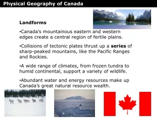
Many and Varied Landforms • The Eastern Lowlands • Flat coastal plains that runs along the Atlantic and the Gulf of Mexico • Piedmont: low plateau between the Eastern Lowlands and the Appalachian mountains • Contains many fast-flowing rivers
Many and Varied Landforms • Appalachian Mountains • West of the coastal plain • 1,600 miles long from Newfoundland to Alabama • Several mountain ranges • Green and Catskill in the North • Blue Ridge and Great Smoky in South
Many and Varied Landforms • The Interior Lowlands • Covers interior of North America • Flattened by glaciers • Interior plains • Great Plains • Canadian Shield
Many and Varied Landforms • Western Mountains, Plateaus, and Basins • Rocky Mountains • Continental Divide • Sierra Nevada • Cascade Range • North America’s highest peak = Mt. McKinley
Many and Varied Landforms • The Islands • Ellesmere, Victoria, Baffin Islands • Aleutian Islands • Hawaiian Islands
Oceans and Waterways • Great Lakes • Mississippi River = longest in continent • Mackenzie River = Canada’s longest river
Land and Forests • North America is the world’s leading food exporter • Much of this agricultural land is found in the plains region and in river valleys • 1/2 of Canada and 1/3 of the U.S. is covered by forests
Minerals and Fossil Fuels • Canada = iron ore, nickel, copper, gold, uranium • Both countries = coal, natural gas, oil, energy producing fossil fuels
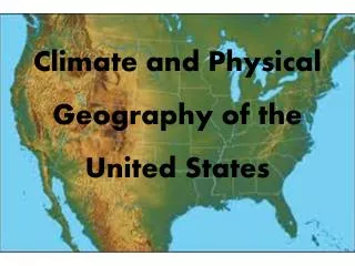
Shared Climates and Vegetation • Colder Climates • Artic coast of Alaska and Canada • Winters = long and bitterly cold • Summers = brief and chilly • Rocky Mountains and Pacific Ranges = highland climate and vegetation
Shared Climates and Vegetation • Moderate Climates • Humid continental • Pacific west coast • Prevailing Westerlies- winds that blow from west to east in the middle latitudes
Differences in Climate and Vegetation • Milder climates • Long growing season for variety of crops • Dry Climates • Great Plains and northern part of Great Basin
Differences in Climate and Vegetation • Tropical Climates • Hawaii and Southern Florida • Florida Everglades
Settlement and Agriculture Alter the Land • First inhabitants were nomads; people who move from place to place • Beringia: land bridge that once connected Siberia and Alaska
Settlement Agriculture Alter the Land • Early settlements became permanent about 3,000 years ago • Agriculture • Changed the landscape to meet their needs
Building Cities • Montreal, Quebec (1642): Canada’s 2nd largest city and a major port • Los Angeles: 2nd most populous city in U.S. • Metropolitan area spreads over 4,060 square miles
Overcoming Distances • Trails and Inland Waterways • St. Lawerence Seaway: N.A.’s most important deepwater ship route • Connects Great Lakes to Atlantic • Oregon and Santa Fe trails
Overcoming Distances • Transcontinental Railroads • 1st one completed in U.S. in 1869 • Trans-Canada railroad completed in 1885
Overcoming Distances • National Highway Systems • Trans-Canada Highway • U.S. interstate system is a network of more than 46,000 miles of highway