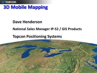
Mobile Mapping
Mobile Mapping. Coastal Mapping Presented by: Kenneth Pitts, P.L.S., R.L.S. Presentation Overview. Technology Applications Project Specific Information Summary Questions. Sanborn Van Mobile Mapping. 2x 200 Khz Lasers 2 x 5Mp Digital Cameras 2x GPS antennas 1x POS IMU 1x DMI

Mobile Mapping
E N D
Presentation Transcript
Mobile Mapping Coastal Mapping Presented by: Kenneth Pitts, P.L.S., R.L.S.
Presentation Overview • Technology • Applications • Project Specific Information • Summary • Questions
Sanborn Van Mobile Mapping • 2x 200 Khz Lasers • 2 x 5Mp Digital Cameras • 2x GPS antennas • 1x POS IMU • 1x DMI • 1TB Storage
Optech Lynx Images Courtesy of Optech,WH Pacific, ADS Inc
Applications • Rail – Collect infrastructure and assets Includes tunnels) • Air – Map runways/lights – terminal , and all other assets • Transportation- Roads, curbs, ditches- drains- light, signs • Utilities- Power poles – overhead wires and connectors • Building, trees, vegetation • Accurate Topographic map for flood analysis
Transportation Applications • Highway Infrastructure/Pavement Mapping • Overhead Obstructions/ Bridge & Tunnel Clearances • Asset Management - Road Inventory – manholes, barriers, curbs, lights, vegetation etc (GASB34 compliant) • Signage (MUTC Federal DOT reflectivity requirements ) • Road & grade survey for pre & post construction analysis • Encroachments- Obstructions in ROW • Master Planning
Urban Mapping-BIM Applications Point Cloud Images Courtesy of Optech & SINECO
Urban Mapping-BIM Applications 3D Model –Generic Textures Images Courtesy of Optech & SINECO
Marine Application Collection from a Watercraft Vehicle; Habitat, Environmental Flood Modeling, Beach Erosion, Port & Harbor
America Samoa • Preliminary Survey • Determine best technology for environment • Determine requirements of information for applications such as: • New and future planning & development • Safety, Hazard planning and response • Environmental planning
Technology & Application Summary • Benefits of Ground & Mobile Technology; • Collect both GIS & Survey Data • Provide Base Mapping • Emergency Planning Operations (First Response) • Environmental Assessment & Planning • Natural Resource Mapping • Road and Utility Mapping