Download
1 / 37
370 likes | 372 Views
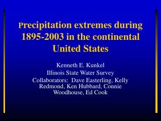
This study examines the frequency and intensity of precipitation extremes in the continental United States from 1895 to 2003. It explores the causes of observed trends and the implications for the global change debate.

E N D
Precipitation extremes during 1895-2003 in the continental United States Kenneth E. Kunkel Illinois State Water Survey Collaborators: Dave Easterling, Kelly Redmond, Ken Hubbard, Connie Woodhouse, Ed Cook
Questions • Are the frequency and intensity of extremes changing? • What is the magnitude of natural variability in the frequency and intensity of extremes • What are the implications for the global change debate?
Trends in extreme precipitation • Characteristics of early 20th Century pluvial • Causes of observed trends
U.S. Climate Data • U.S. Cooperative Observer Network in operation since late 1880s • Daily Observations – Max and Min Temp, Precip, Snowfall, Snow Depth • Digitizing of Observations began in 1948 • Miscellaneous projects resulted in the digitizing of selected data prior to 1948
Until recently, digital availability of pre-1948 daily climate data has been deficient
Climate Database Modernization Project • U.S. Congress has appropriated funds to NOAA NESDIS to digitize data records • One of the first data sets chosen for digitization was the daily cooperative records. Digitization of these records finished for the most part in 2001.
Long-term Stations: 1895-2003 Red – new; Blue - old
Data Set Quality Control • Basic QC of data performed by National Climatic Data Center • A collaborative project, partially funded by NOAA OGP CCDD, to more completely QC these data has been completed • Illinois State Water Survey, National Climatic Data Center (Dave Easterling), U. of Nebraska-Lincoln (Ken Hubbard), Desert Research Institute (Kelly Redmond)
Extremes Definition • Event Duration – days • Recurrence (threshold exceedance) –years • 1,5,10,30-day duration • 1,5,20-year recurrence • National index
1-dy,1-yr Extreme Precipitation: 1895-1905 Blue = positive anomaly Red = negative anomaly
1-dy, 1-yr Extreme Precipitation: 1990-2000 Blue = positive anomaly Red = negative anomaly
Current Drought in West • High frequencies in western U.S. occurred shortly before 1922 Colorado River compact • Analysis of this period reveals role of extreme seasons • Compact based on 16.5 maf annual flow; 1906-2001 average was 15.1 maf; paleoclimatic reconstructions indicate 400-year average of only 13.5 maf
Tree ring reconstruction • Tree-ring reconstruction of western US climate recently extended back to more than 1000 years before present (Cook et al, Science, in press) • Comparative analysis tree-ring reconstruction for early 20th Century pluvial (consecutive years of positive PDSI, cumulative PDSI sum) – Connie Woodhouse, Dave Easterling, Ed Cook
Western United States Tree-Ring Climate Reconstruction Consecutive Years of Positive Palmer Drought Severity Index
Causes • Studies with GISS GCM • North Pacific Index • Cyclone tracks Klein, W. H., 1957: Principal tracks and mean frequencies of cyclones and anticyclones in the Northern Hemisphere. U.S. Weather Bureau Research Paper 40, 60 pp. U.S. Weather Bureau, Daily Synoptic Series, Historical Weather Maps, Northern Hemisphere Sea Level, January 1899 to June 1939, Cooperative project of U.S. Army Air Force and U.S. Weather Bureau, Washington DC 1944.
CONCLUSIONS • Heavy Precipitation Frequencies were highest during the late 20th Century but also rather high during the late 19th and early 20th Century • The late 20th Century peak may be caused by Tropical Pacific SST anomalies. The early 20th Century peak occurs at a time of large positive values of the NPI and above normal frequency of cyclones coming ashore in the Pacific Northwest.