CWB
C orporate W atershed B ase. CWB. Provides an intelligent, connected, feature-coded stream network Supports GIS analysis, allocation decisions, planning processes and environmental monitoring History: Started in 1995 as TRIM Watershed Atlas (TWA)

CWB
E N D
Presentation Transcript
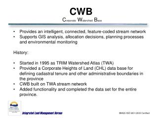
Corporate Watershed Base CWB • Provides an intelligent, connected, feature-coded stream network • Supports GIS analysis, allocation decisions, planning processes and environmental monitoring • History: • Started in 1995 as TRIM Watershed Atlas (TWA) • Provided a Corporate Heights of Land (CHL) data base for defining cadastral tenure and other administrative boundaries in the province • CWB built on TWA stream network • Added functionality and completed the data set for the entire province. BMGS ISO 9001:2000 Certified
CWB – Status (November, 2005) • Software tools developed: • Delineating and matching named hydrographic features • Generating skeletons for double-sided rivers and waterbodies • Defining mainstems • Data Processing: • Province wide connected stream network (with skeletons) • Delineation of named hydrographic features with names attached • Matching of streams and waterbodies between CWB and 1:50,000 BC Watershed Atlas (WSA) • Definition of mainstem and secondary flow • Correction of known errors in the data • Loading into a database BMGS ISO 9001:2000 Certified
CWB – What to Expect(by the end of March, 2006) • National Hydro Network (NHN) compliant dataset is available • Topologically clean set of hydrographic data • Including named features, lakes and double line rivers directionalized clockwise, and inland features, a definition of primary and secondary flows (different from BC definition), and obstructions • BC Network becomes available • Topologically clean set of hydrographic data • Including named features, lakes and double line rivers directionalized downstream, wetlands, controlling arcs, routes, hierarchy, order, magnitude, and obstructions, a different and more specific definition of primary/secondary flow. BMGS ISO 9001:2000 Certified
CWB – SMT • Development of Web Service (SMT) BMGS ISO 9001:2000 Certified
CWB SMT Main Screen BMGS ISO 9001:2000 Certified
CWB SMT – more detail BMGS ISO 9001:2000 Certified
Synthetic Stream BMGS ISO 9001:2000 Certified
Upstream Tool BMGS ISO 9001:2000 Certified
Find Location (1 of 2) BMGS ISO 9001:2000 Certified
Find Location (2 of 2) BMGS ISO 9001:2000 Certified