Download
1 / 22
220 likes | 352 Views
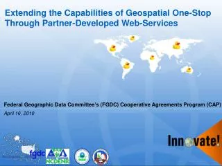
Extending the Capabilities of Geospatial One-Stop Through Partner-Developed Web-Services . Federal Geographic Data Committee’s (FGDC) Cooperative Agreements Program (CAP). April 16, 2010. Agenda. Introduction Project Basics GOS Catalog Interfaces

E N D
Extending the Capabilities of Geospatial One-Stop Through Partner-Developed Web-Services Federal Geographic Data Committee’s (FGDC) Cooperative Agreements Program (CAP) April 16, 2010
Agenda • Introduction • Project Basics • GOS Catalog Interfaces • GeoFinder for the Environment (GFE) Capabilities • GFE Partner Implementations • How Can You Leverage the GFE in your Organization? • Questions • Contact Information
Introduction • Background • Created software that extends GOS services to include new partners and features • Called GeoFinder for the Environment (GFE) • Built on a pilot effort that began with EPA • Expanded through NSDI CAP Grant • Core Partners: • Innovate!, Inc. • Environmental Protection Agency (EPA) • Couer D’Alene Tribe (CDA) • North Carolina Department of Environment and Natural Resources (NCDENR) • Provided free training to interested parties • 45 participants: States, Federal Agencies, Tribes, Others • Key goal: expand use of GOS (and GFE) services and meet user needs more effectively
Project Basics • Geospatial Metadata Catalogs • In use for many years • Collect, store, organize metadata documents in a central location • Often accessed through web-based front end search interfaces • Application Programming Interfaces (APIs) • Developed to make metadata contents available to programmers outside of the catalog portal or website • Users can develop search interfaces (or simple links) from their applications leverage the content of the catalog • Greatly expands the utility of a metadata catalog • Two Common Implementations: • Catalog Service for the Web (CS-W) • Representational State Transfer (REST)
GOS Catalog Interfaces • What services are available from the GOS catalog? • CS-W • REST • Z39.50 • Open Archives Initiative Protocol for Metadata Harvesting (OAI-PMH) • GOS REST Basics • Simple, URL-based API with GeoRSS, HTML, and KML outputs • Access a metadata document directly (using unique identifier) • Access search interface to perform targeted searches • How does one access the GOS REST interface? • GOS Targeted Document Query: • http://catalog.geodata.gov/geoportal/rest/document/{UUID} • GOS Search Query: • Base URL: http://catalog.geodata.gov/geoportal/rest/find/document • Default returns 10 most recently published documents in GeoRSS format • Custom Query Example: • http://catalog.geodata.gov/geoportal/rest/find/document?searchText=affiliation:85&isPartOf=geodata.gov&contentType=liveData&start=1&max=100&f=html&orderBy=dateDescending
GFE Capabilities • Metadata search and discovery tool • Federated search model • Supports many catalog implementations • Easy to plug into new partner catalogs • Key features • Web based front end • Simple, URL-based API • Easy to use outputs and parameters • Extends GOS • Extends the basic capabilities of GOS • Targeted catalog search (GOS, States, etc.) • Additional capabilities to customize output
GFE Capabilities *Note: not all capabilities currently being used
GFE Capabilities • Accessing the GFE: • Web Interface: http://dev.innovateteam.com/GFE/ • Can be used as a basic search and discovery interface • Can also be used as a test environment for constructing API URLs
GFE Capabilities • Accessing the GFE API: • API Base URL: http://dev.innovateteam.com/GFE/search/get? • API Parameters: • SearchServices (target specific catalog provider) • Keywords (specify the keywords you’re looking for) • f (output format: kml, georss, html, html_static) • http://dev.innovateteam.com/GFE/search/get?SearchServices=GOS2&Keywords=water&f=html
GFE Capabilities • GFE API Parameters (cont’d) • KeywordType (all, any, phrase) • Westbc, Eastbc, Southbc, Northbc(bounding box) • Values must be between the ranges of -180 to 180 and -90 to 90, respectively • source(filters GOS2 sources based on numeric code provided by GOS) • http://dev.innovateteam.com/GFE/search/get?SearchServices=GOS2&Keywords=water&f=html&source=3667 • css (specify your own stylesheet) • http://dev.innovateteam.com/GFE/search/get?SearchServices=GOS2&Keywords=water&f=html&source=3667&css=http://geonetsystems.com/share/main.css • xslt (specify your own xslt to identify elements to include in output records) • http://dev.innovateteam.com/GFE/search/get?SearchServices=GOS2&Keywords=superfund&KeywordType=all&f=html&source=10787&xsl=http://geonetsystems.com/share/htmlJZ.xsl
GFE Capabilities • GFE Outputs - KML
GFE Capabilities • GFE Outputs – KML, with Add to Map capabilities for WMS and KML
GFE Capabilities • GFE Outputs • GeoRSS output displayed in Google Maps:
GFE Capabilities • GFE Outputs • WMS shown on web-based map viewer
GFE Partner Implementations • CDA: Integrated GFE capabilities directly into their main GIS Data Home Page • http://gis.cdatribe-nsn.gov/SearchGISData.aspx
GFE Partner Implementations • CDA: Integrated GFE capabilities directly into their main GIS Data Home Page • http://gis.cdatribe-nsn.gov/SearchGISData.aspx
GFE Partner Implementations • EPA: Integrated GFE capabilities into EPA Earth Application • http://earth.epageo.org:443/earth/
How Can You Leverage the GFE? • Basic Options: • Add your catalog to the list of GFE sources (if available) and make use of the API to display your resources • Harvest metadata to GOS and reuse content from there (using GFE API or GOS API, or both) • Create a list of targeted links from your web pages/applications that can help guide users to your (or others’) content that is useful for your business needs • No programming needed • Reuses GFE resources rather than standing up your own • Embed results into an iframe in your webpage • Dynamically generate content in your own web page • Create a simple search interface that can allow users to search for data from your own web applications • No need to buy your own software • Use the API capabilities from your web applications to expand users’ ability to find and access resources
Any Questions? • Thank you for your time today http://innovateteam.com/
More Information • People: • Innovate!, Inc.: • Jessica Zichichi: jzichichi@innovateteam.com • FGDC Lead: • Doug Nebert: ddnebert@fgdc.gov • Places: • GFE website: http://dev.innovateteam.com/GFE/ • GOS website: http://geodata.gov • EPA Earth: http://earth.epageo.org:443/earth/ • CDA data access website: http://gis.cdatribe-nsn.gov/SearchGISData.aspx • FGDC website: http://www.fgdv.gov • Innovate website: http://innovateteam.com