Download
1 / 79
790 likes | 977 Views
Issues in Australian Environments Land and Water Management Case Study: Murray Darling River. Traditional landuse. http://dl.screenaustralia.gov.au/module/19/ 2 min video 1966 Nomads in the Gibson Desert. River fish traps like these near Brewarrina,

E N D
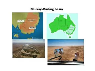
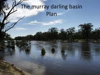
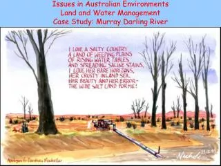
Issues in Australian EnvironmentsLand and Water ManagementCase Study: Murray Darling River
Traditional landuse • http://dl.screenaustralia.gov.au/module/19/ 2 min video 1966 Nomads in the Gibson Desert River fish traps like these near Brewarrina, New South Wales, were built using a complex network of rock walls designed to channel fish of varying sizes into specific catchment areas.
Aboriginal Land use • Aboriginal Australians have occupied the Murray-Darling river system for many thousands of years, and Europeans for less than 200. The Aborigines lived in harmony with the land and the river’s cycles of flood and drought. The river provided them with fish and crustaceans, and other foods; the river red gums provided the bark for their canoes and for shelter. They built elaborate fish traps and made nets for catching fish and birds.
Aboriginal Land use • Aboriginal communities along the Murray River were denser than almost anywhere else on the Australian mainland, because of the relatively continual availability of food and water.
Land clearing • When the British arrived in 1788 10% of Australia was covered by forest. • Woodlands covered a further 23 %. Within 200 years the area covered by eucalypt forest has been halved and the area of rainforest has been reduced by 75 %. • The forests that remain are disappearing at the rate of 1 % per year. • In particular the rate of deforestation is highest in SE QLD and exceeds that being carried out in the Amazon.
Cultivation of crops • Experimental rain grown cotton crops were first trialled in Queensland in the mid 1800s and production slowly increased until the 1930s when world prices fell enough for production to cease. In the 1950s and 1960s irrigated cotton production began and by the 1970s commercial production of irrigated cotton accelerated rapidly.
Wheat • Wheat is the major crop in the MDB (Murray Darling Basin).
Cotton • Today, cotton is mainly grown in the Northern part of the Murray-Darling Basin, along the Darling River and near the tributaries in northern New South Wales and southern Queensland. About 80 per cent of cotton crops are grown under irrigation. The Murray-Darling Basin accounts for over 93 per cent of Australia’s raw cotton production • http://www.smh.com.au/news/water-issues/cotton-sucking-life-out-of-murray/2008/08/15/1218307227802.html August 2008
Rice • Most of Australia’s rice is also grown within the Murray-Darling Basin. In 1924 rice production began around the townships of Leeton and Griffith in the Murrumbidgee Irrigation Area. Rice is now the major irrigated cereal crop and is grown entirely in the Murrumbidgee and Murray valleys of New South Wales. The annual rice production in Australia is between 1 and 1.7 million tonnes, with 1.2 million tonnes produced in 2002. Rice requires more water to grow than cotton.
Vineyards, Citrus, Fruit and Nut orchards • Today, vineyards, citrus, fruit and nut orchards cover approximately 30,000 hectares of irrigated land and produce one third of Australia’s wines and citrus fruit. Up to 90 per cent of South Australia’s citrus, stone fruits and nuts are produced in the area. Angas Park, Australia’s largest producer of dried tree fruit, has a plant in Loxton employing a large team of full-time and seasonal workers.
Vineyards • The Riverland has also become the largest wine-producing region in Australia and most major Australian wine companies source grapes from the area. The National Wine Centre of Australia provides more information about Riverland wineries.
Land degradation: What is it? • Land degradation is any change in the land that reduces its existing or potential productivity.
Land degradation • Our soil resources are an important natural asset, and their degradation is a significant concern to Australian farmers, governments and the general public. When left untreated, degraded soil reduces agricultural productivity, while salinity can damage buildings and infrastructure such as water pipes, roads and sewers. Degradation can also damage habitat for wildlife, kill micro-organisms that live in the soil, and harm the quality of our inland waters.
Video • http://www.powerhousemuseum.com/education/ecologic/aussalt.htm Why is Aust So Salty video. Need to open it in broadband 6 mins
Salinity Where is it and why?
Soil Salinity • Salinity occurs when the water table rises, bringing natural salts to the surface (in sufficient quantity, these salts are toxic to most plants). When trees or other deep-rooted vegetation are replaced with vegetation that uses less water, the water table may rise to cause dryland salinity. (If the water table rises through increased irrigation then irrigation salinity can occur.
Dryland Salinity • Dryland Salinity is where the water table rises after more water infiltrates due to the clearing of trees.
Recharge and leakage • Water `leakgage' beneath the root zone and entering internal drainage and groundwater systems has increased. • Ground water recharge is the amount of water being added to the ground water. If this is higher than discharge, which is the amount of water lost from the ground water, then the water table rises. As it does, the water dissolves salt held in the soil profile, and the salt becomes more and more concentrated as the water moves upwards. If the salty water keeps rising, it eventually reaches the surface and subsurface layers of the soil. The water evaporates, leaving the salt behind.
Irrigation Salinity • Irrigation Salinity is where the water table rises due to excessive irrigation meaning extra water infiltrates.
Concentrated salt at the surface will kill vegetation. • Also plants trying to survive in saline areas are preferentially grazed. • Removing vegetation causes problems with wind and water erosion and lost production.
Salinity Forecasts State/Territory 2000 2050 New South Wales 181 0001 300 000 Victoria 670 0003 1 100 000 South Australia 390 000 600 000 Western Australia 4 363 000 8 800 000 Tasmania 54 000 90 000 Queensland not assessed 3 100 000 Total 17 000 000 http://www.abc.net.au/water/stories/s1572428.htm Water facts on Salinity
Degradation • Our soil resources are an important natural asset, and their degradation is a significant concern to Australian farmers, governments and the general public. When left untreated, degraded soil reduces agricultural productivity, while salinity can damage buildings and infrastructure such as water pipes, roads and sewers. Degradation can also damage habitat for wildlife, kill micro-organisms that live in the soil, and harm the quality of our inland waters.
Murray Darling • Show Clickview 16 min video River’s End 60 mins 2008 • And clickview 507 Catalyst 2008.05.01 • http://www.abc.net.au/water/stories/s2003556.htm
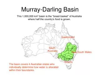
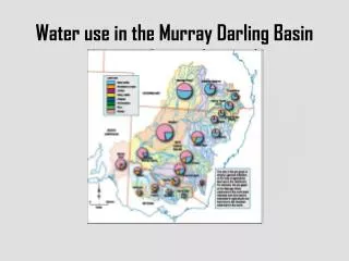
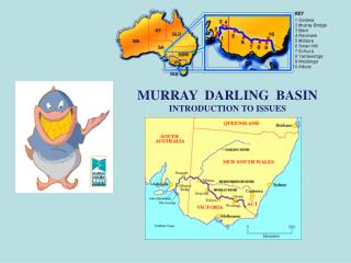
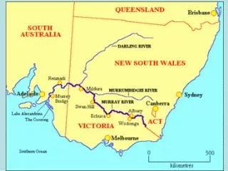
Murray Darling • is the 7th biggest river system on the planet • is Australia's largest and most developed river system • covers more than 1 million square kilometres of land • provides drinking water for over 3 million people • encompasses 30,000 wetlands • represents much of Australia's unique flora and fauna • provides over 41% of Australia's gross value of agricultural production • once boasted 28 billion trees, yet now has only 5 billion