Download
1 / 26
260 likes | 394 Views
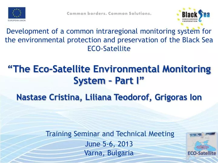
Development of a common intraregional monitoring system for the environmental protection and preservation of the Black Sea ECO-Satellite “The Eco-Satellite Environmental Monitoring System – Part I” Nastase Cristina, Liliana Teodorof, Grigoras Ion Training Seminar and Technical Meeting

E N D
Development of a common intraregional monitoring system for the environmental protection and preservation of the Black Sea ECO-Satellite “The Eco-Satellite Environmental Monitoring System – Part I” Nastase Cristina, Liliana Teodorof, Grigoras Ion Training Seminar and Technical Meeting June 5-6, 2013 Varna, Bulgaria
Methodology for selection of monitoring stations location 1. The monitoringprogram elements: set of goals conceptual pattern set of physical-chemical indicators methodology for data collection methodology for indicators process for linking indicators reporting methodology • 2. Characteristics of a monitoring program: • is relevant and a good tool • a certain scale • a model that emphasizes the relationships between ecosystems • integrated monitoring system • adaptive and flexible • practical features
Organization of the monitoring system isbased on the following criteria: • Multifunctional approach ; • The ecosystem approach ; • Approach in terms of multiple pollution sources ; • Approach in terms of surface water pollution ; • Management in the Danube basin.
According toWater Framework Directive 2000/60/EC, Article 2.10, "surface water body" means a discrete and significant element of surface water such as a lake, a reservoir, a stream, river or canal, part of a stream, river or canal, a transitional water or a stretch of coastal water.
Basic criteria for delineation of surface water bodies: • surface water category; • surface waters typology; • surface waters physical characteristics. • Additional criteria for delineation of surface water bodies: • water status; • protected areas; • hydromorphological alterations.
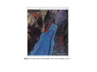
Key aspects of water bodies delineation: • small water bodies; • water bodies grouping ("aggregation") depending on the cause which influence their condition; • tributaries which belong to the same types and whose status is natural or it is determined by the same dominant pressure , which confluence in a lake / stream have been grouped in a single water body. • no longer considered and defined water bodies, those which have permanent depletion • 3 water-rivers bodies, represented by the main arms of Danube. • 63 natural lakes water bodies; • 3 artificial water bodies: Mila 35channel, Crisan-Caraorman, Sulina channel, St. George channel. • 1 transitional lacustrine water body, represented by Sinoe Lake.
Typology for the Danube arms Establishment of abiotic typology : a. ecoregions of emplacement areas; b. landscape characteristics (geographical area and altitude); c. morphological characteristics (area and slope); d. hydrological characteristics (fluid flow); e. natural environment characteristics (temperature and precipitation); f. geological and lithological characteristics of the substrate. Hydromorphology: a. water course due to Danube arms and its channels; b. natural lakes due to its marshes and backwaters; c. transitional waters (which may be lacustrine and marine). Channels Network in Danube Delta consists of 45 streams with natural water circulation in length 1742 km and 26 channels in length of 1753 km.
Typology for the delta lakes Abiotic typology : a. ecoregion; b. altitude; c. depth; d. geology. Deltaic lakes are generally characterized by: a. membership to Pontic ecoregion (ecoregion 12); b. altitudes <200m; c. small depths (3-15m) and very small depths (<3m); d. area between 0.5 – 1 km2 (S), 1 – 10 km2 (M), 10 - 100 km2 (L) and > 100 km2 (XL). e. geology: calcareous, siliceous and organic - peat.
Tipology of transitional waters Abiotic typology a. Ecoregion; b. Salinity; c. The area affected by the tides; d. Depth. Mixing water characteristics a. Current speed; b. Water turbidity; c. The average composition of the substrate; d. Water temperature; e. Time of ice cover . Types of transitional waters a. river transitional waters; b. lake transitional waters; c. marine transitional waters.
Applications Surface water categories: • Flowing waters on the territory of Danube Delta Biosphere Reserve; • Main river arteries ; • Active circulating water channels; • Channels and streams from natural areas with free regime; • Channels and streams within insides with controlled water circulation with or without circulation of water.
Stagnant waters In Danube Delta Biosphere Reserve are 479 lakes. 63 lakes were used to establish the abiotic typology of deltaic lakes. 1. S Type Lakes (area between 0.5 to 1 km2) 10 lakes from: • Sontea-Fortuna aquatic complex: Alb, Pintilie, Radacinoasele lakes. • Rosu-Puiu aquatic complex: Bondarului, Potcoava lakes. • Gorgova-Uzlina aquatic complex: Cuzmintu Mare, Gorgostel lakes. • Matita-Merhei aquatic complex: Sfistofca lake. 2. M Type Lakes (area between 1 to 10 km2) 40 lakes from: • Somova-Parches aquatic complex: Rotundu, Somova, Parches lakes. • Sontea-Fortuna aquatic complex: Nebunu, Fortuna, Baclanestii Mari, Ligheanca, Mester lakes. • Rosu-Puiu aquatic complex: Puiu, Rotund-Puiulet, Vatafu, Erenciuc, Iacob lakes. • Gorgova-Uzlina aquatic complex: Cuibul cu Lebede, Isacel, Gorgovat, Potcoava 1, Uzlina, Obretinciuc, Obretinul Mare, Obretinul Mic, Babinti Mari 1, Babinti Mari 2, Fastic, Pojarnia, Taranova lakes. • Matita-Merhei aquatic complex: Matita, Merheiul Mic, Miazazi, Trei Iezere, Babina, Bogdaproste lakes. • Dunavat –Dranov aquatic complex: Belciug, Zatonul Mare, Durnoleatca, Lunga, Poliacova, Raducului, Zaghen, Saun lakes. 3. L Type Lakes(area between 10 to 100 km2) 11 lakes from: • Gorgova-Uzlina aquatic complex: Gorgova, Isac lakes. • Rosu-Puiu aquatic complex: Rosu, Rosulet, Lumina lakes. • Matita-Merhei aquatic complex: Merhei lake. • Razim-Sinoe aquatic complex: Golovita, Zmeica lakes. • Dunavat –Dranov aquatic complex: Dranov, Agighiol, Babadag lakes. 4. XL Type Lakes(area larger than 100 km2) 2 lakes from • Razim-Sinoe aquatic complex: Razim and Sinoe lakes.
The rest of 416 lakes were not selected in abiotic typology, they are considered with an area less than 0.5 km2. • In terms of abiotic, it were identified 7 types of deltaic lakes ROLN04, ROLN05, ROLN06, ROLN07, ROLN08, ROLN09 and ROLN13.
Types of deltaic lakes included in Monitoring Program (examples)
Discussion: Contribution to environmental monitoring Average concentrations of phosphorus from orthophosphate in the Danube Delta lakes, between 2005-2010
Raw data will be available only for specialists. For majority of people this data don’t have meaning. Split this data in quality classes using national and European standards we solve the problem. • Table data will be presented in graphic form (charts or maps). • Use as indicators of environmental quality, colors that have well known signification (ex. traffic light – red, yellow, green). • Integrate data coming from many monitoring station, create maps. • Integrate this maps in a GIS system in order to correlate the environmental monitoring information with other spatial information Principles to make environmental monitoring easy to understand
Table data Processing data Information National quality standards How make environmental monitoring information more accessible
Numerical Information Spatial processing Maps Transforming information in knowledge is tricky • The people can process maps information more quickly than tabular one. • The environmental information should be correlated with other spatial information in order to understand the phenomena.
Interpretation and presentation of water quality data class quality standard Class quality Maps Database Data Maps O2 O2 O2 Spatial processing Map classification N-NH4 N-NH4 N-NH4 . . . . . . . . . Pb Pb Pb
Combine algorithm Class quality Maps O2 N-NH4 Map combination One class quality map for combined chemical parameters . . . Pb Combine class quality maps
← parameter request parameter data → Map processing server ← map process request WMS → GIS server Database server ← parameter request parameter data → ← info request info data → Client Servers functions and connections
Water quality monitoring station in Danube Delta Biosphere Reserve
PROCESSING Transformation data to information - first step
PROCESSING Transformation data to information - second step
PROCESSING Transformation data to information – third step O2 NH4 WFD rule When combine layers, the biggest class from all is the value for the output layer O2 + NH4