Download
1 / 65
650 likes | 699 Views
Learn about the models and structures of ArcGIS UML and data modeling, including georelational data models and the use of geodatabases.

E N D
Models and Structures of ArcGISUML and Data Modeling Elements
Model / Data Model • Model = representation of something in the real world, of a process in the real world - how the world WORKS • Data Model = representation of data or information ABOUT that something or process - how the world LOOKS • limited representation of reality • a discretization or partitioning of space • constructs for representation in a computer
Data Model • usually a representation of the data collection process • FIELD … “grid” • OBJECT … “isoline” • FIELD or OBJECT … “geo-relational” • “Delauney triangulation” (alternative)
• partition areas based on “influence” of sample points (Thiessen polys) e.g., trusted elevation benchmarks or VIPs, market area delimitation, rain gauge area assignment, etc.
3 Data Models • geo-relational coverage (object view; from classic ArcInfo) • geo-relational shapefile (object view; from ArcView) • geodatabase (object-oriented; from ArcGIS)
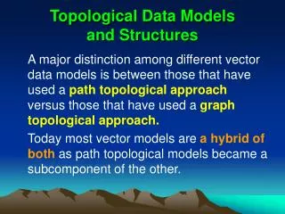
A B Georelational Data Model:“Classic” ArcInfo and ArcView Arc Info command line interface Unix, NT, Windows ArcView as interface
Data Structure • the way in which the data model is representedin the GIS • concerned simply with what can be computed and what can’t • not tied to process at all • DEM/raster for field model • coverage/shapefile for ESRI geo-relational (object model) • contour for isoline variation on object model • TIN for Delauney triangulation/Voronoi model • geodatabase for OO geodatabase
Data Structures • ArcInfo coverages • ArcView shapefiles • ArcInfo grids, USGS DEMs • Images (e.g., georeferenced tiffs) • TINs • Geodatabases
ESRI Coverage as a Data Structure Image courtesy of Louisville/Jefferson County Information Consortium, Kentucky
ESRI “Shapefile” .shp — shape format; the feature geometry itself .shx — shape index format; a positional index of the feature geometry to allow seeking forwards and backwards quickly .dbf — attribute format; columnar attributes for each shape, in dBase III format .prj — projection format; the coordinate system and projection information, a plain text file describing the projection .sbn and .sbx – spatial index .xml — metadata in XML format
yellow coverage green shapefile gray geodatabase ArcGIS Icons( Zeiler, pp. 65-71 )
Geodatabase If coverages are apples … and shapefiles are oranges … The Geodatabase can be your grocery bag… ESRI Geodatabase Video (3:57 to 11:20)
Elements of the Geodatabase • Feature Datasets • Feature Classes • Relationship classes • Geometric Networks • Domains • Ranges • Coded Values • Topology • Tables • Metadata • And More!!!
Geodatabase • Features and attributes as objects • Relationships among features • Validation or editing rules, behaviors • “Container” for • Vector, raster, tabular data • Relationships • Topology Object Table MS-Office
Sharing on Steroids:ESRI Data Models for Geodatabase Templates Pre-designed schema (skeleton) of • Objects -Feature classes -Tables • Relationships • Domains • Rules
Why Data Models & Gdb Templates? • Work with users & partners on practical design projects • Build useful ready to load geodatabases • Continue the process with feedback from real projects • Support & encourage standards
Data Modeling for Spatial Analysis • What is spatial analysis? • "a set of methods whose results change when the locations of the objects being analyzed change" • Methods for working with spatial data • to detect patterns, anomalies • to find answers to questions • to test or confirm theories • deductive reasoning • to generate new theories and generalizations • Inductive reasoning
What is Spatial Analysis (cont.) • Methods for adding value to data • in doing scientific research • in trying to convince others • A collaboration between human and machine • How do we set up the framework for spatial analysis? • Data model to data structure
A Georelational to a Geodatabase Model • coverage and shapefile data structures • homogenous collections of points, lines, and polygons with generic, 1- and 2-dimensional "behavior" • can’t distinguish behaviors • Point for a marker buoy, same as point for OBS • “smart features” in a geodatabase • lighthouse must be on land, marine mammal siting must be in ocean
Purpose of Arc Marine, Arc Hydro and others • basic template for implementing GIS projects • input, formatting, geoprocessing, creating maps, performing analyses • basic framework for writing program code and maintaining applications • development of tools for the community • promote networking and data sharing through established standards
Project Data Model Project Data Model Project Data Model Arc Marine Design Strategy “Generic” MarineData Model Inheritance User Group Data Model User Group Data Model User Group Data Model
Geodatabase Concepts • ESRI's new data object-oriented data model • objects, features, behaviors • Geodatabase • collection of feature classes/data sets, rasters, TINs • all data in relational tables • behavior is coupled with features through rules (object-orientation) • Feature data set • Contains feature classes • defines topological role of features • has a coordinate system • Feature class • stored in a relational table • special field for geometric shape • geometric data incorporated into the database • Point, multipoint, segment, path, ring, polyline, polygon
ArcMarine Geodatabase Overall Geodatabase Feature Dataset Feature Class Table Relationship Class
Modeling Process (1) Conceptual Model Lists, flow diagrams, etc Real World Objects and relationships (2) Logical Model Diagram in CASE Tool (3) Physical Model Database Schema (Object state) Graphic courtesy of ESRI
Data Model Levels Reality Human-oriented Conceptual Model Increasing Abstraction Logical Model Computer-oriented Physical Model
(2) Logical - UML • Unified Modeling Language • Diagrammatic notation = “visual language”... • For constructing a data model • Drawings, relationships constructed in Visio • Tools to input a drawing to ArcGIS • input data to the data model
UML NotationZeilerpp. 97-99 • a class is shown as a box • top part: name of class • lower part: attributes • methods associated with the class • lines connect boxes, indicate relationships
UML Notation ( cont. ) • Abstract class • specify subclasses underneath • no new instances • Feature Class • Specify subtypes underneath Food Veggies Meats
Relationships • Links between classes, shown as lines • One to one • One to many • Many to many
Relationships (cont.) • 1:1 - solid line • one record in Class A linked to one record in Class B • “is married to” • the class of state capitals linked to the class of states • 1:n - solid line with * at one end • one record in Class A linked to any number of records in Class B • "owns" • the class of states linked to the class of area codes
Relationships (cont.) • m:n - solid line with * at both ends • any number of records in Class A linked to any number of records in Class B • "has visited” • "was never married to" • the class of mountain lions linked to the class of wilderness areas