Download
1 / 22
220 likes | 323 Views
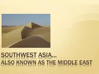
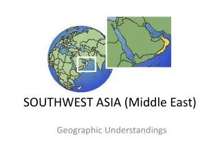
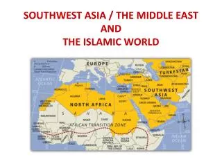
SS7G5. The student will locate selected features in Southwestern Asia (Middle East). Locate the following places on your map:. Euphrates River (Turkey, Iraq, Syria) Jordan River (Jordan, Israel) Tigris River (Turkey, Iraq) Suez Canal (Saudi Arabia, Egypt)

E N D
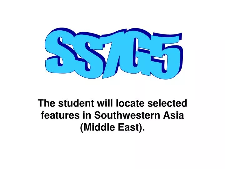
SS7G5 The student will locate selected features in Southwestern Asia (Middle East).
Locate the following places on your map: Euphrates River (Turkey, Iraq, Syria) Jordan River (Jordan, Israel) Tigris River (Turkey, Iraq) Suez Canal (Saudi Arabia, Egypt) Persian Gulf (Iran, Saudi Arabia, Kuwait, UAE, Qatar) Strait of Hormuz (UAE, Oman, Iran) Arabian Sea (Iran, Oman, Pakistan, India) Red Sea (Egypt, Saudi Arabia, Sudan) Gaza Strip (Israel) http://lizardpoint.com/geography/mideast-quiz.php
Euphrates River The Euphrates River begins in the mountains of Turkey. It flows southward through Syria and Iraq. It meets up with the Tigris River in southern Iraq and empties into the Persian Gulf. The Euphrates River is one of the most important rivers in the world. The Tigris Euphrates valley was the birthplace of ancient civilizations. The river is the source of political tension between Turkey, Syria and Iraq because they all compete for the use of its waters for irrigation and the generation of hydroelectric power. Picture of the Euphrates River
Jordan River The Dead Sea is the lowest point on the Earth’s surface The Jordan River extends from the Sea of Galilee to the Dead Sea. It is considered to be one of the world's most sacred rivers to both Christians and Jews. It is a major river in southwest Asia and provides crucial water for Jordan and Israel.
Tigris River City of Baghdad The Tigris River is 1,150 miles long and begins on the Armenian plateau in Turkey. In Iraq, it receives additional water from four other rivers. As a result, the Tigris is a faster flowing river and is more subject to catastrophic flooding than the Euphrates.
The Suez Canal is an artificial sea-level waterway in Egypt, connecting the Mediterranean Sea and the Red Sea. Suez Canal It is approximately 100 miles long. It opened in November 1869, allowing water transportation between Europe and Asia without navigating around Africa. The northern terminus is Port Said, and the southern terminus is Port Tawfik at the city of Suez.
Persian Gulf The Persian Gulf Persian: خلیج فارس, Arabic: الخليج الفارسي lies between the Arabian Peninsula and Iran. This inland sea is connected to the Gulf of Oman in the east by the Strait of Hormuz, and its western end is marked by the major river delta of Arvand-Rud , which carries the waters of the Euphrates and Tigris.
The Strait of HormuzArabic: مضيق هرمز - Persian: تنگه هرمز a narrow, strategically important waterway between the Persian Gulf and the Gulf of Oman, which leads into the Arabian Sea and the Indian Ocean. 40% of the world’s oil shipments go through the Strait (approximately 17 million barrels a day). Because it is such an important ocean trade route, nations have been willing to go to war to keep the Strait open.
Arabian Sea Arabian Sea is a portion of the Indian Ocean between the Arabian Peninsula on the west and the subcontinent of India on the east. Bounded on the north by Iran and Pakistan, it merges with the main body of the Indian Ocean in the south. Gulf of Oman Gulf of Aden Among the principal arms of the Arabian Sea are the Gulf of Aden, which links it with the Red Sea, and the Gulf of Oman, which links it with the Persian Gulf.
Red Sea A narrow, inland sea, separating the Arabian peninsula, from northeastern Africa. The maximum depth of the sea is 9,970 ft, and its maximum width is 220 mi. The Suez Canal connects the Red Sea with the Mediterranean Sea, and the Indian Ocean. The Red Sea formed when the Arabian Peninsula was torn from Africa, 20 million years ago. The Red Sea occupies an area known as the Great Rift Valley.
Arabic: قطاع غزة Hebrew: רצועת עזה A Palestinian territory bordered on the south by Egypt and on the north and east by Israel. Israel occupied the area until 2005, when the government of the area was turned over to Palestinian authorities. Today it controlled by Hamas and the land is being used by radical groups to launch missiles toward Israel.
Locate the following countries on your map: Afghanistan, Iran, Iraq, Israel, Saudi Arabia, and Turkey
Afghanistan Landlocked Capital – Kabul Currency - Afghani (AFN) Official languages: Dan (Persian) and Pashto Afghanistan is east of Iran and north of Pakistan. Mountains cover most of the country. The climate is harsh; very hot in the summer and extremely cold in the winter. The climate and the landscape make farming very difficult. Much of the economy is based on deposits of minerals and precious stones. Women wearing Burqas
Iran Capital – Teheran Official language: Persian Currency - Iranian rial (ريال) (IRR) Once known as Persia, Iran’s government is a Theocratic Republic. Iran is home to the world’s oldest civilizations, dating back to 4,000 BC. Oil serves as Iran’s major source of income. Most of the population lives in the west (desert to the east).
Iraq Capital – Baghdad Currency - Iraqi dinar (IQD) Official languages: Arabic and Kurdish Modern Iraq was created after WWI. It covers a region often referred to as the “cradle of civilization”. Iraq, once known as Mesopotamia, has abundant oil and natural gas reserves. Although it is estimated that nearly 90% of these reserves have not been tapped, they are a major source of Iraq’s income. Kadhimain Mosque, Baghdad
Israel Capital - Jerusalem Official languages: Hebrew and Arabic Currency - Israeli new sheqel (₪) (ILS or NIS) The Wailing Wall or Western Wall is the remains of the great Jewish temple, which had stood for close to 500 years. Herod began rebuilding and adding on to the temple around 19 B.C.E., and the total work was not finished until fifty years later. The temple was destroyed by the Romans in 70 C.E. It is thought by Jews to be the most sacred of places, because the temple was thought to be the place where God resides on earth.
Saudi Arabia Capital – Riyadh Currency - Riyal (SAR) Official language: Arabic Mecca is the holiest place in the Islamic religion. Saudi Arabia exports more oil than any other nation in the world. Saudi law is based on the Quran and quite harsh according to western standards. The state will beat offenders or cut off hands or feet for crimes like stealing. Women’s rights are greatly restricted.
Turkey Capital – Ankara Currency - Turkish lira5 (TRY) Official language: Turkish Mosque in Istanbul, Turkey Turkey, like Russia, stretches into two different continents; Europe and Asia. It was once the center of the Ottoman Empire. Turkey was founded in 1923.
The End Created by: Debra Harrington Yeager Middle School 2009
References • http://www.lib.utexas.edu/maps/middle_east_and_asia/sw_asia_pol96.jpg • http://schools-wikipedia.org/images/834/83425.png • http://cache.eb.com/eb/image?id=93259&rendTypeId=4 • http://demo.lutherproductions.com/bibletutor/level1/program/start/places/grfx/overall.gif • http://images.nciku.com/sourcing_images/28/28685_getty_20080730182144.jpg • http://www.jameswbell.com/a008thetigrisriver.html • http://images.encarta.msn.com/xrefmedia/aencmed/targets/maps/map/T622209A.gif • http://static.howstuffworks.com/gif/willow/the-suez-canal1.gif • http://web.mst.edu/~rogersda/umrcourses/ge342/Suez%20Canal%20today.jpg • http://www.worldatlas.com/aatlas/infopage/hormuz.gif • http://en.wikipedia.org/wiki/File:Arabian_Sea_map.png • http://encarta.msn.com/encyclopedia_761575387/Red_Sea.html • http://www.panasianbiz.com/wp-content/uploads/2009/01/gaza-strip-1.png • http://travel.nationalgeographic.com/places/images/photos/photo_lg_iraq.jpg • http://media.news.com.au/travel/lp/maps/wg-israel-1000110068-400x300.gif • http://www.wisegeek.com/what-is-the-wailing-wall.htm • http://www.images-photography-pictures.net/mecca-saudi-arabia-m-soli.jpg • http://images.hostelworld.com/images/tours/37472_7972_2.jpg