Download
1 / 19
190 likes | 402 Views
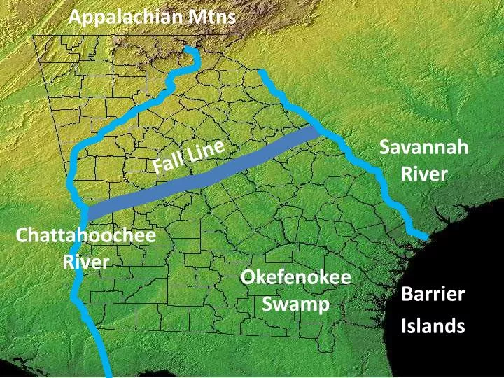
Appalachian Mtns. Savannah River. Fall Line. Chattahoochee River. Okefenokee Swamp. Barrier Islands. What and where is the FALL LINE?.

E N D
Appalachian Mtns Savannah River Fall Line Chattahoochee River Okefenokee Swamp Barrier Islands
What and where is the FALL LINE? The fall line is a natural boundary that separates the Piedmont and the Coastal Plain regions. Due to the drop off of the hilly Piedmont region into the flat Coastal Plain, the waterfalls found on the fall line caused many rivers in the area to be difficult to navigate.
What and where is the FALL LINE? However, the waterfalls did offer sources of water power and many mills were located on the fall line. In addition, many of Georgia’s most important cities such as Columbus, Macon, and Augusta were located on the fall line due to their location as the last navigable upstream points in the state.
THE FALL LINE’S MOST IMPORTANT RESOURCE Kaolin is one of Georgia's largest natural resources. According to the U.S. Geological Survey, more than 8 million metric tons of kaolin are mined from Georgia each year, with an estimated value of more than $1 billion. Georgia is by far the leading clay-producing state in America and is recognized as a world leader in the mining, production, processing, and application of kaolin products. Kaolin in Georgia is generally found in a northeast to southwest band of deposits extending from Augusta to Macon to Columbus. This belt parallels the fall line, which marks the boundary between the Piedmont and the Coastal Plain. Kaolin is most commonly used in the paper-coating industry. It is also used as a filler (added to plastics, for example, and rubber compounds), as a pigment additive in paints, in ceramics (tile, chinaware, and bathroom toilets and sinks), and in pharmaceuticals such as toothpaste. - New Georgia Encyclopedia
What and where is the OKEFENOKEE SWAMP? The Okefenokee Swamp covers 700 square miles and is the largest swamp in North America. Located in southeastern Georgia, the swamp can be found in four Georgia counties. Native Americans lived in the swamp dating back to the Archaic period. The most famous Indian tribe that lived in the swamp was the Seminole, which fought two wars against the United States in the Okefenokee area.
What and where is the OKEFENOKEE SWAMP? White families began settling in the area in 1805. From 1910 until 1937, before Franklin Roosevelt established 80% of the Okefenokee as a wildlife refuge, the swamp was a major source of timber. Now, protected by the federal government, over hundreds of animal species live in the area, the most well known being the American alligator.
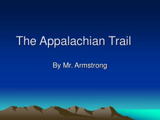
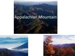
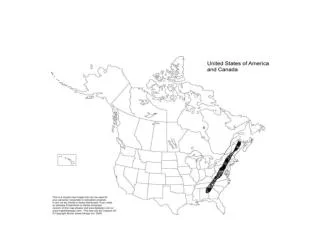
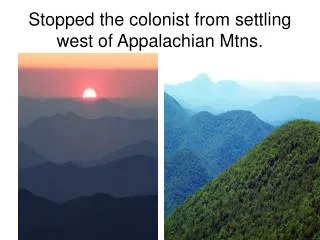
What and where are the APPALACHIAN MOUNTAINS? The southernmost point of the Appalachian Mountains is located in Georgia. Georgia’s highest peaks are in the Appalachian Mountain ranges and they can be found in the three mountain regions. In the southern states these mountains are often called the Blue Ridge due to the blue haze that appears around their peaks.
What and where are the APPALACHIAN MOUNTAINS? Long ago, the Appalachians were some of the tallest mountains in the world, though millions of years of erosion have weathered them tremendously. Today the highest peak in Georgia is Brasstown Bald, which has an elevation of over 4700 feet above sea level. In comparison, the highest peak in the continental United States is Mt. Whitney which is almost 14,500 feet.
What and where is the CHATTAHOOCHEE RIVER? The Chattahoochee River begins it journey to the Gulf of Mexico in the Blue Ridge Region of the state and forms part of the border between Alabama and Georgia. Native Americans long used the river as a food and water source, as did Georgia’s European settlers. Due to the Fall Line the Chattahoochee becomes difficult to navigate between the Piedmont and Coastal Plain regions, though river traffic was important during the 1800s from the Gulf of Mexico to the city of Columbus.
What and where is the CHATTAHOOCHEE RIVER? Today, the Chattahoochee is used primarily as a water source for the millions of Georgians living in the Piedmont area, though the river is also used for industry and recreation as well. Note: The states of Florida and Alabama have sued Georgia due to its unrestricted rights over the use of the river. Should Georgia be allowed to have unrestricted rights to the river? Which Social Studies Concepts apply to this issue?
What and where is the SAVANNAH RIVER? • The Savannah River forms the border between Georgia and South Carolina. One of Georgia’s longest waterways, the Savannah River begins in Hart County, forms Lake Hartwell, and then flows to the Atlantic Ocean. The river has been a source of water, food, and transportation for thousands of years. Paleo Indians lived around the river and Spanish explorer Hernando De Soto was the first European to cross it.
What and where is the SAVANNAH RIVER? James Oglethorpe chose a site 18 miles upriver to create Georgia’s first city, Savannah. Today, the river is navigable for over 200 miles between the city of Savannah and Augusta. In addition to shipping, the river is used as a major source of drinking water for Savannah and Augusta, to cool two nuclear power plants in South Carolina, and to generate hydroelectric power.
What and where are the BARRIER ISLANDS? The Barrier Islands, also known as the Sea Islands or Golden Isles, are a chain of sandy islands off the coastline of Georgia. These islands protect the mainland from wind and water erosion. There are 14 Barrier Islands off Georgia’s coast including Tybee, St. Simons, Jekyll, and Cumberland. Some of the islands, such as Cumberland, are wild life refuges and are national or state parks. Others, like St. Simons, have been developed and three (Little Cumberland, Little St. Simons, and St. Catherine’s) are still privately owned.
What and where are the BARRIER ISLANDS? People have lived on these islands for thousands of years. Indians lived on them and in the 1500s the Spanish set up missions there. During the Colonial and Antebellum periods, plantations were set up on the island to grow products such as rice and indigo. Today, the islands are mainly tourist and recreation destinations though the fishing and paper industries are still important economic enterprises.
GEORGIA’S CLIMATE Georgia has a humid subtropical climate with hot summers and mild winters, though the mountainous areas tend to be cooler than that of the rest of the state. Georgia usually has a large amount of precipitation throughout the year and ranges from 45 to 75 inches per year depending on the area, but receives very little snow fall. Georgia is prone to tornadoes and often feels the effects of hurricanes, though the state has not been hit directly since 1898.
GEORGIA’S CLIMATE Georgia’s warm, wet, climate has made it an ideal location for agriculture. From its beginning Georgia was established for growing crops, and James Oglethorpe and the rest of the trustees hoped its climate would allow for the cultivation of rice, indigo, wine and silk. Though wine and silk proved to be unsuccessful, rice and indigo grew well in Georgia. When slavery was legalized in the colony, Georgia developed the plantation based agriculture of the rest of the South. Slavery became more entrenched when Eli Whitney invented the cotton gin in 1793, in turn causing the demand for cotton production to increase.
GEORGIA’S CLIMATE After the Civil War, Georgia remained predominately an agricultural state until the 20th century. During this time period most of Georgia’s population was involved in agriculture, primarily working as sharecroppers or tenant farmers. Today, while most Georgians are not involved in agriculture, it is still Georgia’s number one industry. In addition, Georgia’s relatively mild climate has brought many people and businesses to the state, making it the 9th most populous in the nation.