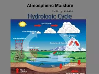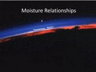
Moisture
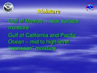
Moisture. Gulf of Mexico – near surface moisture Gulf of California and Pacific Ocean – mid to high level “monsoon” moisture. Cold Front cold air undercuts warm air Warm Front warm air overruns cold air Stationary Front a stalled front Dry Line dry air undercuts moist air

Moisture
E N D
Presentation Transcript
Moisture Gulf of Mexico – near surface moisture Gulf of California and Pacific Ocean – mid to high level “monsoon” moisture
Cold Frontcold air undercuts warm air Warm Frontwarm air overruns cold air Stationary Fronta stalled front Dry Linedry air undercuts moist air Low Pressure Areasdraws air in and lifts it Thunderstorm Outflowcold air flowing out from astorm undercuts warm air Lifting mechanisms Hills / Mountains
Upper-level disturbance and jet streak draws air skyward. Upper Level Disturbance L
Buoyancy The tendency or capacity to remain afloat in a liquid or rise in the air. The upward force that a fluid exerts on an object less dense than itself.
BuoyancyWhy storms DON’T form on some warm and humid days In cloud temps Environmental temps
20,000 ft 0F 15,000 ft 25F 10,000 ft 40F 5,000 ft 62F 0 ft 85F 9 27 45 63 Buoyancy A cloud forms…so the parcel will cool more slowly at a rate of 3.5F/1000 Feet. At 3000 Feet Parcel Temp drops to 70F . 5F / 1000 Ft
Buoyancy In cloud temps Environmental temps
Weather Radar VIL VIL – Vertically Integrated Liquid. (KG/M2) VIL = 63 VIL is a measure of the updraft strength and a good hail indicator.
Weather Radar VIL VIL – Vertically Integrated Liquid. (KG/M2) VIL is a measure of the updraft strength and a good hail indicator.
Mid- and Long-distance cloud features Courtesy Evan Bookbinder
Single Cell Cluster Squall Line Supercell Thunderstorm Spectrum Short-Lived Severe Pulse Severe Rotating Updraft
- Weak winds aloft. - Very buoyant air can result in strong, nearly vertical updrafts. - As the downdraft overwhelms the updraft (falls through the updraft), ONLY a short period of rain, wind, and possible hail occurs. “Pulse” storms
Initial Later Finally “Pulse” stormupdraft sequence Storm is initially dominated by the updraft, Then after a short time...the downdraft overwhelms (falls through) the updraft
Shelf clouds occur on the edge of the updraft- downdraft interface Shelf clouds slope down AWAY from the rain When you see a shelf cloud, think strong winds Squall line – shelf clouds
Formed by 2 different air-masses interacting Shelf cloud Cool Outflow
Often turbulent with small scale twisting and curling motions in clouds. • - Motion is neither organized nor persistent. • - Scud clouds may form and dissipate rapidly. “Accessory” Clouds
Bow Echoes / Squall Line As winds aloft accelerate toward the ground the squall line bows forward. A bow echo is a radar signature strongly suggesting wind damage.
End of Part Two Click the “Back” button in your browser to exit the slide show.