Download
1 / 21
210 likes | 334 Views
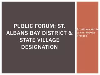
Public Forum: St. Albans Bay District & State Village Designation. St. Albans Guide to the Rewrite Process. Agenda. Overview of Zoning Bylaws Update Process Proposed St . Albans Bay District VT State “Village Center” Designation Discussion Next Steps Adjournment.

E N D
Public Forum: St. Albans Bay District & State Village Designation St. Albans Guide to the Rewrite Process
Agenda • Overview of Zoning Bylaws Update Process • Proposed St. Albans Bay District • VT State “Village Center” Designation • Discussion • Next Steps • Adjournment
Zoning & Subdivision Regulations St. Albans Guide to the Rewrite Process
What is Zoning? • Zoning is the most common way in which municipalities regulate the land uses and physical development • Districts: Division of Uses • Minimum Lot Sizes • Setbacks • Minimum Frontage • Maximum Height • Maximum building and lot coverage • These Regulations are codified in our zoning bylaws
Zoning Districts: Division of Uses • What you can build depends on where—or in what ‘zone’—your property is. • The Town uses zoning to group land into different districts, or zones, with rules about what you can build in each • St. Albans Zoning Districts: • Rural • Residential • Residential Commercial • Light Industrial • Heavy Industrial • Conservation • Lakeshore
Each Zoning district has permitted, conditional and prohibited uses Permitted Conditional & prohibited Uses
Minimum lot Sizes Lot size is calculated by multiplying the lot width by lot depth.
FY – Front Yard Setback RY – Rear Yard Setback SY – Side Yard Setback SetBacks The horizontal distance from a structure to the property line
Maximum Height Height Height Ground
St. Albans Bay Current Use + Zoning
Existing Zoning: A tale of Two Zones Commercial/Residential Residential
Existing Conditions • There are 146 parcels in the Bay area, 39 Parcels in Commercial/Residential and 108 in the Residential District • Median parcel size is .875 acres • 33% of all parcels are less than ½ acre • 26% of all parcels are less ½ - 1 acre • 18% of all parcels are 1 – 2 acres • 14% of all parcels are 2 – 5 acres • 10 % are over 10 acres*+ *Less than 1% of parcels are 5-10 acres + Percentages may not add up to 100% because of rounding
Town Plan: Bay District Zoning “A new Zoning District called St. Albans Bay Village Center located in the traditional village center of St Albans Bay is proposed. This will accommodate mixed-use development and commercial waterfront development, including marinas.” • Purpose- The purpose of the St Albans Bay Area District is to allow for new residential and commercial development that maintains the historic village character of this area. • Future Planning - The St. Albans Bay Area District shall be a new Zoning District that would allow the Town of St. Albans to develop distinct regulations to support the role of St. Albans Bay as a location for social and economic activities. Residential/Commercial District designation may also be an appropriate designation for this area rather than a distinct new district. The Town should consider State of Vermont designation of a Village Center for this area so that additional incentives are available to landowners in the district. The bounds of this area and the scope of uses need to be determined and formulated as an amendment to the Town Plan and Zoning Bylaws and Subdivision Regulations”
“Village center” means the core of a traditional settlement, typically comprised of a cohesive mix of residential, civic, religious, commercial, and mixed use buildings, arranged along a main street and intersecting streets that are within walking distance for residents who live within and surrounding the core. Village centers are typically smaller in scale than downtowns and are characterized by a development pattern that is consistent with smart growth principles.
Village Designation Benefits 10% HISTORIC TAX CREDITS • Available as an add-on to approved Federal Historic Tax Credit projects. • Eligible costs include interior and exterior improvements, code compliance, plumbing and electrical upgrades. 25% FACADE IMPROVEMENT TAX CREDITS • Eligible facade work up to $25,000. 50% CODE IMPROVEMENT TAX CREDITS • Available for up to $50,000 each for elevators and sprinkler systems and $12,000 for lifts. • Eligible code work includes ADA modifications, electrical or plumbing up to $25,000. PRIORITY CONSIDERATION FOR HUD, CDBG AND MUNICIPAL PLANNING GRANTS • Priority consideration for Municipal Planning Grants and funding from Vermont’s Community Development Program. PRIORITY CONSIDERATION BY STATE BUILDING AND GENERAL SERVICES (BGS) • Priority site consideration by the State Building and General Services (BGS) when leasing or constructing buildings. SPECIAL ASSESSMENT DISTRICTS • May create a special assessment district (also known as special benefits district or business improvement district) to raise funds for both operating costs and capital expenses to support specific projects in downtown.