Download
1 / 64
640 likes | 664 Views
This overview delves into the significance of coastal waters, ocean ownership, United Nations laws, and characteristics of coastal waters. Estuaries and human activities are discussed, along with the importance of coastal wetlands in cleansing water and protecting shores.

E N D
Overview • Coastal waters support about 95% of total biomass in ocean • Most commercial fish caught within 320 km (200 m) from shore • Important also for shipping, oil and gas production, and recreation • Many pollutants found here http://www.safmc.net/Portals/0/shrimp%20trawler2.jpg
Ocean ownership • 1609 sea is free to all (mare liberum) • Assumed fish resources are inexhaustible • 1702 territorial sea under coastal nation’s sovereignty (3 nautical miles from shore) • Distance of cannon shot Fort Sumter, Charleston harbor, South Carolina http://www.kid-friendly-family-vacations.com/image-files/fort_sumter.jpg
United Nations and ocean laws • 1958-1982 United Nations Law of the Sea Conferences • National sovereignty extends 12 nautical miles • Exclusive Economic Zone (EEZ) 200 nautical miles (370 km) from land (mineral and fishing resources) • Right of free passage for ships • Open ocean mining regulated by International Seabed Authority • United Nations arbitrates disputes http://upload.wikimedia.org/wikipedia/commons/thumb/7/7d/Zonmar-en.svg/300px-Zonmar-en.svg.png
EEZ of the U.S.--about 30% more than land area of entire U.S. Fig. 11.1
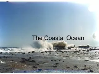
Characteristics of coastal waters • Adjacent to land (to edge of continental shelf) • Influenced by river runoff, wind, tides • Salinity variable • Freshwater runoff • Winds • Mixing by tides http://upload.wikimedia.org/wikipedia/commons/5/58/Outer_Continental_Shelf_map.png
Characteristics of coastal waters • Temperature variable • Low-latitudes: restricted circulation, very warm • High-latitudes: sea ice • Mid-latitudes • Seasonal changes • Prevailing winds
Temperature characteristics Fig. 11.3
Salinity characteristics Fig. 11.2
Coastal geostrophic currents • Wind and runoff • Piled up surface water affected by Coriolis effect and friction • Flow parallel to coast • Davidson Current on Pacific coast • Labrador current on Atlantic coast http://content.answers.com/main/content/wp/en/thumb/1/16/500px-LabradorCurrentus-coastguard.jpg
Fig. 11.4 http://content.answers.com/main/content/wp/en/thumb/1/16/500px-LabradorCurrentus-coastguard.jpg
Types of coastal waters • Estuary • Partially enclosed coastal area with ocean water and freshwater (runoff) mixing • Coastal wetland • Ecosystem with water table close to surface • Lagoon • Shallow coastal water separated from ocean • Marginal sea • Relatively large semi-isolated body of water
Origin of estuaries Chesapeake Bay • Rising sea level “drowns” what was once land • Coastal plain estuary • Former river valley now flooded with seawater • Fjord • Former glaciated valley now flooded with seawater • Bar-built estuary • Lagoon separated from ocean by sand bar or barrier island • Tectonic estuary • Faulted or folded down-dropped area now flooded with ocean Glacier Bay Indian River San Francisco Bay
Origin of estuaries Chesapeake Bay Glacier Bay Indian River Lagoon San Francisco Bay
Classification of estuaries Based on mixing of freshwater and saltwater • Vertically mixed • Shallow, low volume • Slightly stratified • Deeper • Upper layer less salty; lower layer more salty • Estuarine circulation
Classification of estuaries • Highly stratified • Deep, relatively strong halocline • Salt wedge • Deep, high volume • Strong halocline
Classification of estuaries Fig. 11.7
Estuaries and human activities • Important breeding grounds for many marine animals • Protective nurseries • Pressures from increasing human populations • Columbia River estuary (salt wedge) • Damages due to dams, logging http://www.awalkinthewoods.us/Image15.gif
Indian River Lagoon Estuary • Well-mixed due to winds and shallow depths • Seasonal changes in salinity, temperature, dissolved oxygen • Most biologically diverse estuary in north america…over 4,000 species of plants and animals • Threats: habitat destruction, stormwater runoff, and invasive exotic species http://www.sms.si.edu/irLspec/images/IRL_subbas.jpg
Chesapeake Bay Estuary • Slightly stratified • Seasonal changes in salinity, temperature, dissolved oxygen • Anoxic conditions below pycnocline in summer • Major kills of commercially important marine animals Fig. 11.9a
Types of coastal wetlands • Ecosystems that are saturated with water • Swamps, tidal flats, coastal marshes, bayous • Salt marsh • Any latitude • Mangroves • Low latitude
Characteristics of coastal wetlands • Biologically important • Nurseries, feeding grounds for commercially important marine animals http://www.tpwd.state.tx.us/learning/resources/publications/images/wetlands600.jpg
Characteristics of coastal wetlands • Efficiently cleanse polluted water • Absorb water from coastal flooding • Protect shores from wave erosion Coastal wetlands of Louisiana http://soundwaves.usgs.gov/2008/03/WetlandLG.jpg
Loss of coastal wetlands • Half of U.S. coastal wetlands lost to development (housing, industry, agriculture) • U.S. Office of Wetland Protection, 1986 • Minimize loss of wetlands • Protect or restore wetlands http://www.on.ec.gc.ca/wildlife/factsheets/images/glfs-coast-stress.jpg
http://www.on.ec.gc.ca/wildlife/factsheets/images/glfs-coast-stress.jpghttp://www.on.ec.gc.ca/wildlife/factsheets/images/glfs-coast-stress.jpg
Predicted rise in sea level over next 100 years will destroy or shift wetlands inland http://pubs.usgs.gov/circ/circ1316/html/images/fig12_1.gif
Lagoons • Freshwater zone • Transition zone of brackish water • Saltwater zone • Hypersaline in arid regions Fig. 11.12
Marginal seas • Mostly from tectonic events • Ocean crust between continents, e.g., Mediterranean Sea • Behind volcanic island arcs, e.g., Caribbean Sea • Shallower than ocean • Connected to ocean http://www.shinesforall.com/images/Caribbeanmap.gif
Caribbean Sea • On Caribbean plate defined by Greater and Lesser Antilles – volcanic island arc • Relatively shallow marginal sea – deepest is Cancun Trough at 7,686 m (25,220 ft) • Underlain by oceanic crust http://www.kwabs.com/bathacarib.gif http://woodshole.er.usgs.gov/project-pages/caribbean/images/PBATHY1.GIF
Caribbean circulation • Atlantic Ocean surface flow • Waters move though Lesser Antilles • Move into Gulf of Mexico Florida current between Florida and Cuba (Florida Straits) • merges with Gulfstream http://www.1yachtua.com/caribbean_sailing/caribbean_sailing_maps/carribean_sea_current_map.gif
Mediterranean Sea • Remnant of Tethys Sea • Deeper than usual marginal sea • Underlain by oceanic crust • Thick salt deposits Fig. 11.14a
Mediterranean circulation Fig. 11.14b • High rates of evaporation • Mediterranean Intermediate Water very salty • Returns to Atlantic Ocean as subsurface flow • Circulation opposite to estuarine circulation
http://www.motherjones.com/news/featurex/2006/03/marine_pollution_580x280.gifhttp://www.motherjones.com/news/featurex/2006/03/marine_pollution_580x280.gif Marine pollution • Any harmful substance or energy put into the oceans by humans • Harmful to living organisms • Standard laboratory bioassay – concentration of pollutant that causes 50% mortality among test organisms • Hindrance to marine activities (e.g., fishing) • Reduction in quality of sea water http://gcaptain.com/maritime/blog/wp-content/uploads/2007/10/marpol-chart.png
http://www.motherjones.com/news/featurex/2006/03/marine_pollution_580x280.gifhttp://www.motherjones.com/news/featurex/2006/03/marine_pollution_580x280.gif http://gcaptain.com/maritime/blog/wp-content/uploads/2007/10/marpol-chart.png
http://www.bluepeacemaldives.org/blog/wp-content/uploads/2008/02/aerial.jpghttp://www.bluepeacemaldives.org/blog/wp-content/uploads/2008/02/aerial.jpg Waste disposal in ocean • Diluting pollutants with huge volume of ocean water • Long-term effects not known • Debate about dumping wastes in ocean • None at all • Some, as long as properly disposed and monitored Male’ in the Maldives, Indian Ocean http://www.bluepeacemaldives.org/blog/?cat=8
Main types of marine pollution • Petroleum • Sewage sludge • DDTs and PCBs • Mercury • Non-point-source pollution and trash http://www.fao.org/docrep/W8440e/W8440e07.GIF
Petroleum Fig. 11.15t • Oil spills due to accidents in transport • Blowout of undersea oil wells • Example, Ixtoc #1, Gulf of Mexico, 1979 http://www.marinebuzz.com/marinebuzzuploads/SuperAbsorbentImbiberBeadstocontainOilan_9C27/image1.png
Petroleum • Biodegradable hydrocarbons • Recovery faster than expected • Exxon Valdez oil spill, 1989 • But many organisms killed outright • Long-term consequences uncertain Fig. 11.16
Oil spills in U.S. • Florida, Massachusetts, 1969 • Barge spilled 189,000 gallons of #2 fuel oil • Sharp reduction in species diversity in tidal flat areas • Recovery in 3-5 years • Still oil in subsurface sediments (15 cm or 6 in) Fig. 11.19
http://rpitt.eng.ua.edu/Class/EffectsandFates/Module7/Module7_files/image004.jpghttp://rpitt.eng.ua.edu/Class/EffectsandFates/Module7/Module7_files/image004.jpg Oil spills in U.S. • Argo Merchant, Nantucket, 1976 • No oil on shore • Mainly plankton damaged The ARGO MERCHANT ran aground on Nantucket Shoals, 29 nautical miles southeast of Nantucket Island, Mass. in high winds and ten foot seas. On December 21, the ARGO MERCHANT broke apart and spilled its entire cargo of 7.7 million gallons of No. 6 fuel oil. Fig. 11.20a
Cleaning oil spills • Natural processes • Volatilization • Photo oxidation • Emulsification • Biodegration by pelagic organisms • Biodegration by benthic organisms
Cleaning oil spills Fig. 11.22
http://www.marinebuzz.com/marinebuzzuploads/OilSpillbyOffshorePlatformStatfjordAinNo_C420/oil_boom.jpghttp://www.marinebuzz.com/marinebuzzuploads/OilSpillbyOffshorePlatformStatfjordAinNo_C420/oil_boom.jpg Cleaning oil spills • Artificial processes • Isolate spill with booms • Skimming or absorbing surface oil slick • Bioremediation by “hydrocarbon-eating” bacteria http://www.jamstec.go.jp/jamstec/bio2.gif http://www.en-dk.dk/uploads/pics/ro-clean_skimmer.jpg