Download
1 / 18
190 likes | 219 Views
Dive into the world of geography with this interactive chapter, understanding maps, globes, and their vital roles in identifying locations, features, and more. Learn about different types of maps and how they can be utilized for various purposes.

E N D
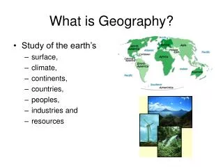
What is Geography? KCCT Coach: Chapter 12 Amanda McGinnis Campbell Ridge Elementary
Please select a Team. • Lucky Leprechauns • Fighting Clowns • Classy Clowns • Perky Penguins • Pie Throwers
Uses of Geography • a MAP is a representation on paper of some physical location • Can you think locations that may have a map? • a GLOBE is a special kind of map of the world—it is a sphere…an accurate small scale model of Earth
Uses of Geography cont. • Maps and globes are used to identify a LOCATION…the place where something is • Maps and globes are designed to SCALE • To SCALE means that if you shrunk down the world to the exact size of a globe, the locations on the globe would exactly match the locations on Earth
Types of Maps • PHYSICAL MAPS focus on physical features such as rivers, mountains, plains, etc. It is used to identify land masses and waterways
Types of Maps • POLITICAL MAPS identify political borders (countries and states). They are used to identify countries, states, and cities
Types of Maps • THEMATIC MAPS identify locations based on a theme, like “oil producing nations” or They are used to identify locations based on traits.
Other items used to identify location: • CHARTS are a type of outline map. They are used to identify and track a particular characteristic, such as variations in climate (where the regions go over political borders)
Other items used to identify location: • PHOTOGRAPHS and AERIAL PHOTOGRAPHS (photos from the sky) can also identify location. How would this be used?
Other items used to identify location: • GRAPHS can also give information about location, but they usually do not show what a location looks like. they can show change over time—maps and charts cannot.
Which type of map would you use to locate the Rocky Mountains? • political • physical • thematic • chart
What type of map would identify locations where oil reserves are located? • political • physical • thematic • chart
What is this? • chart • graph • political map • aerial photo
If you wanted to show how the amount of snowfall in your state varies from month to month, which of the following would you create? • chart • graph • physical map • thematic map