Download
1 / 8
90 likes | 243 Views
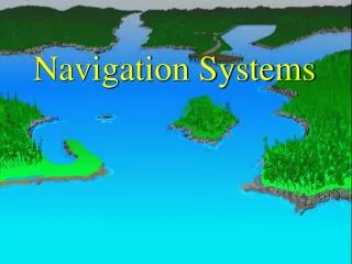
Navigation Systems for Lunar Landing. Ian J. Gravseth Ball Aerospace and Technologies Corp. March 5 th , 2007. Lunar Landing Problem Overview. What is needed Navigate to the correct area Need to know position and orientation relative to the landing site Measure altitude and velocity

E N D
Navigation Systems for Lunar Landing Ian J. Gravseth Ball Aerospace and Technologies Corp. March 5th, 2007
Lunar Landing Problem Overview • What is needed • Navigate to the correct area • Need to know position and orientation relative to the landing site • Measure altitude and velocity • Identify Hazards in relative space • Land Safely • Avoid Hazards (Steep Slopes, Rocks, Holes, other structures, etc.) • Land with acceptable velocities • Precision Landing • Some landers require < 10 m final targeting error • Landing sites are more challenging than Apollo-era sites • High contrast lighting for final approach • Worse than no natural lighting • Rougher terrain • A robust sensor or set of sensors are needed for a high reliability landing system • Notional sensors include an altimeter, a velocimeter, a terrain relative navigation sensor, and a hazard relative navigation sensor
Flash Lidar • Pros • Sensor provides all required data types • Altimetry • Velocimetry • Terrain relative navigation • Hazard detection • Precision navigation when close to the surface • Low mass, power and volume • System produces direct range measurements • The sensor provides 256 x 256 pixels, each with X, Y, Z, intensity and quality at 30 Hz. • Real time processing • Light insensitive • Self-correlated images are provided • Self-contained navigation algorithms are available • Cons • No flight heritage • TRL of the system may be advanced through other space based Lidar applications • Lower number of pixels than an optical camera Lidar FOV LaserBeam Flip-away Scanner
Visual Cameras • Pros • Cameras are low mass, power and volume • Descent cameras have previous flight heritage (DIMES, etc.) • Provides estimates of horizontal position and velocity • High resolution image data • Cons • Cameras require good lighting conditions • May not work in scientifically interesting landing sites or in high contrast regions • Existing algorithms require an altitude estimate • Doesn’t provide direct 3D image data 2D image locations 3D map locations Images courtesy of JPL
Radars • Pros • Sensor functions during any lighting conditions • Very accurate range and velocity measurements • Flight Heritage • Used on all Mars Landers • Cons • Large mass, volume and power • Hazard measurements with a phased array system are available, but are very constrained • Configuration, mass issues, resolution issues • Radars don’t generally perform well when they are close to landing
Scanning Lidar • Pros • Sensor provides all required data types • Flight heritage for space missions • Cons • Challenging alignment tolerances • Unequal sampling distance during a scan • Higher power and mass than a flash system • Stitching data together in real time or faster required for use of data • Vehicle motion will distort the images • ~20% of the maximum ranging capability relative to a flash system • Significantly larger mass and power than a flash Lidar
Geiger Counters (Kaktus Gamma Ray Altimeter) • Pros • Only altimeter option that is currently in use for this same problem (re-entry and landing of people on the Earth’s surface) • Extensive heritage • Radio source is always “on”, does not require power • Cons • Ground roughness can affect accuracy because the intensity of the reflected gamma-quantum flow is averaged over the entire diameter of the circle • Russian technology-politics, ITAR, contract with Energia • Radioactive source • Limited range of operation • Altitude and potentially velocity only Images courtesy of JPL
Landing Sensor Summary • Active • Flash Lidar • Scanning Lidar • Radar • Geiger counter • Passive • Optical Sensors Flash Lidar is the most attractive sensor for Lunar Landing