Download
1 / 23
240 likes | 263 Views
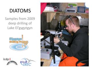
Discover the basic hydrology, limnology, and climatology of the El’gygytgyn Crater region through a detailed physical overview including digital elevation models, stream statistics, imagery, bathymetry, and weather data. Gain insights into Lake El’gygytgyn's unique features and understand its complex dynamics. This study provides valuable information for researchers and environmental enthusiasts.

E N D
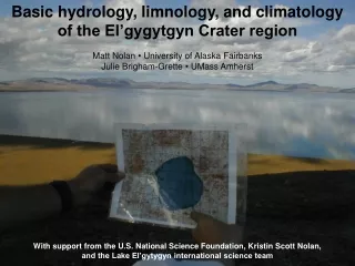
Basic hydrology, limnology, and climatology of the El’gygytgyn Crater region Matt Nolan • University of Alaska Fairbanks Julie Brigham-Grette • UMass Amherst With support from the U.S. National Science Foundation, Kristin Scott Nolan, and the Lake El’gytygyn international science team
Physical Overview of Lake El’gygytgyn AreaDigital Elevation Model N The Bears Back 1998 Core Walrus Snout Point Snout Bay Buckle Point Outlet We created a digital elevation model of the region which can be used in a variety of terrestrial studies. The crater is roughly 18 km in diameter with a watershed area of 293 km2 and lake area of 110 km2.
Physical Overview of Lake El’gygytgyn AreaDigital Elevation Model Roughly 50 streams enter the lake and basic physical statistics were compiled on them using this DEM. This local stream numbering system should be adopted by researchers here to facilitate collaborations and minimize confusion. Coordinates exist for all outlets.
Physical Overview of Lake El’gygytgyn AreaImagery Water tracks Submarine delta formation We purchased Ikonos imagery of the crater region in 2001. This imagery was used to make a variety of 3D visualizations and is useful for a variety of terrestrial studies.
Physical Overview of Lake El’gygytgyn AreaBathymetry Using bathymetry from Russian sources (which seems quite accurate), we calculated lake volume and hypsometries. The lake contains roughly 14 km3 of water. Though 175 meters seems deep, it is actually shallow compared to its 12 km width.
Physical Overview of Lake El’gygytgyn AreaWeather A weather station was established in July 2000, and is presumably still running (if it hasn’t been shot again). This station records air temperature, relative humidity, barometric pressure, wind speed and direction, rainfall, snow pack, solar radiation balance, and soil moisture.
Physical Overview of Lake El’gygytgyn AreaWeather August 31 September 1 Enough said about how quickly the weather can change?
Physical Overview of Lake El’gygytgyn AreaWeather Bedrock Prograding stream sediments Locally measured wind directions indicate a dominant trend. We hypothesize that this trend leads to water currents which work in concert with the stream delta formation on the western shore to create the unique shape of the lake.
Physical Overview of Lake El’gygytgyn AreaWeather Crater rim and center Bedrock Prograding stream sediments Locally measured wind directions indicate a dominant trend. We hypothesize that this trend leads to water currents which work in concert with the stream delta formation on the western shore to create the unique shape of the lake. That is, the center of the crater is not directly beneath the center of the lake.
Physical Overview of Lake El’gygytgyn AreaLake Ice Dynamics and Water Mixing Thermistor strings located in the deepest part of the lake indicate a textbook pattern of temperature stratification in winter and complete mixing in summer. We did not detect any thermocline in summer, likely due to constant winds stirring up the water in this wide, thin lake.
Physical Overview of Lake El’gygytgyn AreaWeather Locally measured air temperature compares quite well with the NCEP global reanalysis model output for this area, indicating that the NCEP model (running from 1948 to present) can be used as a reliable proxy for real measurements when needed.
Physical Overview of Lake El’gygytgyn AreaWeather Given this good correlation, the NCEP data can also be used to help understand the dominant storm tracks and climate trends here, which is something I plan to do in the near future, using tools like Hysplit and self-organized SLP maps as seen here.
Physical Overview of Lake El’gygytgyn AreaWeather The NCEP reanalysis (1948-2002) is used to create give a sense of typical air temperature conditions throughout the year. March and April will no doubt be the most comfortable and productive times for winter drilling.
Physical Overview of Lake El’gygytgyn AreaWeather The NCEP reanalysis indicates that the region is currently undergoing a warming trend. This warming trend is being driven by winters with fewer extreme low temperatures, which is good for winter drilling. It’s still plenty cold enough to make thick ice though.
A. 17 Sep 99 B. 26 Aug 99 C. 22 Oct 99 D. 01 Nov 99 E. 08 Nov 99 F. 25 Nov 99 H. 26 Dec 99 G. 02 Dec 99 I. 12 Jan 00 J. 05 Feb 00 K. 01 Nov 99 L. 05 Feb 00 M. 11 Nov 00 O. 19 Mar 01 N. 11 Nov 00 N. 19 Mar 01 P. 21 Mar 01 Physical Overview of Lake El’gygytgyn AreaLake Ice Dynamics and Water Mixing We used space-borne SAR to track lake ice dynamics, including freeze-up, snowmelt, and breakup. Here, an interesting pattern of lake ice bubbles is seen developing.
Physical Overview of Lake El’gygytgyn AreaLake Ice Dynamics and Water Mixing These bubbles (the bright areas) are likely caused by the respiration and decomposition of living things. Given that the water is less than 3C, it is likely that warm dense water from the shallow shelves sinks to the deepest part of the lake, even in winter, suggesting the deepest area may be biogeochemically different than its surroundings.
A. 17 May 99 B. 18 May 99 C. 8 May 00 D.11 May 00 G. 18 May 00 H. 19 May 00 Physical Overview of Lake El’gygytgyn AreaLake Ice Dynamics and Water Mixing We can determine the onset of snowmelt by the disappearance of the bullseye pattern, because SAR cannot penetrate wet snow.
E. 26 Apr 99 F. 17 May 00 I. 16 June 00: Landsat 7 Physical Overview of Lake El’gygytgyn AreaLake Ice Dynamics and Water Mixing The northern edge of the lake is usually blown free of snow, piling it up deeper to the south (as much as 1.5 meters). Ice melt begins at the edges of the lake, where the shelves are present and surface streams pile up warm water.
A. 08 July 99 D. 05 July 00 C. 11 July 99 Physical Overview of Lake El’gygytgyn AreaLake Ice Dynamics and Water Mixing Lake ice breakup begins with moat formation along the margins. This frees the ice to move with the wind, where it begins getting hung up with the deltas at streams 12-14 (Snout Point and Buckle Point). Once these leads form, large pans are free to rotate and crush, leading to rapid distintigration of the candle ice.
Table 1. Important dates of lake ice dynamics derived from SAR. Winter Onset of Lake Ice Freezing Onset of Lake Ice Snowmelt Onset of Lake Ice Moat Formation Completion of Lake Ice Melt 1997-1998 No Data < 8 July < 8 July 8 July – 9 Aug 1998-1999 > 6 Oct 17 May – 18 May 24 June – 4 July 28 July – 13 Aug 1999-2000 16 Oct – 19 Oct 8 May – 11 May 23 June – 2 July 16 July – 19 July 2000-2001 18 Oct – 20 Oct 14 May - 17 May 20 June – 23 June 13 July – 17 July Physical Overview of Lake El’gygytgyn AreaLake Ice Dynamics and Water Mixing I plan to update this chart and combine it with further modeling as part of new work.
Modeled Ice Thickness NCEP Air Temperature Measured Lake Ice Coverage Modeled Snow Thickness Physical Overview of Lake El’gygytgyn AreaLake Ice Dynamics and Water Mixing We can model lake ice breakup pretty well. As part of new work, I hope to determine the range of condition necessary to maintain a permanent ice cover, as well as model ice sublimation, to determine the conditions necessary for lake levels to drop substantially.
Physical Overview of Lake El’gygytgyn AreaOutreach We have a number of 3D visualizations of the lake online. These give a good sense of the what the crater region is like. You can also find some 360° panoramas there.
Physical Overview of Lake El’gygytgyn AreaOutreach As part of future work, I plan to create several hundred high resolution spherical panoramas of the crater, in different seasons. I’m happy to train others to do this too. Here is a demo of a similar project I am doing in north-eastern Alaska.