Download
1 / 14
140 likes | 269 Views
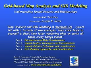
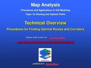
Map Analysis Procedures and Applications in GIS Modeling Topic 19, Routing and Optimal Paths. Technical Overview Procedures for Finding Optimal Routes and Corridors. Online book written by Joseph K. Berry www/innovativegis.com/Basis/MapAnalysis/ published by BASIS Press. Existing Powerline.

E N D
Map AnalysisProcedures and Applications in GIS ModelingTopic 19, Routing and Optimal Paths Technical OverviewProcedures for Finding Optimal Routes and Corridors Online book written byJoseph K. Berrywww/innovativegis.com/Basis/MapAnalysis/published byBASIS Press
Existing Powerline Goal– identify thebest route for an electric transmission linethat considers various criteria for minimizing adverse impacts. Proposed Substation Houses • Criteria – the transmission line route should… • Avoid areas ofhigh housing density …prefer low housing density • Avoid areas that arefar from roads …prefer close to roads • Avoid areaswithin or near sensitive areas …prefer far from sensitive areas • Avoid areas of highvisual exposure to houses …prefer low visual exposure Roads Sensitive Areas Elevation Houses Transmission Line Siting Model (Hypothetical)
PROPOSED SUBSTATION (END) AVOID AREAS OF HIGH HOUSING DENSITY EXISTING POWERLINE (START) (Least preferred) (Most preferred) MOST PREFERRED ROUTE ACCUMULATED PREFERENCE SURFACE Step 3.The steepest downhill path from the Substation over the Accumulated Preference surface identifies the “most preferred route”— Most Preferred Route avoiding areas of high visual exposure HOUSES HOUSING DENSITY DISCRETE PREFERENCE MAP Step 2.Accumulated Preference from the existing powerline to all other locations is generated based on the Discrete Preference map. Step 1.Housing Density levels (0-83 houses) are translated into values indicating relative preference (1= most preferred to 9=least preferred) for siting a transmission line at every location in the project area. Routing and Optimal Paths (avoid high housing density)
Withina single map layer Amonga set of map layers Avoid areas of… “Algorithm” “Calibrate” “Weight” High Housing Density …build on this single factor Far from Roads In or Near Sensitive Areas High Visual Exposure Model logic is captured in a flowchart where the boxes represent maps and lines identify processing steps leading to a spatial solution Siting Model Flowchart (Model Logic)
Withina single map layer Amonga set of map layers “Algorithm” “Calibrate” “Weight” Step 1 Identify overall Discrete Preference(1 Good to 9 Bad rating) End Start Start Step 2 Generate anAccumulated Preferencesurface from the starting location to everywhere End Step 3 Step 2 Step 1 Step 3 Identify theMost Preferred Routefrom the end location Model logic is captured in a flowchart where the boxes represent maps and lines identify processing steps leading to a spatial solution Siting Model Flowchart (Model Logic)
Step 1 Discrete Preference Map …identifies the “relative preference” of locating a route at any location throughout a project area considering all four criteria [avoid areas of High Housing Density, Far from Roads, In/Near Sensitive Areas and High Visual Exposure] Calibrate …then Weight Least Preferred “Mountain” of impedance (avoid) Discrete Preference Map HDensity Most Preferred (most preferred) “Pass” RProximity SAreas VExposure <click hereto download an animated PowerPoint slide set describing calibration and weighting>
Step 2 Accumulated Preference Map …identifies the “total incurred preference” (minimal avoidance) to locate the preferred route from a Starting location to everywhere in the project area Accumulated Preference Map (most preferred) “Pass” (most preferred) “Pass” Splash Algorithm – like tossing a stick into a pond with waves emanating out and accumulating preference as the wave front moves <click hereto download an animated PowerPoint slide set demonstrating Accumulation Surface construction>
Step 3 Most Preferred Route …the steepest downhill path from the End over the accumulated preference surface identifies the optimal route that minimizes traversing areas to avoid (most suitable) Optimal Route (most preferred) “Pass” (most preferred) “Pass” <click hereto download a short video (.avi) describing Optimal Path analysis>
…the accumulation surfaces from the Start to the End locations are added together to create a total accumulation surface—the “valley” is flooded to identify the set of nearly optimal routes (most preferred) “Pass” Optimal Corridor (most preferred) “Pass” Generating Optimal Path Corridors <click here to download an animated PowerPoint slide set demonstrating Optimal Corridor analysis>
Combining alternative corridors identifies the decision space reflecting various perspectives Feature Article in GeoWorld, April, 2004 A Consensus Method Finds Preferred Routing See www.geoplace.com/gw/2004/0404/0404pwr.asp Example Results (Georgia Experience)
1 for 0 to 5 houses …group consensus is that low housing density is most preferred Judgment Fact The Delphi Process is used to achieve consensus among group participants. It is a structured method involving iterative use of anonymous questionnaires and controlled feedback with statistical aggregation of group response. Withina single map layer (criterion) …the “Greens” Calibrating Map Layers (using Delphi) Model calibration refers to establishing a consistent scale from 1 (most preferred)to 9 (least preferred) for rating each map layer…
1) Information on each data layer is presented anddiscussed by the group 2) Each participant identifies their cut-off values 1=good to 9= bad (avoid) 3) Summary statistics are computed and used to stimulate discussion about differences in opinions Delphi Process (Spreadsheet) …structured method involving iterative use of anonymous questionnaires and controlled feedback …the process is repeated until there is “acceptable” consensus on the CALIBRATIONS
…group consensus is that housing density is very important (10.38 times more important than sensitive areas) HD * 10.38 R * 3.23 SA * 1.00 VE * 10.64 Amonga set of map layers (criteria)…the “Blues” Weighting Map Layers (using AHP) Model weighting establishes the relative importance among map layers (model criteria) on a multiplicative scale… The Analytical Hierarchy Process (AHP) establishes relative importance among by mathematically summarizing paired comparisons of map layers’ importance.
GIS-based approaches for siting electric transmission lines utilize relative ratings (calibration) and relative importance (weights)in considering factors affecting potential routes. A quantitative process for establishing objective and consistent weights is critical in developing a robust and defendable transmission line siting methodology. Objective, Quantitative, Predictable, Consistent, Defensible Conclusion (Technical Overview) References: See www.innovativegis.com/basis, select , online book Map Analysis, Topic 19 “Routing and Optimal Paths” See www.innovativegis.com/basis, select Column Supplements, Beyond Mapping, September 03, Delphi See www.innovativegis.com/basis, select Column Supplements, Beyond Mapping, September 03, AHP See www.geoplace.com/gw/2004/0404/0404pwr.asp, Feature Article in GeoWorld, April, 2004 “A Consensus Method Finds Preferred Routing” (Georgia Experience)