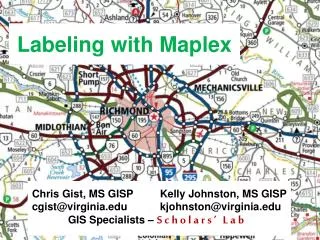
Creating Great Labels Using Maplex
July 11 – 15, 2011. Creating Great Labels Using Maplex. Craig Williams Natalie Vines. Presentation Overview. What are the types of text in ArcGIS? Labeling vs. Annotation The role of Maplex for ArcGIS Maplex position properties Demo - street labeling Maplex fitting strategies


Creating Great Labels Using Maplex
E N D
Presentation Transcript
July 11–15, 2011 Creating Great Labels Using Maplex Craig Williams NatalieVines
Presentation Overview • What are the types of text in ArcGIS? • Labeling vs. Annotation • The role of Maplex for ArcGIS • Maplex position properties • Demo - street labeling • Maplex fitting strategies • Maplex conflict resolution properties • Demo - Maximizing text placement • Annotation • Summary • Questions
What Are The Types Of Text in ArcGIS? • What are Labels? • Dynamically placed text by a label engine • Map refresh generates new text locations • Placed text can be “locked” after placement • What is Annotation? • Stored • Geodatabase • Map document • Editable
Labels to Annotation Cycle Geodatabase annotation editing tools Convert to annotation ESRI Label Engines Maplex Label Engine Labelmaps Standard Label Engine Digitalmaps A
Labeling In ArcMap • Unified user experience • Labeling toolbar • Label Manager • Feature weights • Label priorities • Lock labels, view unplaced labels • Integration of Maplex for ArcGIS • Plugs in to standard tools • Uses ArcGIS text symbol • Uses standard label expression and label class organization
Maplex For ArcGIS • Advanced high-quality cartographic text placement engine • Fully integrated with ArcGIS • Shared tools • Full annotation support • Numerous placement options • End goal of reducing map production time and costs • Included with ArcInfo, optional extension for ArcEditor and ArcView licenses • Read-only mode for maps without a Maplex license • Available with server map services, but recommended for caching only
Quality placement for Maplex for ArcGIS Common tools for both label engines Maplex Specific Commands Labeling Toolbar • Central location for labeling needs • Extra commands enabled with Maplex
Label Manager • Central location for label classes • Easy access to common parameters
Label Summary • Highlights potential problems in labeling properties
Label Weights • Define weights to control behavior when labels and features overlap • Maplex weighting is based on values from 0 – 1000 • A value of 1000 is always treated as a barrier
Label Priority • Order of label placement priority • Label class level property • Also serves as the deletion priority for conflict resolution
Street Placement • Street placement mode • Character and word spacing • Strategies optimized for placing street labels
Contour Placement • Contour placement mode • Page or Uphill alignment • Label laddering
Street Labeling Street placement Overrun features Abbreviation dictionary Font reduction Strategy order
Polygon Border Labeling • Opposing labels are placed together • Option to repeat labels at a distance • Single sided boundaries optionally labeled
Polygon Leader Anchor Points • Multiple options for placement of leader line anchor point when labeling polygons A
Label orientation • Align to the graticule • Available to any label placed horizontally • East Asian vertical text placement • Font must have vertical text metrics
Strategy Order • Select the order which fitting strategies are tried
Label Stacking Control the horizontal alignment • Dynamic stacking • Automatic stacking • Space, comma • Automatic alignment • Left, right, center • Controlled stacking • User-defined characters • Forced stacking • Control justification Add new character Control the line break
Label Reduction • Font size reduction • Stepped decreases in font • size to fit a label • Font width reduction • Stepped decreases in width • of characters to fit a label
Label Abbreviations • Imported and exported to/from files or database tables • Multiple dictionaries per map • Translation, Keyword, and Ending types • Truncation option not tied to a dictionary
Conflict Resolution • Additional access to label weights • Simplify placement by removing excess labels and assigning label buffers
Labeling Process Labeling occurs after features draw • Properties are gathered from layers • Properties are sorted by priority • Barriers are gathered from the map • Properties and barriers are then passed to the label engine • Result is placed text drawn to screen
Maximizing text placement Boundary labels Contour labels River labels Internal zones External zones Street address placement Callouts
Converting Labels to Annotation • Convert Labels to Annotation dialog • WYSIWYG conversion • Grid showing all target annotation feature classes • Unplaced labels written as annotation to the database • Unplaced Annotation Window • Batch Tiled Labels to Annotation tool in ArcToolbox • Contour Annotation tool in ArcToolbox
Annotation Licensing • Feature Linked Annotation • ArcEditor license to edit • Annotation created with Maplex • No additional restrictions • Graceful downgrade to the Standard Label Engine for feature-linked updates without a Maplexlicense • Newly created features • Updates to geoemtry
Annotation Feature Class • Graphic text stored in the Geodatabase • Each feature class has a symbol collection • Improves productivity • Promotes standardization • Created when converting from labels • Control over feature-linked annotation behavior • Creation of new features • Modification of feature geometry
Managing Annotation – Annotation Classes • Feature class can have multiple annotation classes • Reduces the number of feature classes • Big performance gain in drawing and relationship logic • Created from label classes when converting to annotation • Each annotation class has: • An expression • A symbol • A scale range
Managing Annotation • Annotation properties are exposed as individual feature attributes • Supports queries against text symbol information • Allows for bulk updates to symbol properties
Editing Annotation - Overview • Tightly integrated with feature editing environment • Efficient experience when working with unplaced annotation • Supports editing of multi-word annotation • Leader line support Edit Annotation tool on the main Editor toolbar Feature templates for efficient feature creation Enter text for next construction
Constructing New Annotation • WYSIWYG construction tools • Provide visual feedback • Place annotation where you want it the first time • Productivity shortcuts • Hotkeys • Templates allow for predefined symbol / attribute choices • Use of expression to derive text (Cntrl-W)
Maplex For ArcGIS • Examples • Detailed explanations of options • Common labeling task help ArcGIS 10 Maplex Web Help
What’s new in ArcGIS 10.1 Maplex label engine included at all license levels • Python label expressions • Global Maplex properties now at the label class level • New label placement options and improvements Key numbering Straddle lines Borders and Junctions A
Summary • Maplex is an advanced high-quality cartographic text placement engine • Integrates with the existing labeling and annotation experience • Provides numerous placement properties and strategies to define the location of labels • Efficient tools to edit annotation • New functionality coming at ArcGIS 10.1
Related Presentations • Labeling and Annotation Basics • Room 6F Wednesday 10:15am • Managing and Editing Annotation • Room 4 Wednesday 8:30am • Room 6C Thursday 10:15am • The Business Case for Mapping: Key Technologies that Save You Time • Room 15BThursday 3:15pm See us at the Mapping and Visualization island in the ESRI Showcase
Questions? Please fill out the evaluation for this workshop: www.esri.com/sessionevals