Improved Conservation of Mass Module in Air Quality Models: CAMx Terrain Simulation
Explore the effects of sub-grid-scale terrain on air quality simulations in CAMx model. Implement a solution for accurate representation of terrain features, addressing biases and laminar-flow assumptions. Analyze the impact on emissions and dry deposition in a real-world domain for enhanced model performance and efficiency.

Improved Conservation of Mass Module in Air Quality Models: CAMx Terrain Simulation
E N D
Presentation Transcript
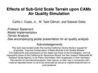
Problem Statement Model Implementation Terrain Analysis See accompanying poster presentation for air quality analysis Acknowledgements This work was funded under the Central California Ozone Study’s request for proposals, “Improve Conservation of Mass Module in Air Quality Models”. The statements and conclusions of this report are those of the Investigator, and not necessarily those of the California Air Resources Board, the San Joaquin Valleywide Air Pollution Study Agency, or its Policy Committee, their employees or their members. The mention of commercial products, their source, or their use in connection with material reported herein is not to be construed as actual or implied endorsement of such products. Effects of Sub-Grid Scale Terrain upon CAMx Air Quality SimulationCarlie J. Coats, Jr., M. Talat Odman, and Saswati Datta
Problem Statement • Meteorology models do violence to the underlying terrain by “smoothing” (at least 3 dx), so even grid scale terrain has errors. • Systematic temperature biases require re-running emissions • Meteorological laminar-flow assumptions do violence to surface exchanges in variable terrain. • Effects most important under stable (e.g., nocturnal) conditions – unstable mixing ameliorates these effects • For CAMx: parameterize effects of sub-grid scale terrain (this talk; see accompanying poster presentation by Saswati Datta) • Emissions: both surface-based and plume-based • Dry Deposition
Terrain for CCOS 4KM DomainMM5-Smoothed vs True-Mean from USGS 30” DEM:Note enhanced detail and variability
Model Implementation for CCOS/CAMx • Terrain pre-processor PENFRAC • Computes 3D variables TFRAC, the fraction of each grid cell in contact with each of the 3-D model layers, PENFRAC: cumulative terrain penetration. • New CAMx module LPEN_MOD encapsulates • Optional reading of TFRAC (otherwise TFRAC confined to Layer 1) • Layer collapse from MM5 to CAMx • Stack height adjustment • Nest interaction • Routines DIFFUS, EMISS, PLUMERIS optionally use TFRAC to allocate surface effects in the vertical. • Discovered mass inconsistency for dry deposition in DIFFUS • Improved 8-PE parallel efficiency from 30% to 95%, just to finish the project.
CCOS-Domain Terrain VariabilityRange of terrain height for 30” DEM in each 4KM grid cellMax is 2071 meters!
CCOS-Domain Terrain VariabilityStandard Deviation of 30” DEM in each 4KM grid cell.Max is 551 meters.
CCOS Domain MM5 Layer Structure • Layer 1 top ~ 20 m above ground • Layer 4 top ~ 100 m... • Layer 10 top ~ 300 m... • Layer 20 top ~ 900 m... • Simple-Z maximum terrain penetration: 22 layers, ~ 1000 M.